Old Maps of Conway, Arkansas for Metal Detecting
Plan your next treasure hunt with 50 historic maps of Conway. Find old homesites, ghost towns, trails, and gathering spots that may be lost to time — perfect for identifying promising metal detecting locations.
- Locate forgotten sites: Uncover places like long-lost settlements, abandoned rail lines, or gathering spots.
- Plan better hunts: Use map overlays combined with LiDAR or satellite views to narrow in on historically rich areas.
- Made for detectorists: Thousands of hobbyists use these maps to discover relics, coins, and hidden history.
Use these historic maps to boost your research and find new opportunities beneath the surface of Conway.
Conway, AR maps
(50)- 1890 Map of Benton
 1890 Benton1890 Print · USGSSaline and Pulaski counties are shown here in the late nineteenth century as the rail network began to reshape the river-valley economy. Genealogists and researchers can trace family roots through old settlements like Brazils and Avilla or locate landmarks like Goosepond Mt and Aplin.
 - 1892 Map of Morrillton
 1892 Morrillton1892 Print · USGSThe Arkansas River valley at the end of the nineteenth century was a landscape of vital ferry crossings and early rail expansion. Genealogists and historians can trace the foundations of Morrillton and Perryville or locate river landmarks like Galla Rock Fy. and Stouts Ldg.
 - 1894 Map of Morrillton
 1894 Morrillton1894 Print · USGSThe Arkansas River valley and the Ouachita foothills meet in the 1890s, where river traffic and the rail line define the local economy. Genealogists can trace early homesteads and crossings near Morrillton, Burnetts Ford, and the rugged heights of Cedar Falls Mt.5 unique versions available
 - 1894 Map of Benton
 1894 Benton1894 Print · USGSCentral Arkansas in the late nineteenth century was a landscape of steep ridges and critical river crossings. Genealogists and researchers can trace the early rail corridor of the St. Louis Iron Mountain and Southern R. R. near Benton or locate family roots in Avilla and Brazils.5 unique versions available
 - 1955 Map of Little Rock, 1978 Print
 1955 Little Rock1978 Print · USGSCentral Arkansas in the mid-fifties exhibits a landscape of growing cities, massive military installations, and mountain reservoirs. Genealogists and historians can trace the industrial Bauxite Mines, regional rail lines, and local landmarks like Antioch Church.
 - 1956 Map of Little Rock
 1956 Little Rock1956 Print · USGSCentral Arkansas in the mid-fifties shows a landscape defined by burgeoning military bases and the timber-and-mineral wealth of the Ouachitas. Genealogists and researchers can trace old rail lines like the Missouri Pacific and find established communities such as Bauxite, Sheridan, and Mabelvale.
 - 1956 Map of Russellville
 1956 Russellville1956 Print · USGSThe Arkansas River valley and the surrounding Boston Mountains are captured here in the mid-fifties, showing a landscape of small timber towns and new reservoirs. Genealogists can trace family roots through upland settlements like Pelsor and Witts Springs or locate the campus of Arkansas Polytechnic College.2 unique versions available
 - 1960 Map of Little Rock
 1960 Little Rock1960 Print · USGSCentral Arkansas in the late fifties shows a landscape of growing military bases and massive new reservoirs. Local historians can trace the mid-century expansion of Little Rock and Hot Springs alongside the industrial works at Bauxite and the Pine Bluff Arsenal.
 - 1961 Map of Menifee, 1962 Print
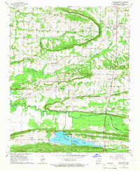
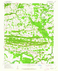 1961 Menifee1962 Print · USGSConway County communities are captured here in the early sixties as they developed along the Missouri Pacific rail line. Genealogists and local historians can locate several rural landmarks including the County Training Sch, Pilgrim Rest Ch, and the waters of Old River Lake.3 unique versions available
 - 1961 Map of Fourche, 1962 Print
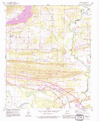
 1961 Fourche1962 Print · USGSThe Arkansas River valley meets the Ouachita foothills in the early sixties, showing a landscape of river-bend towns and rising ridgelines. Genealogists can trace family roots through Little Italy and Lundsford Corner, or locate historic sites like Mt Moriah Ch and Rainey Cem.5 unique versions available
 - 1961 Map of Gleason, 1962 Print
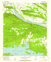
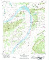
 1961 Gleason1962 Print · USGSThe Arkansas River valley comes alive in the early sixties, showing the vital river crossings and mountain ridges of Faulkner and Perry counties. Genealogists and local historians can trace the Toadsuck Ferry, the Missouri Pacific rail line, and rural landmarks like Bethel Ch or Casey Cem.3 unique versions available
 - 1961 Map of Conway, 1963 Print
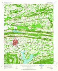
 1961 Conway1963 Print · USGSThe college town of Conway and the northern reaches of Lake Conway are captured here in the early sixties as the city expanded along the rail lines. Researchers can locate numerous local landmarks including Hendrix College, Oak Grove Cemetery, and State Teachers College.4 unique versions available
 - 1961 Map of Conway, 1963 Print
 1961 Conway1963 Print · USGSConway and central Arkansas are captured here during a season of mid-century growth and collegiate expansion. Researchers can locate vanished rural landmarks and early infrastructure like Hendrix College, Beaver Fork Lake, and the Drive-in Theater.
 - 1961 Map of Greenbrier, 1966 Print
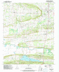
 1961 Greenbrier1966 Print · USGSThe Greenbrier area of Faulkner County is captured here in the early 1960s, showing a landscape of upland ridges and creek valleys. Researchers can trace rural lineages through sites like Bethlehem Ch, Estep Cem, and the community of Wooster.2 unique versions available
 - 1964 Map of Russellville
 1964 Russellville1964 Print · USGSMid-century Central Arkansas is defined here by the river-valley towns and the surrounding mountain ranges before the full expansion of the interstate system. Genealogists and historians can trace rail-town development along the Missouri Pacific Railroad and locate landmarks like Arkansas Polytechnic College or Petit Jean State Park.
 - 1964 Map of Little Rock
 1964 Little Rock1964 Print · USGSCentral Arkansas in the mid-sixties is a landscape of mountain ridges, industrial rail lines, and growing military hubs. Researchers can trace the development of Bauxite and Hot Springs or locate rural landmarks like Sparkman and the Pine Bluff Arsenal.
 - 1977 Map of Russellville
 1977 Russellville1977 Print · USGSThe Arkansas River Valley and surrounding Ozark Mountains are documented here during a period of significant postwar growth and infrastructure development. Genealogists and researchers can locate family landmarks such as Mount Carmel Cem, St Josephs Church, and several remote Coal Mine sites along the Missouri Pacific RR line.
 - 1983 Map of Conway, 1984 Print
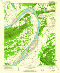
 1983 Conway1984 Print · USGSThe Arkansas River valley in the early eighties shows a landscape of river-bend settlements and expanding wildlife areas. Genealogists and historians can trace the Missouri Pacific RR through old river towns like Toad Suck, Morrilton, and Menifee.
 - 1984 Map of Russellville
 1984 Russellville1984 Print · USGSThe Arkansas River valley was undergoing significant change in the 1950s as transportation and water management reshaped the region from Russellville to Conway. Researchers can trace the era's rail networks like the Missouri Pacific RR and explore landmarks like Magazine Mountain and Petit Jean State Park.
 - 1985 Map of Little Rock, 1988 Print
 1985 Little Rock1988 Print · USGSLittle Rock and its surrounding river valley are shown in the mid-eighties as the region balanced urban expansion with its industrial and military roots. Genealogists and historians can locate dozens of institutions and family landmarks, including Mount Holly Cem, the Bauxite Mines, and Central High Sch.
 - 1991 Map of Gleason, 1995 Print
 1991 Gleason1995 Print · USGSThe Arkansas River corridor near the Perry and Faulkner county lines comes into focus in the early 1990s. Genealogists and local historians can locate rural landmarks like Stony Point Cem, Pleasant Hill Ch, and the distinctive Toad Suck Ferry Lock & Dam.
 - 1991 Map of Menifee, 1995 Print
 1991 Menifee1995 Print · USGSConway and Faulkner counties meet along the winding Cadron Creek during the early nineties, showing a landscape of small communities and rural industry. Researchers can find deep-rooted local history at the County Training Sch, Mount Olive, and the Old Indian Reservation Boundary.
 - 1992 Map of Russellville, 1993 Print
 1992 Russellville1993 Print · USGSCentral Arkansas in the early nineties shows a landscape defined by the Arkansas River valley and the surrounding national forests. Trace the development of river towns like Russellville and Dardanelle alongside landmarks such as Lake Dardanelle and Magazine Mtn.
 - 1994 Map of Greenbrier
 1994 Greenbrier1994 Print · USGSGreenbrier and its surrounding ridges come into focus in the early 1990s as the community expanded north of the new reservoir. Genealogists and local historians can locate several rural landmarks including Bethlehem Ch, Estep Cem, and the neighborhoods of Treasure Hills and Wooster.
 - 1994 Map of Conway
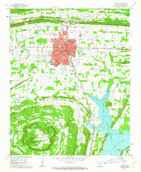
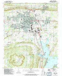 1994 Conway1994 Print · USGSConway emerges as a thriving regional center in the early nineties, balancing its identity as a college town with its position along the Union Pacific line. Researchers can trace historic family plots at Oak Grove Cem and Macedonia Cem or locate old landings along Lake Conway like Brannon Landing.
Showing maps 1-25 of 50
Top cities near Conway
- North Little Rock historical maps
- Maumelle historical maps
- Morrilton historical maps
- Greenbrier historical maps
- Vilonia historical maps
- Mayflower historical maps
See more
Top neighborhoods of Conway
- Gleason historical maps
- Red Hill historical maps
- Thousand oaks historical maps
- Belk Corner historical maps
- Brumley historical maps
- Ivy Place historical maps
See more
Frequently asked questions
- What are the different types of historical maps available for Conway?
- What is the oldest map of Conway?
- Where can I purchase historical maps of Conway for my home or office?
- Where can I download high-res historical maps of Conway?
- Are there historical topographic maps available for Conway?
- Is there historical aerial imagery available for Conway?
- Where are historical maps of Conway sourced from?