Old Maps of Hot Springs, Arkansas for Metal Detecting
Plan your next treasure hunt with 45 historic maps of Hot Springs. Find old homesites, ghost towns, trails, and gathering spots that may be lost to time — perfect for identifying promising metal detecting locations.
- Locate forgotten sites: Uncover places like long-lost settlements, abandoned rail lines, or gathering spots.
- Plan better hunts: Use map overlays combined with LiDAR or satellite views to narrow in on historically rich areas.
- Made for detectorists: Thousands of hobbyists use these maps to discover relics, coins, and hidden history.
Use these historic maps to boost your research and find new opportunities beneath the surface of Hot Springs.
Hot Springs, AR maps
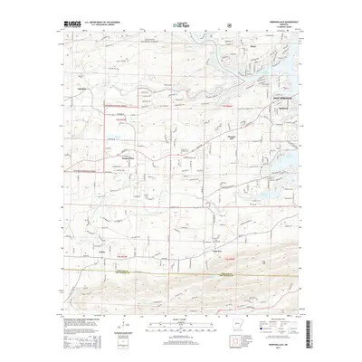
(45)- 1890 Map of Benton
 1890 Benton1890 Print · USGSSaline and Pulaski counties are shown here in the late nineteenth century as the rail network began to reshape the river-valley economy. Genealogists and researchers can trace family roots through old settlements like Brazils and Avilla or locate landmarks like Goosepond Mt and Aplin.
 - 1890 Map of Hot Springs
 1890 Hot Springs1890 Print · USGSThe Ouachita and Fourche La Fave river valleys are mapped here in the late nineteenth century, showing a landscape of isolated mountain settlements. Researchers can trace early family sites near Buckville, Cedar Glades, and the nascent streets of Hot Springs.
 - 1894 Map of Hot Springs
 1894 Hot Springs1894 Print · USGSThe thermal waters of Hot Springs and the surrounding Ouachita wilderness appear here in the decade before the region’s twentieth-century expansion. Genealogists can trace early homesteading locations and vanished rural hubs like Buckville, Cedar Glades, and Wards Crossing.5 unique versions available
 - 1894 Map of Benton
 1894 Benton1894 Print · USGSCentral Arkansas in the late nineteenth century was a landscape of steep ridges and critical river crossings. Genealogists and researchers can trace the early rail corridor of the St. Louis Iron Mountain and Southern R. R. near Benton or locate family roots in Avilla and Brazils.5 unique versions available
 - 1948 Map of Malvern, 1957 Print
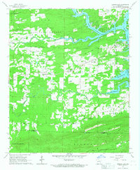
 1948 Malvern1957 Print · USGSHot Spring County and the Ouachita River valley are captured here just after the war, showing the industrial growth and rural character of the region. Researchers can trace the development of Malvern and find vanished landmarks like Antioch Sch, Jones Mills, and the Rockport Cem.3 unique versions available
 - 1949 Map of Malvern
 1949 Malvern1949 Print · USGSMalvern and the Ouachita River valley are shown here in the late 1940s, as industrial sites and new reservoirs began to reshape the Hot Spring County landscape. Genealogists and local historians can locate many rural landmarks, including Potash Sulphur Springs, Taylor Chapel, and the Price Cem.
 - 1955 Map of Little Rock, 1978 Print
 1955 Little Rock1978 Print · USGSCentral Arkansas in the mid-fifties exhibits a landscape of growing cities, massive military installations, and mountain reservoirs. Genealogists and historians can trace the industrial Bauxite Mines, regional rail lines, and local landmarks like Antioch Church.
 - 1956 Map of Little Rock
 1956 Little Rock1956 Print · USGSCentral Arkansas in the mid-fifties shows a landscape defined by burgeoning military bases and the timber-and-mineral wealth of the Ouachitas. Genealogists and researchers can trace old rail lines like the Missouri Pacific and find established communities such as Bauxite, Sheridan, and Mabelvale.
 - 1960 Map of Little Rock
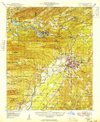
 1960 Little Rock1960 Print · USGSCentral Arkansas in the late fifties shows a landscape of growing military bases and massive new reservoirs. Local historians can trace the mid-century expansion of Little Rock and Hot Springs alongside the industrial works at Bauxite and the Pine Bluff Arsenal.
 - 1964 Map of Little Rock
 1964 Little Rock1964 Print · USGSCentral Arkansas in the mid-sixties is a landscape of mountain ridges, industrial rail lines, and growing military hubs. Researchers can trace the development of Bauxite and Hot Springs or locate rural landmarks like Sparkman and the Pine Bluff Arsenal.
 - 1966 Map of Hot Springs North, 1967 Print
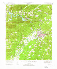
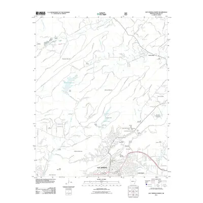
 1966 Hot Springs North1967 Print · USGSHot Springs and the surrounding Ouachita foothills are captured here in the mid-1960s, showing the city's urban expansion against the federal park boundaries. Genealogists can trace family landmarks like Robbins Cem, New Bethel Ch, and the historic Big Chalybeate Springhouse.4 unique versions available
 - 1966 Map of Hempwallace, 1967 Print
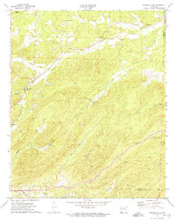
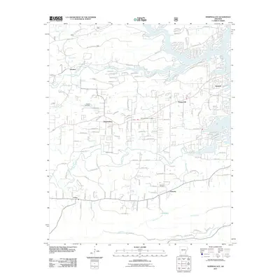
 1966 Hempwallace1967 Print · USGSGarland and Hot Spring counties are shown during a period of transition in the late sixties as recreation grew around the river. Researchers can locate family landmarks like Oak Grove Cem and Aldrich Cem or trace the path of the Old Railroad Grade.2 unique versions available
 - 1966 Map of Hot Springs South, 1967 Print
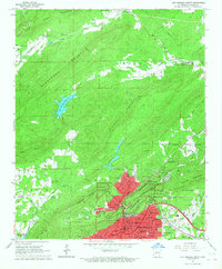
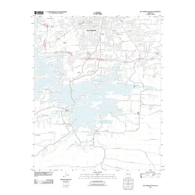
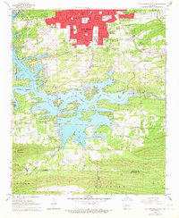 1966 Hot Springs South1967 Print · USGSHot Springs and the surrounding Arkansas lakelands are captured here in the mid-sixties, showing the growth of Lake Hamilton and the southern city limits. Researchers can trace historical landmarks including the Oaklawn Racetrack, the Fish Hatchery, and numerous local sites like New Hope Ch.5 unique versions available
 - 1972 Map of Fountain Lake, 1974 Print
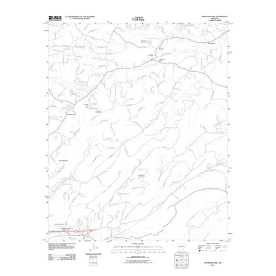
 1972 Fountain Lake1974 Print · USGSGarland County and the surrounding hills were witnessing the early growth of Hot Springs Village and Fountain Lake in the early 1970s. Researchers can trace historic cemeteries and churches such as McClendon Cem, Rockdale Ch, and the Missouri Pacific rail line.3 unique versions available
 - 1978 Map of Lake Catherine, 1979 Print
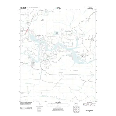
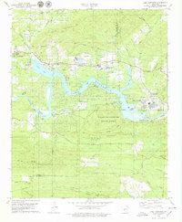 1978 Lake Catherine1979 Print · USGSThe Ouachita River valley comes to life in the late seventies as a hub of hydroelectric power and lakeside recreation. Genealogists and hikers can trace old family sites like Irwin Cem or explore the early development of Lake Catherine State Park and Jones Mills.2 unique versions available
 - 1982 Map of Lake Ouachita
 1982 Lake Ouachita1982 Print · USGSThe Ouachita Mountains of West Central Arkansas are shown here during the early eighties, a time of established recreation and protected timberlands. Researchers can locate small communities like Buckville (PO) and Pencil Bluff or trace the drainage of the Fourche La Fave River.
 - 1985 Map of Malvern
 1985 Malvern1985 Print · USGSCentral Arkansas in the mid-eighties shows a landscape of timberlands and river valleys anchored by the industrial hubs of Malvern and Pine Bluff. Genealogists can locate family landmarks and rural institutions like Social Hill Sch, Magnet Cove, and Pine Bluff Arsenal.2 unique versions available
 - 1985 Map of Little Rock, 1988 Print
 1985 Little Rock1988 Print · USGSLittle Rock and its surrounding river valley are shown in the mid-eighties as the region balanced urban expansion with its industrial and military roots. Genealogists and historians can locate dozens of institutions and family landmarks, including Mount Holly Cem, the Bauxite Mines, and Central High Sch.
 - 1986 Map of Arkadelphia
 1986 Arkadelphia1986 Print · USGSSouthwest Arkansas in the mid-eighties shows a landscape of timbered ridges and significant new reservoirs. Researchers can trace rural schoolhouses and churches like Sunshine Sch and Hempwallace Ch alongside the famous Crater of Diamonds State Park.2 unique versions available
 - 2011 Map of Hot Springs North, 2011 Print
 2011 Hot Springs North2011 Print · USGSCovers Hot Springs, including Ozark Lithia, Euclid Heights, and other nearby areas
 - 2011 Map of Hempwallace, 2011 Print
 2011 Hempwallace2011 Print · USGSCovers Hot Springs, including Rockwell, Hempwallace, and other nearby areas
 - 2011 Map of Hot Springs South, 2011 Print
 2011 Hot Springs South2011 Print · USGSCovers Hot Springs, including Red Oak, Lake Hamilton, and other nearby areas
 - 2011 Map of Fountain Lake, 2011 Print
 2011 Fountain Lake2011 Print · USGSCovers Hot Springs, including Fountain Lake, Fountain Lake, and other nearby areas
 - 2011 Map of Lake Catherine, 2011 Print
 2011 Lake Catherine2011 Print · USGSCovers Hot Springs, including Diamondhead, Price, and other nearby areas
 - 2014 Map of Hempwallace, 2014 Print
 2014 Hempwallace2014 Print · USGSCovers Hot Springs, including Rockwell, Hempwallace, and other nearby areas
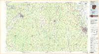
Showing maps 1-25 of 45
Top cities near Hot Springs
- Hot Springs Village historical maps
- Malvern historical maps
- Mountain Pine historical maps
- Magnet Cove historical maps
- Fountain Lake historical maps
- Fountain Lake historical maps
See more
Top neighborhoods of Hot Springs
Frequently asked questions
- What are the different types of historical maps available for Hot Springs?
- What is the oldest map of Hot Springs?
- Where can I purchase historical maps of Hot Springs for my home or office?
- Where can I download high-res historical maps of Hot Springs?
- Are there historical topographic maps available for Hot Springs?
- Is there historical aerial imagery available for Hot Springs?
- Where are historical maps of Hot Springs sourced from?