Old Maps of Hempstead County, Arkansas for Academic Research
Study the evolution of Hempstead County with 162 high-resolution historic maps. Whether you're teaching, researching, or modeling changes in land use, these maps provide essential visual documentation of urban, environmental, and geographic change.
- Analyze long-term change: Track patterns in development, transportation, and natural features.
- Ideal for environmental or urban studies: Support academic projects with primary historical map data.
- Use in the classroom or lab: Educators and researchers rely on these maps to bring historical context to life.
These maps are a powerful tool for teaching, research, and visualizing how Hempstead County has changed over the decades.
Hempstead County, AR maps
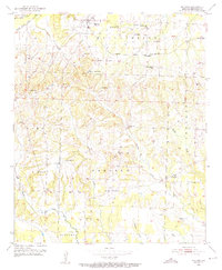
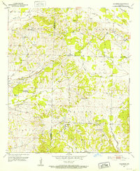
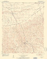
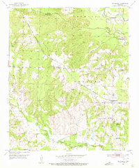
(162)- 1901 Map of Gurdon
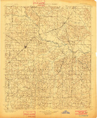 1901 Gurdon1901 Print · USGSSouthwest Arkansas at the dawn of the twentieth century was a landscape defined by the arrival of the rails and the timber industry. Researchers can trace the development of early rail towns like Gurdon, Prescott, and Whelen Springs along the St. Louis Iron Mountain and Southern R. R.3 unique versions available
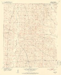
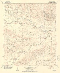
 - 1906 Map of Caddo Gap
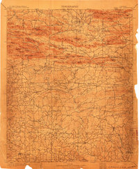 1906 Caddo Gap1906 Print · USGSWest-central Arkansas at the dawn of the twentieth century shows a rugged landscape defined by the Ouachita ridges and early mountain industries. Researchers can trace defunct mining communities like Slatington and Fancy Hill, or locate long-gone railway stops at Hickory Station and Brocktown.3 unique versions available
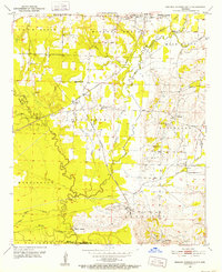
 - 1950 Map of Red Bluff, 1966 Print
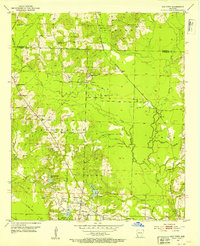
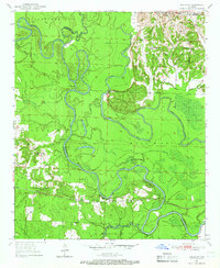 1950 Red Bluff1966 Print · USGSHempstead and Little River counties are captured at mid-century as the river-and-rail economy shaped local life. Genealogists can locate family landmarks like Saratoga Cemetery, Mt Olive Church, and the site of Ward Ferry.2 unique versions available
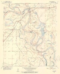
 - 1951 Map of Red Bluff
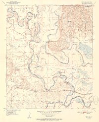 1951 Red Bluff1951 Print · USGSHempstead County at the start of the fifties shows a landscape shaped by the winding oxbows of the Little River. Genealogists and researchers can trace local family roots at Saratoga Cem or locate the rail-side community of Red Bluff along the ST Louis San Francisco line.2 unique versions available
 - 1951 Map of Blevins, 1952 Print
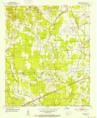
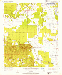
 1951 Blevins1952 Print · USGSHempstead County communities thrive along the Prescott and Northwestern railroad in the early fifties. Genealogists can trace local roots through landmarks like the Blevins Training School, Mt Zion Cemetery, and Holly Grove Church.4 unique versions available
 - 1951 Map of Patmos, 1952 Print
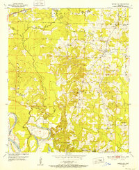
 1951 Patmos1952 Print · USGSHempstead County’s rural landscape is captured here in the early fifties, centered on the rail-line village of Patmos. Genealogists and historians can trace numerous family landmarks, from Macedonia Cem to local centers like Patmos School and the Indian Mounds.4 unique versions available
 - 1951 Map of Mineral Springs South, 1952 Print
 1951 Mineral Springs South1952 Print · USGSHoward County's agricultural and industrial landscape is captured here in the early 1950s. Genealogists and historians can trace community roots through landmarks like the County Training Sch in Tollette and the riverfront at Saline Landing.4 unique versions available
 - 1951 Map of Fulton, 1952 Print
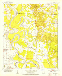
 1951 Fulton1952 Print · USGSThe Red River bottomlands of Southwest Arkansas are captured here in the early fifties, where the railroad meets a shifting river. Genealogists and local historians can trace the foundations of Fulton, locate the Old Allens Ferry site, or find rural landmarks like Galilee Ch and Red Hill Cem.6 unique versions available
 - 1951 Map of Columbus, 1952 Print
 1951 Columbus1952 Print · USGSHempstead County rural life is captured in the early fifties, showing a landscape of small settlements and country crossroads. Genealogists can trace family footprints at Macedonia Cem, Columbus High Sch, and the vanished storefronts of Yancy.3 unique versions available
 - 1951 Map of Sheppard, 1952 Print
 1951 Sheppard1952 Print · USGSHempstead County at the start of the fifties shows a landscape of rail-connected settlements and rural parish life. Researchers can find old community hubs like Guernsey High Sch, the Bright Star Cem, and the junction at Sheppard.4 unique versions available
 - 1951 Map of Spring Hill, 1952 Print
 1951 Spring Hill1952 Print · USGSHempstead County south of Hope was a region of small rural congregations and river-fed agriculture in the early fifties. Genealogists can locate specific family landmarks like Holly Spring Cem, the Ranger Station, and the abandoned Stevenson School.3 unique versions available
 - 1951 Map of Nashville, 1952 Print
 1951 Nashville1952 Print · USGSNashville and the surrounding Howard County countryside are shown here in the early fifties, centering on a thriving railroad town. Genealogists can trace family names and sites across rural settlements like Bingen, old churches like Oak Grove Ch, and the Missouri Pacific rail line.3 unique versions available
 - 1951 Map of Washington, 1952 Print
 1951 Washington1952 Print · USGSHempstead County at mid-century shows a landscape shaped by the Missouri Pacific rail line and the Ozan Creek forks. Researchers can trace family roots at Mt Moriah Home Ch, locate the Belk Cem, or study the street plan of Washington.2 unique versions available
 - 1951 Map of Pisgah, 1952 Print
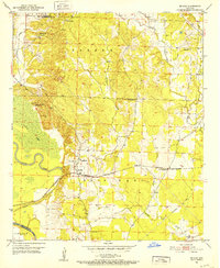
 1951 Pisgah1952 Print · USGSSouthwest Arkansas in the early fifties shows a landscape of riverbottom farms and rural townships. Trace family history through Billstown Cem, locate old junctions like Billstown, and follow the Prescott and Northwestern rail line.3 unique versions available
 - 1951 Map of Hope, 1952 Print
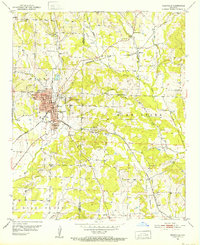
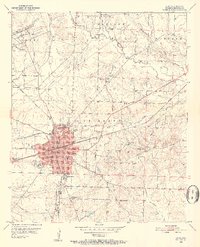 1951 Hope1952 Print · USGSHempstead County at mid-century is centered on the busy rail junction of Hope as it appeared before major highway expansion. Genealogists and local historians can trace specific community anchors like the Chester Hospital, Rose Hill Cemetery, and the University of Arkansas Experiment Station.4 unique versions available
 - 1951 Map of Mc Nab, 1952 Print
 1951 Mc Nab1952 Print · USGSHempstead County in the early fifties is captured here as a network of rail-side settlements and rural congregations. Genealogists can locate Douglas Sch, the Whitehouse Cem, and several local churches like Zion Hill Ch and Mars Hill Ch.3 unique versions available
 - 1951 Map of McCaskill, 1952 Print
 1951 McCaskill1952 Print · USGSMcCaskill and the surrounding timberlands of Hempstead County are shown here in the early fifties, anchored by the PRESCOTT AND NORTHWESTERN rail line. Genealogists can locate family landmarks such as Young Cem, the Blevins Sch No 2, and local churches like Avery Chapel.3 unique versions available
 - 1952 Map of Old Town, 1953 Print
 1952 Old Town1953 Print · USGSLafayette County was a hub of rail and resource extraction in the early fifties, with the landscape transitioning between timber, gravel, and oil. Researchers can trace family sites at Old Lewisville Cem, locate the Mining Railroad, or find the community centers at Midway Ch and Dobson Station.3 unique versions available
 - 1952 Map of Fouke NE, 1953 Print
 1952 Fouke NE1953 Print · USGSMiller County river bottoms and the high ground of the Cleveland district are captured here in the early fifties. Genealogists and researchers can locate the Rock Springs Cem, the rural Hervey Sch, and the rail stop at Artex.4 unique versions available
 - 1952 Map of Boyd Hill, 1953 Print
 1952 Boyd Hill1953 Print · USGSLafayette and Miller counties meet along the winding Red River in the early fifties, showing a landscape defined by seasonal floodwaters and rural industry. Genealogists can locate family landmarks like Boyd Hill Cem, Galilee Ch, and the stop at Mayton on the St Louis Southwestern line.4 unique versions available
 - 1953 Map of El Dorado, 1967 Print
 1953 El Dorado1967 Print · USGSSouth Arkansas in the mid-1960s was a landscape of industrial growth and river-fed commerce. Researchers can trace the extensive Oil and Gas Fields around Magnolia, the expansive U S Naval Ammunition Depot, and the busy rail lines of the Missouri Pacific.3 unique versions available
 - 1955 Map of Little Rock, 1978 Print
 1955 Little Rock1978 Print · USGSCentral Arkansas in the mid-fifties exhibits a landscape of growing cities, massive military installations, and mountain reservoirs. Genealogists and historians can trace the industrial Bauxite Mines, regional rail lines, and local landmarks like Antioch Church.
 - 1956 Map of Little Rock
 1956 Little Rock1956 Print · USGSCentral Arkansas in the mid-fifties shows a landscape defined by burgeoning military bases and the timber-and-mineral wealth of the Ouachitas. Genealogists and researchers can trace old rail lines like the Missouri Pacific and find established communities such as Bauxite, Sheridan, and Mabelvale.
 - 1957 Map of El Dorado
 1957 El Dorado1957 Print · USGSSouth Arkansas in the mid-1950s was a critical hub of military logistics and rail-river commerce. Genealogists and historians can trace family land across the Arkansas Louisiana border and locate sites like the U.S. Naval Ammunition Depot or the rail junctions at Magnolia and Camden.
 - 1958 Map of El Dorado
 1958 El Dorado1958 Print · USGSSouthern Arkansas and the Louisiana borderlands are shown during a period of heavy rail traffic and defense industry activity. Researchers can trace the legacy of the U. S. Naval Ammunition Depot or locate family roots in Smackover, Huttig, and Nashville.3 unique versions available
Showing maps 1-25 of 162
Top cities of Hempstead County
- Hope historical maps
- Blevins historical maps
- Perrytown historical maps
- Washington historical maps
- Fulton historical maps
- Ozan historical maps
See more
Frequently asked questions
- What are the different types of historical maps available for Hempstead County?
- What is the oldest map of Hempstead County?
- Where can I purchase historical maps of Hempstead County for my home or office?
- Where can I download high-res historical maps of Hempstead County?
- Are there historical topographic maps available for Hempstead County?
- Is there historical aerial imagery available for Hempstead County?
- Where are historical maps of Hempstead County sourced from?