
1951 Map of Washington
USGS Topo · Published 1952About this map
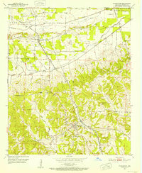
The town of Washington serves as the focal point of this 1950s survey, illustrating the community's layout just after the mid-century. This area is defined by the complex drainage of the Middle Fork Ozan Creek and South Fork Ozan Creek, where the natural waterways are marked by Old Channel segments, indicating a landscape in transition. The Missouri Pacific railroad cuts through the terrain, connecting the town to the smaller settlement of Ozan to the northwest.
Find a feature on this map
21 named features on this map. Tap any name to fly to it.
Don’t see what you’re looking for? This feature index may not catch every label — zoom into the map to look around manually.
Map Details
Editions of this 1951 Washington Map
2 editions found
Other maps of this area

1951 · Blevins
USGS Topo · 1:24,000

1951 · Columbus
USGS Topo · 1:24,000

1951 · Sheppard
USGS Topo · 1:24,000

1951 · Nashville
USGS Topo · 1:24,000

1951 · Pisgah
USGS Topo · 1:24,000

1951 · Hope
USGS Topo · 1:24,000

1951 · Mc Nab
USGS Topo · 1:24,000

1951 · McCaskill
USGS Topo · 1:24,000

1953 · El Dorado
USGS Topo · 1:250,000

1957 · El Dorado
USGS Topo · 1:250,000