
1951 Map of Blevins
USGS Topo · Published 1952About this map
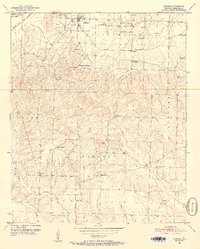
Blevins serves as the central hub of this early 1950s landscape, where the Prescott and Northwestern railroad cuts through the northern townships of Wallaceburg and Nowland. The area is defined by a dense network of country schools and churches, reflecting a deeply rooted rural community structure. Notable institutions like the Blevins Training School and Antioch School are visible alongside numerous local landmarks such as Mt Moriah Church and Bells Chapel.
Find a feature on this map
32 named features on this map. Tap any name to fly to it.
Don’t see what you’re looking for? This feature index may not catch every label — zoom into the map to look around manually.
Map Details
Editions of this 1951 Blevins Map
4 editions found
Other maps of this area

1901 · Gurdon
USGS Topo · 1:125,000

1951 · Sheppard
USGS Topo · 1:24,000

1951 · Washington
USGS Topo · 1:24,000

1951 · Pisgah
USGS Topo · 1:24,000

1951 · Hope
USGS Topo · 1:24,000

1951 · McCaskill
USGS Topo · 1:24,000

1953 · El Dorado
USGS Topo · 1:250,000

1957 · El Dorado
USGS Topo · 1:250,000

1958 · El Dorado
USGS Topo · 1:250,000

1960 · El Dorado
USGS Topo · 1:250,000