Old Maps of Sulphur Rock, Arkansas for Metal Detecting
Plan your next treasure hunt with 38 historic maps of Sulphur Rock. Find old homesites, ghost towns, trails, and gathering spots that may be lost to time — perfect for identifying promising metal detecting locations.
- Locate forgotten sites: Uncover places like long-lost settlements, abandoned rail lines, or gathering spots.
- Plan better hunts: Use map overlays combined with LiDAR or satellite views to narrow in on historically rich areas.
- Made for detectorists: Thousands of hobbyists use these maps to discover relics, coins, and hidden history.
Use these historic maps to boost your research and find new opportunities beneath the surface of Sulphur Rock.
Sulphur Rock, AR maps
(38)- 1890 Map of Batesville
 1890 Batesville1890 Print · USGSIndependence and Sharp counties relied on a intricate network of river ferries and rural outposts in the 1890s. Researchers can trace ancestral locations like Old Clem Place, historic church sites like Bethesda Ch, and river crossings at Walls Fy.
 - 1891 Map of Batesville
 1891 Batesville1891 Print · USGSNorthern Arkansas in the late nineteenth century centers on the White River corridor. Genealogists can trace family landmarks like Old Clem Place and early river crossings such as Grigsby Fy or the rail lines through Sulphur Rock.6 unique versions available
 - 1932 Map of Strawberry
 1932 Strawberry1932 Print · USGSThe river bottoms of Northeast Arkansas are captured in the early 1930s, showing the intersection of the Strawberry River and Black River. Researchers can locate historic landmarks like the Pruitts Mill Site, Buck Cem, and local schools including Cord Sch.
 - 1935 Map of Strawberry, 1936 Print
 1935 Strawberry1936 Print · USGSNortheast Arkansas in the mid-1930s shows a landscape of upland ridges and river bottomlands at the junction of four counties. Researchers can trace rural family life through many churchyards and schools, from Sulphur Rock up to the Pruitte Mill Site and Saffell.
 - 1935 Map of Newport, 1937 Print
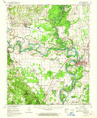
 1935 Newport1937 Print · USGSJackson and Independence counties are captured here in the mid-1930s as the river-and-rail economy shaped local life. Genealogists can trace family landmarks like MeGuire Cem and Griffin Sch, while historians can locate the old river port at Jacksonport.2 unique versions available
 - 1941 Map of Strawberry, 1946 Print
 1941 Strawberry1946 Print · USGSThe rural river valleys of northeast Arkansas are shown here during the early 1940s, highlighting a landscape of small schools and post offices. Genealogists can trace family roots through landmarks like Saffell Post Office, Buck Cem, and Harmony Sch.
 - 1942 Map of Salado, 1945 Print
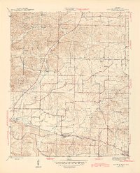
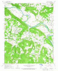
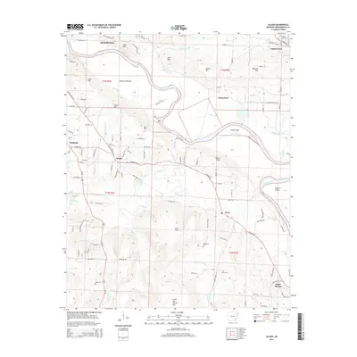
 1942 Salado1945 Print · USGSIndependence County along the White River remained a landscape of river-bend settlements and prominent ridges during the 1940s. Genealogists and local historians can trace family landmarks like Montgomery Sprs, Pine Mtn, and the pass at Mountain Gap.2 unique versions available
 - 1943 Map of Sulphur Rock, 1945 Print
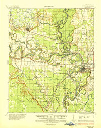
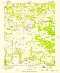
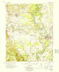
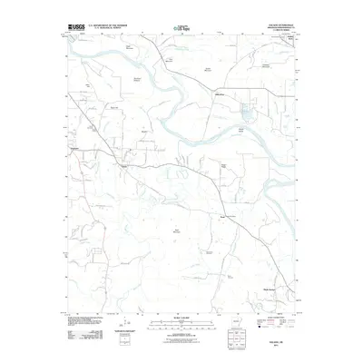
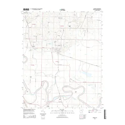
 1943 Sulphur Rock1945 Print · USGSIndependence County during the mid-forties reveals a rural landscape defined by the Missouri Pacific rail line and numerous community crossroads. Genealogists and local historians can trace family roots at Rehoboth Cem, locate the old County Farm, or identify vanished school sites like New Hope Sch and Brewer Sch.6 unique versions available
 - 1953 Map of Memphis, 1966 Print
 1953 Memphis1966 Print · USGSEastern Arkansas and the Memphis riverfront are shown here during the mid-century period of regional growth and river management. Local historians can trace the paths of the Chicago Rock Island & Pacific RR through Forrest City or locate river landmarks like President's Island.3 unique versions available
 - 1954 Map of Charlotte, 1955 Print
 1954 Charlotte1955 Print · USGSMid-century Independence County comes alive in this 1950s survey of the river valleys and upland farms. Genealogists and local historians can locate numerous rural landmarks such as Antioch Ch, Convenience Cem, and the settlement of Charlotte.2 unique versions available
 - 1956 Map of Memphis
 1956 Memphis1956 Print · USGSThe Mississippi Delta and the bluffs of West Tennessee meet in the mid-fifties, showing a landscape defined by massive river systems and rail hubs. Researchers can trace the path of Crowleys Ridge or locate vanished river landings near Centennial Island and Island No 35.
 - 1956 Map of Newark, 1957 Print
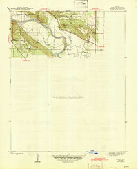
 1956 Newark1957 Print · USGSThe bottomlands of Independence County are shown in detail during the mid-fifties, dominated by the winding loops of the White River. Genealogists and historians can trace numerous family-named landmarks and rural cemeteries such as Akron Cem, Blue Springs Cem, and the Oil Trough Ferry.
 - 1962 Map of Newark, 1963 Print
 1962 Newark1963 Print · USGSThe Independence County river valley comes into sharp focus during the early 1960s, showing the interaction between the White River and local rail towns. Genealogists can trace family roots through numerous sites like Akron Cem, Oil Trough Ferry, and Oak Grove Ch.3 unique versions available
 - 1962 Map of Newport, 1967 Print
 1962 Newport1967 Print · USGSThe Arkansas Delta comes to life in the early sixties, showing the river-dominated landscape of Jackson and Independence Counties. Researchers can trace family sites at Elgin Landmark Ch or follow the Missouri Pacific rails through Oil Trough and Newport.
 - 1965 Map of Salado, 1966 Print
 1965 Salado1966 Print · USGSIndependence County in the mid-1960s is shown here as a landscape of river-bottom farms and upland timber before major modern development. Researchers can locate family landmarks such as Swaims Chapel, the Egner Cem, and the path of the Old River Road.2 unique versions available
 - 1966 Map of Newport
 1966 Newport1966 Print · USGSThe White River meanders through Jackson and Independence counties in the mid-sixties, revealing a network of river-bend settlements and rail hubs. Researchers can trace historic church sites like Mt Zion Ch, family cemeteries such as Salem Cem, and the industrial pulse of Newport and Newark.
 - 1986 Map of Batesville
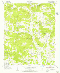
 1986 Batesville1986 Print · USGSNorth-central Arkansas in the mid-eighties shows a landscape of river-bend towns and Ozark foothills during a period of steady growth. You can trace family roots through numerous upland sites like Hickory Valley School, Sandtown Hill Cem, and the riverfront at Oil Trough.2 unique versions available
 - 1989 Map of Sulphur Rock, 1990 Print
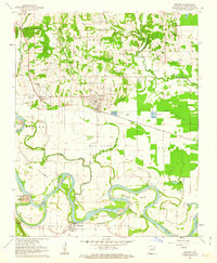
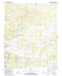 1989 Sulphur Rock1990 Print · USGSIndependence County's landscape east of Batesville shows a unique mix of mid-century infrastructure and pioneer-era roots in the late 1980s. Genealogists and historians can trace numerous family cemeteries like Harvison Cem and landmarks such as the Old RR Gr or Arkansas College.
 - 2011 Map of Newark, 2011 Print
 2011 Newark2011 Print · USGSCovers Sulphur Rock, including Newark, Oil Trough, and other nearby areas
 - 2011 Map of Charlotte, 2011 Print
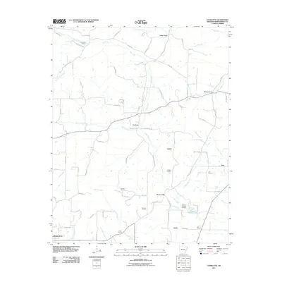 2011 Charlotte2011 Print · USGSCovers Sulphur Rock, including Charlotte, Pleasant Hill, and other nearby areas
 - 2011 Map of Salado, 2011 Print
 2011 Salado2011 Print · USGSCovers Sulphur Rock, including Batesville, Southside, and other nearby areas
 - 2011 Map of Sulphur Rock, 2011 Print
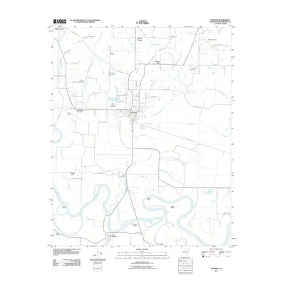
 2011 Sulphur Rock2011 Print · USGSCovers Sulphur Rock, including Batesville, Moorefield, and other nearby areas
 - 2014 Map of Charlotte, 2014 Print
 2014 Charlotte2014 Print · USGSCovers Sulphur Rock, including Charlotte, Pleasant Hill, and other nearby areas
 - 2014 Map of Salado, 2014 Print
 2014 Salado2014 Print · USGSCovers Sulphur Rock, including Batesville, Southside, and other nearby areas
 - 2014 Map of Newark, 2014 Print
 2014 Newark2014 Print · USGSCovers Sulphur Rock, including Newark, Oil Trough, and other nearby areas
Showing maps 1-25 of 38
Top cities near Sulphur Rock
- Batesville historical maps
- Newport historical maps
- Southside historical maps
- Cave City historical maps
- Diaz historical maps
- Newark historical maps
See more
Frequently asked questions
- What are the different types of historical maps available for Sulphur Rock?
- What is the oldest map of Sulphur Rock?
- Where can I purchase historical maps of Sulphur Rock for my home or office?
- Where can I download high-res historical maps of Sulphur Rock?
- Are there historical topographic maps available for Sulphur Rock?
- Is there historical aerial imagery available for Sulphur Rock?
- Where are historical maps of Sulphur Rock sourced from?