1960s Maps of Balch, Arkansas
Explore 2 historic maps of Balch from the 1960s. These maps offer a rare glimpse into what life looked like during the 1960s — showing old roads, neighborhoods, homes, and landmarks that have changed or disappeared over time.
Whether you're researching your family's past, planning a metal detecting trip, or studying how Balch's landscape evolved across the 1960s, these high-resolution maps are a powerful tool for exploring the history of this region.
- Focus on a specific era: All maps on this page are from the 1960s, giving you a focused view of this time period.
- See what’s changed: Compare century-old streets, trails, and buildings to today's modern landscape using overlays and satellite layers.
- Research with precision: Use these maps for genealogy, historical research, land use analysis, or educational projects.
- View, download, or print: Maps are fully viewable online in high resolution, and can be downloaded or printed for your own records.
Start exploring Balch's history through authentic maps from the 1960s. This is your window into the past.
Balch, AR maps
(2)- 1965 Map of Amagon, 1966 Print
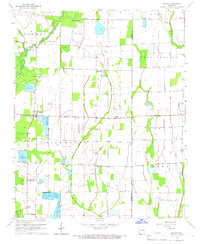 1965 Amagon1966 Print · USGSNortheast Arkansas in the mid-sixties is captured here as a landscape of managed wetlands and small rural communities. Genealogists can locate family burial sites at Carter Cem and Johnson Cem or trace the early industrial footprint of Stringers Mill.
 - 1967 Map of Tuckerman
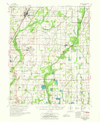 1967 Tuckerman1967 Print · USGSThe Jackson County lowlands are captured here in the mid-sixties, showing a landscape defined by the Cache River and its sloughs. Trace family history at Gracelawn Cem, find old school sites like Eastside Sch, and locate industrial landmarks like Stringers Mill.
End of results
Showing maps 1-2 of 2
Top cities near Balch
- Newport historical maps
- Tuckerman historical maps
- Diaz historical maps
- Weiner historical maps
- Grubbs historical maps
- Campbell Station historical maps
See more
Frequently asked questions
- What are the different types of historical maps available for Balch?
- What is the oldest map of Balch?
- Where can I purchase historical maps of Balch for my home or office?
- Where can I download high-res historical maps of Balch?
- Are there historical topographic maps available for Balch?
- Is there historical aerial imagery available for Balch?
- Where are historical maps of Balch sourced from?