Old Maps of Driftwood, Arkansas for Genealogy
Trace your family roots with 12 historic maps of Driftwood. These high-res maps reveal old neighborhoods, homesites, landmarks, and streets — helping you uncover where your ancestors lived and how the area evolved over time.
- Explore historic neighborhoods: Identify where your relatives may have lived in the 1800s or 1900s.
- Compare maps over time: Trace the changes in streets, buildings, and landmarks for multi-generational research.
- Perfect for genealogy & ancestry research: Used by family historians and researchers to map out lineage and migration.
These maps are an incredible resource for exploring your personal connection to Driftwood's past.
Driftwood, AR maps
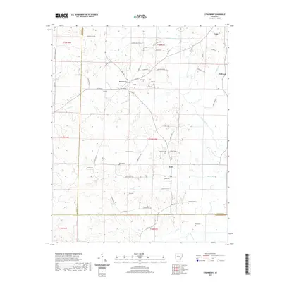
(12)- 1932 Map of Strawberry
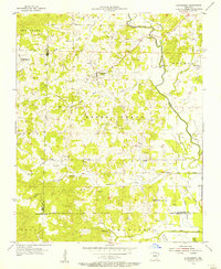
 1932 Strawberry1932 Print · USGSThe river bottoms of Northeast Arkansas are captured in the early 1930s, showing the intersection of the Strawberry River and Black River. Researchers can locate historic landmarks like the Pruitts Mill Site, Buck Cem, and local schools including Cord Sch.
 - 1935 Map of Strawberry, 1936 Print
 1935 Strawberry1936 Print · USGSNortheast Arkansas in the mid-1930s shows a landscape of upland ridges and river bottomlands at the junction of four counties. Researchers can trace rural family life through many churchyards and schools, from Sulphur Rock up to the Pruitte Mill Site and Saffell.
 - 1941 Map of Strawberry, 1946 Print
 1941 Strawberry1946 Print · USGSThe rural river valleys of northeast Arkansas are shown here during the early 1940s, highlighting a landscape of small schools and post offices. Genealogists can trace family roots through landmarks like Saffell Post Office, Buck Cem, and Harmony Sch.
 - 1953 Map of Memphis, 1966 Print
 1953 Memphis1966 Print · USGSEastern Arkansas and the Memphis riverfront are shown here during the mid-century period of regional growth and river management. Local historians can trace the paths of the Chicago Rock Island & Pacific RR through Forrest City or locate river landmarks like President's Island.3 unique versions available
 - 1955 Map of Strawberry, 1956 Print
 1955 Strawberry1956 Print · USGSThe Arkansas Ozark foothills come alive in the mid-fifties, centered on the Strawberry settlement and its rural surrounds. Genealogists can trace a wealth of family history through local landmarks like Willmuth Cem, Mt Zion Ch, and Saffell.2 unique versions available
 - 1956 Map of Memphis
 1956 Memphis1956 Print · USGSThe Mississippi Delta and the bluffs of West Tennessee meet in the mid-fifties, showing a landscape defined by massive river systems and rail hubs. Researchers can trace the path of Crowleys Ridge or locate vanished river landings near Centennial Island and Island No 35.
 - 1986 Map of Batesville
 1986 Batesville1986 Print · USGSNorth-central Arkansas in the mid-eighties shows a landscape of river-bend towns and Ozark foothills during a period of steady growth. You can trace family roots through numerous upland sites like Hickory Valley School, Sandtown Hill Cem, and the riverfront at Oil Trough.2 unique versions available
 - 2011 Map of Strawberry, 2011 Print
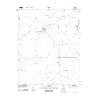 2011 Strawberry2011 Print · USGSCovers Driftwood, including Lynn, Strawberry, and other nearby areas
 - 2014 Map of Strawberry, 2014 Print
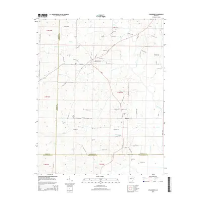 2014 Strawberry2014 Print · USGSCovers Driftwood, including Lynn, Strawberry, and other nearby areas
 - 2017 Map of Strawberry, 2017 Print
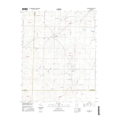 2017 Strawberry2017 Print · USGSCovers Driftwood, including Lynn, Strawberry, and other nearby areas
 - 2020 Map of Strawberry, 2020 Print
 2020 Strawberry2020 Print · USGSCovers Driftwood, including Lynn, Strawberry, and other nearby areas
 - 2024 Map of Strawberry, 2024 Print
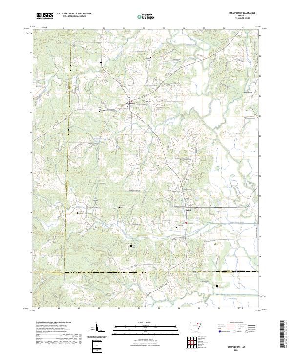 2024 Strawberry2024 Print · USGSNortheast Arkansas in the current era remains a landscape of quiet river towns and family legacies. Genealogists can trace deep roots through numerous sites like Jerusalem Cem and Mount Zion Cem or the community of Strawberry.
End of results
Showing maps 1-12 of 12
Top cities near Driftwood
- Tuckerman historical maps
- Swifton historical maps
- Imboden historical maps
- Black Rock historical maps
- Portia historical maps
- Lynn historical maps
See more
Frequently asked questions
- What are the different types of historical maps available for Driftwood?
- What is the oldest map of Driftwood?
- Where can I purchase historical maps of Driftwood for my home or office?
- Where can I download high-res historical maps of Driftwood?
- Are there historical topographic maps available for Driftwood?
- Is there historical aerial imagery available for Driftwood?
- Where are historical maps of Driftwood sourced from?