1960s Maps of Cabot, Arkansas
Explore 5 historic maps of Cabot from the 1960s. These maps offer a rare glimpse into what life looked like during the 1960s — showing old roads, neighborhoods, homes, and landmarks that have changed or disappeared over time.
Whether you're researching your family's past, planning a metal detecting trip, or studying how Cabot's landscape evolved across the 1960s, these high-resolution maps are a powerful tool for exploring the history of this region.
- Focus on a specific era: All maps on this page are from the 1960s, giving you a focused view of this time period.
- See what’s changed: Compare century-old streets, trails, and buildings to today's modern landscape using overlays and satellite layers.
- Research with precision: Use these maps for genealogy, historical research, land use analysis, or educational projects.
- View, download, or print: Maps are fully viewable online in high resolution, and can be downloaded or printed for your own records.
Start exploring Cabot's history through authentic maps from the 1960s. This is your window into the past.
Cabot, AR maps
(5)- 1960 Map of Little Rock
 1960 Little Rock1960 Print · USGSCentral Arkansas in the late fifties shows a landscape of growing military bases and massive new reservoirs. Local historians can trace the mid-century expansion of Little Rock and Hot Springs alongside the industrial works at Bauxite and the Pine Bluff Arsenal.
 - 1960 Map of Helena
 1960 Helena1960 Print · USGSThe Arkansas and Mississippi Delta regions meet along the great river bends during a period of significant agricultural and rail expansion. Genealogists and historians can trace the paths of the Missouri Pacific railroad through Clarendon or locate landings along the Mississippi River and White River.
 - 1963 Map of Mountain Springs, 1964 Print
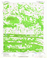 1963 Mountain Springs1964 Print · USGSCentral Arkansas in the early sixties was a landscape of remote ridges and tight-knit rural parishes. Genealogists can trace family names through the Shurley Cem or Barger Cem and locate historic meeting places like Baugh Chapel and Sixteenth Section Ch.3 unique versions available
 - 1964 Map of Russellville
 1964 Russellville1964 Print · USGSMid-century Central Arkansas is defined here by the river-valley towns and the surrounding mountain ranges before the full expansion of the interstate system. Genealogists and historians can trace rail-town development along the Missouri Pacific Railroad and locate landmarks like Arkansas Polytechnic College or Petit Jean State Park.
 - 1964 Map of Little Rock
 1964 Little Rock1964 Print · USGSCentral Arkansas in the mid-sixties is a landscape of mountain ridges, industrial rail lines, and growing military hubs. Researchers can trace the development of Bauxite and Hot Springs or locate rural landmarks like Sparkman and the Pine Bluff Arsenal.
End of results
Showing maps 1-5 of 5
Top cities near Cabot
- Little Rock historical maps
- North Little Rock historical maps
- Jacksonville historical maps
- Sherwood historical maps
- Beebe historical maps
- Lonoke historical maps
See more
Top neighborhoods of Cabot
- The Meadows Addition historical maps
- Glenwood Estates historical maps
- Meadowlark Addition historical maps
- Spring Valley historical maps
- Windwood Circle historical maps
- Kingwood Addition historical maps
See more
Frequently asked questions
- What are the different types of historical maps available for Cabot?
- What is the oldest map of Cabot?
- Where can I purchase historical maps of Cabot for my home or office?
- Where can I download high-res historical maps of Cabot?
- Are there historical topographic maps available for Cabot?
- Is there historical aerial imagery available for Cabot?
- Where are historical maps of Cabot sourced from?