Old Maps of Elaine, Arkansas for Genealogy
Trace your family roots with 17 historic maps of Elaine. These high-res maps reveal old neighborhoods, homesites, landmarks, and streets — helping you uncover where your ancestors lived and how the area evolved over time.
- Explore historic neighborhoods: Identify where your relatives may have lived in the 1800s or 1900s.
- Compare maps over time: Trace the changes in streets, buildings, and landmarks for multi-generational research.
- Perfect for genealogy & ancestry research: Used by family historians and researchers to map out lineage and migration.
These maps are an incredible resource for exploring your personal connection to Elaine's past.
Elaine, AR maps
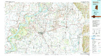
(17)- 1939 Map of Modoc, 1941 Print
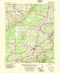
 1939 Modoc1941 Print · USGSPhillips County sits at a crossroads of river and rail during the late 1930s, as the Delta landscape was shaped by flooding and the Missouri Pacific line. Genealogists can trace family roots at Mt Zion Ch Sch & Cem, Beach Tree Ch & Sch, and the old station at Hugo Sta.
 - 1948 Map of Helena
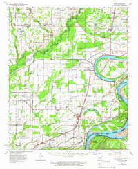
 1948 Helena1948 Print · USGSEastern Arkansas and the Mississippi Delta are captured here just after the war, showing a landscape defined by its great rivers and rail lines. Genealogists can trace family locations near Bemis Plantation, Helena, and smaller rail stops like Wheatley and Moro.
 - 1948 Map of Modoc, 1951 Print
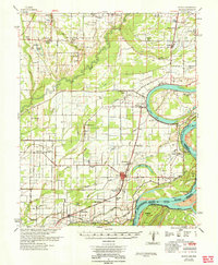
 1948 Modoc1951 Print · USGSThe Arkansas delta of Phillips County is captured here just after the war, showing a landscape defined by the Mississippi River and the rail-side life of the Missouri Pacific. Genealogists can locate family names at St Peter Ch & Cem, the Rosenwald Sch, and the old Modoc settlement.3 unique versions available
 - 1950 Map of Helena
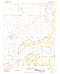
 1950 Helena1950 Print · USGSMid-century Phillips County and the surrounding Delta region are shown at a peak of rail and river commerce. Genealogists and historians can trace family locations through numerous rural communities like Old Austin, Cotton Plant, and West Helena, or follow the routes of the Missouri Pacific RR across Grand Prairie.2 unique versions available
 - 1955 Map of Helena, 1967 Print
 1955 Helena1967 Print · USGSThe Arkansas Delta and Mississippi floodplains are captured here in the mid-fifties, during a period of expanding flood control and rail commerce. Researchers can trace the extensive Chicago Rock Island and Pacific RR lines and locate sites like the Arkansas State College Experimental Rice Farm or Friars Point.2 unique versions available
 - 1959 Map of Helena
 1959 Helena1959 Print · USGSThe Arkansas and Mississippi Delta regions are captured here in the late fifties, showing a landscape defined by the Mississippi River and the Grand Prairie. Genealogists and researchers can trace the rail networks of the Illinois Central RR and locate community landmarks like Helena and the White River National Wildlife Refuge.
 - 1960 Map of Helena
 1960 Helena1960 Print · USGSThe Arkansas and Mississippi Delta regions meet along the great river bends during a period of significant agricultural and rail expansion. Genealogists and historians can trace the paths of the Missouri Pacific railroad through Clarendon or locate landings along the Mississippi River and White River.
 - 1963 Map of Modoc, 1966 Print
 1963 Modoc1966 Print · USGSThe Arkansas Delta in the early sixties is captured here through its tight-knit rural communities and the shifting banks of the Mississippi River. Genealogists can trace the Rosenwald Sch and churches like Brooks Chapel or Old Jerusalem Ch.
 - 1964 Map of Modoc
 1964 Modoc1964 Print · USGSThe Arkansas Delta of the early sixties is shown here as a landscape of river-bend settlements and railroad spurs. Genealogists can locate family landmarks like the Rosenwald Sch, St Claire Ch, and small rail stops such as Ratio and Mary Spur.
 - 1982 Map of Elaine
 1982 Elaine1982 Print · USGSElaine and the Arkansas delta are captured in the early eighties as the river's winding oxbows and rural settlements define the landscape. Researchers can trace family roots through Morning Star Cem or locate historic river access points like Burke Landing and Modoc.
 - 1984 Map of Clarksdale, 1985 Print
 1984 Clarksdale1985 Print · USGSThe Mississippi Delta in the 1980s shows a landscape defined by its great river meanders and a dense network of bayous and rail lines. Researchers can trace the path of the Illinois Central Gulf through Clarksdale or locate river landmarks like Moon Lake and Friars Point.
 - 1990 Map of Clarksdale, 1991 Print
 1990 Clarksdale1991 Print · USGSThe Mississippi Delta in the 1990s remained a landscape of river-driven commerce and small-town resilience. Researchers can trace the path of the Illinois Central Railroad through settlements like Clarksdale, Friars Point, and Alligator.
 - 2011 Map of Elaine, 2011 Print
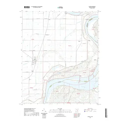
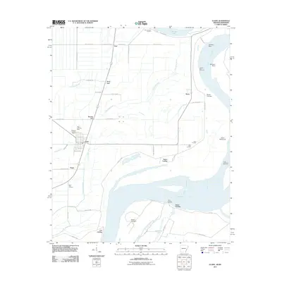 2011 Elaine2011 Print · USGSCovers Elaine, including Morning Star, Hoop Spur, and other nearby areas
 - 2014 Map of Elaine, 2014 Print
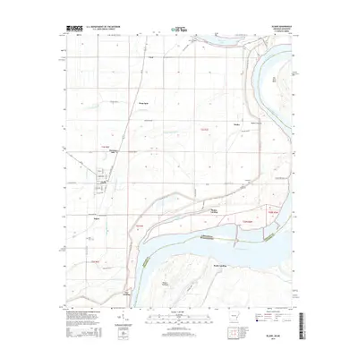 2014 Elaine2014 Print · USGSCovers Elaine, including Morning Star, Hoop Spur, and other nearby areas
 - 2017 Map of Elaine, 2017 Print
 2017 Elaine2017 Print · USGSCovers Elaine, including Morning Star, Hoop Spur, and other nearby areas
 - 2020 Map of Elaine, 2020 Print
 2020 Elaine2020 Print · USGSCovers Elaine, including Morning Star, Hoop Spur, and other nearby areas
 - 2024 Map of Elaine, 2024 Print
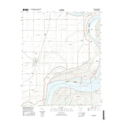
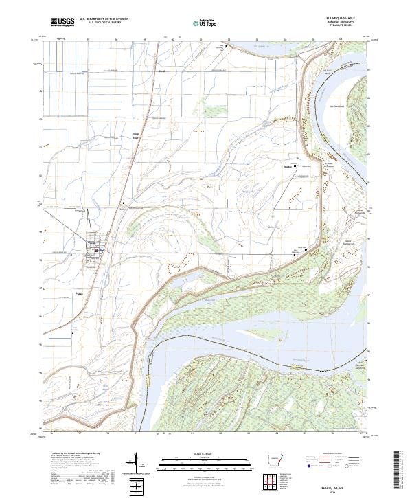 2024 Elaine2024 Print · USGSThe Mississippi Delta's agricultural heartland comes into focus here during the early twenty-first century, centered on the historic town of Elaine. Researchers can trace old family sites and rural landmarks like Morning Star Baptist Church, Jones Cem, and the rail-aligned Hoop Spur.
End of results
Showing maps 1-17 of 17
Top cities near Elaine
- Helena-West Helena historical maps
- Friars Point historical maps
- Lake View historical maps
- Alligator historical maps
Frequently asked questions
- What are the different types of historical maps available for Elaine?
- What is the oldest map of Elaine?
- Where can I purchase historical maps of Elaine for my home or office?
- Where can I download high-res historical maps of Elaine?
- Are there historical topographic maps available for Elaine?
- Is there historical aerial imagery available for Elaine?
- Where are historical maps of Elaine sourced from?