Old Maps of Searcy County, Arkansas for Academic Research
Study the evolution of Searcy County with 146 high-resolution historic maps. Whether you're teaching, researching, or modeling changes in land use, these maps provide essential visual documentation of urban, environmental, and geographic change.
- Analyze long-term change: Track patterns in development, transportation, and natural features.
- Ideal for environmental or urban studies: Support academic projects with primary historical map data.
- Use in the classroom or lab: Educators and researchers rely on these maps to bring historical context to life.
These maps are a powerful tool for teaching, research, and visualizing how Searcy County has changed over the decades.
Searcy County, AR maps
(146)- 1879 Map of Washington
 1879 Washington1879 Print · USGSThe Arkansas backcountry in the late 1870s is captured in this focused survey of the Ozark foothills. Researchers can trace the rugged headwaters of Illinois Creek and identify landmarks like Grapevine Mountain and Longs Spr.
 - 1887 Map of Smyrna
 1887 Smyrna1887 Print · USGSIn the late 1880s, the Smyrna area of Pope County was a landscape of steep Ozark elevations and winding waterways. Genealogists and hikers can trace the original paths of Illinois Creek and Hurricane Cr as they flow around the base of Grapevine Mountain.
 - 1889 Map of Marshall #3
 1889 Marshall #31889 Print · USGSThe Arkansas Ozarks come into focus in the late nineteenth century as early surveyors mapped the headwaters of the Illinois Bayou. Researchers can trace the steep elevations of Grapevine Mountain and locate early landmarks like Longs Spr and the East Fork.
 - 1890 Map of Mountain Home, 1954 Print
 1890 Mountain Home1954 Print · USGSThe Ozark plateau in the late nineteenth century remains a rugged landscape of winding river valleys and isolated hilltop settlements. Genealogists can trace family footprints across Mountain Home, Buffalo City, and Calico Rock before modern dams reshaped the White River.
 - 1891 Map of Mountain Home
 1891 Mountain Home1891 Print · USGSThe Ozark wilderness around Mountain Home is shown here in the late nineteenth century, dominated by a wild river system. Researchers can trace the network of old river crossings like Traceys F'y and Nelsons F'y alongside early towns such as Buffalo City.
 - 1892 Map of Marshall
 1892 Marshall1892 Print · USGSThe Ozark highlands of Searcy and Van Buren Counties appear here in the early 1890s, characterized by isolated mountain settlements and complex river headwaters. Genealogists can trace early homesteads and family-named landmarks such as Wileys Cove, Hendersons Knob, and Witts Springs.
 - 1892 Map of Mountain View
 1892 Mountain View1892 Print · USGSThe Arkansas Ozarks are mapped here in the late nineteenth century, a time when river ferries and fords were the primary connections between isolated mountain towns. Trace the early streets of Mountain View and Clinton, or locate old crossings at Upper Fy. and Wilsons Fd.
 - 1893 Map of Yellville
 1893 Yellville1893 Print · USGSNorthern Arkansas in the late nineteenth century was a world defined by its rivers and local crossings. You can trace the ancestral ferry routes along the White River and locate settlements with unique local nicknames like Peel (Needmore) and St Joe (Monkey Run).2 unique versions available
 - 1894 Map of Mountain View
 1894 Mountain View1894 Print · USGSThe Arkansas Ozark foothills and river valleys are shown in the 1890s as a network of isolated homesteads and river landings. Genealogists can trace early families near Mountain View, Clinton, and river crossings like Upper Fy. or Goffs Cove.5 unique versions available
 - 1894 Map of Mountain Home
 1894 Mountain Home1894 Print · USGSNorthern Arkansas in the 1890s was a rugged territory defined by the winding White and Buffalo rivers. Genealogists and local historians can trace early river crossings and settlements like Traceys Fy & Fd, Ships Fy, Buffalo City, and Henderson.6 unique versions available
 - 1894 Map of Marshall
 1894 Marshall1894 Print · USGSThe Ozark plateau in the 1890s reveals a sparse network of mountain settlements and family landmarks. Genealogists can locate early community centers like Snow Ball and Witts Springs or trace ancestral lands near Point Peter and Hendersons Knob.
 - 1901 Map of Marshall
 1901 Marshall1901 Print · USGSThe Ozark plateau in the 1890s reveals a rugged network of high ridges and river forks where isolation defined early settlement. Genealogists can trace family roots through upland communities like Snowball, Witts Springs, and Wileys Cove before modern infrastructure reached the Boston Mountain range.4 unique versions available
 - 1903 Map of Yellville
 1903 Yellville1903 Print · USGSNorth Central Arkansas in the late nineteenth century is a land of winding river valleys and ridge-top settlements. Genealogists can trace early homesteads and river crossings like Denton Ferry, Yellville, and the remote outposts of Dodd City or St. Joe.
 - 1905 Map of Yellville
 1905 Yellville1905 Print · USGSThe Ozark Mountains and the winding White River define this area at the start of the twentieth century. Genealogists can trace family names through dozens of river crossings and small settlements like Denton Ferry, Rush, and Elixir Springs.3 unique versions available
 - 1929 Map of Yellville, 1954 Print
 1929 Yellville1954 Print · USGSThe Ozark river valleys and early rail corridors of north-central Arkansas are shown here during the late 1920s. Researchers can trace historic river crossings like Whites Ferry and Moony Ford or locate regional hubs such as Yellville and Cotter.
 - 1939 Map of Snowball, 1967 Print
 1939 Snowball1967 Print · USGSSearcy and Newton Counties are shown here just before the 1940s, highlighting a landscape of dispersed mountain farmsteads and rural schoolhouses. Genealogists can trace family names through landmarks like Arnold Cem, Witts Springs, and Juanita Sch.2 unique versions available
 - 1940 Map of Smyrna, 1961 Print
 1940 Smyrna1961 Print · USGSThe Arkansas Ozarks around the Pope and Searcy county lines are shown here at a time when small mountain schools and isolated settlements were the heart of the community. Researchers can trace family roots at Old Smyrna Cem or find the sites of vanished homesteads near Lost Corner and Nogo Sch.2 unique versions available
 - 1941 Map of Snowball
 1941 Snowball1941 Print · USGSThe Buffalo River highlands of Searcy and Newton counties are shown here just before the Second World War. Genealogists and local historians can trace family roots through a dense network of country schools and churches, from Snowball to Faith Mission and the Welcome Home Sch.
 - 1942 Map of Snowball
 1942 Snowball1942 Print · USGSThe Ozark highlands of Newton and Searcy counties appear here in the late 1930s, showing a landscape defined by the Buffalo River. Genealogists can trace family roots through numerous remote sites like Hendrix Cem, Witt Springs, and Juanita Sch.
 - 1943 Map of Smyrna
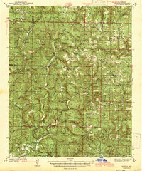 1943 Smyrna1943 Print · USGSThe Boston Mountains of Pope and Van Buren counties appear in the early 1940s as a landscape of isolated ridges and headwater creeks. Genealogists and historians can trace the foundations of rural life at Old Smyrna Cem, Union Hill Sch, and the remote settlement of Nogo.
 - 1945 Map of Harrison
 1945 Harrison1945 Print · USGSThe Ozark and Boston Mountains straddle the Missouri-Arkansas border during the mid-forties, showing a landscape of forest ridges and river valleys. Genealogists and historians can trace rail-connected towns like Monett and West Plains or early lake developments at Bull Shoals Res and Norfork Lake.
 - 1949 Map of Harrison
 1949 Harrison1949 Print · USGSThe Ozark highlands of northern Arkansas and southern Missouri are shown just after the war, when the White River still followed its original course. Genealogists and historians can trace rail lines like the Missouri & Arkansas RR and locate rural hubs like Harrison, Eureka Springs, and Mountain Home.
 - 1949 Map of Snowball
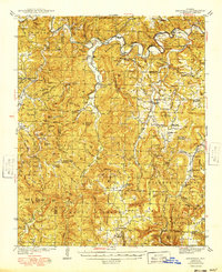 1949 Snowball1949 Print · USGSThe northern Arkansas highlands of the late 1940s are shown here in detail, from the banks of the Buffalo River to the small upland villages. Researchers can trace rural lineages through numerous landmarks like Dodson Cem, Snowball, and the Wasson Sch.
 - 1954 Map of Harrison
 1954 Harrison1954 Print · USGSThe Ozarks and Boston Mountains meet during a period of massive river engineering in the mid-fifties. Researchers can trace the early shorelines of Bull Shoals Lake and Table Rock Reservoir or locate inland towns like Berryville and Harrison.
 - 1956 Map of Russellville
 1956 Russellville1956 Print · USGSThe Arkansas River valley and the surrounding Boston Mountains are captured here in the mid-fifties, showing a landscape of small timber towns and new reservoirs. Genealogists can trace family roots through upland settlements like Pelsor and Witts Springs or locate the campus of Arkansas Polytechnic College.2 unique versions available
Showing maps 1-25 of 146
Top cities of Searcy County
- Marshall historical maps
- Leslie historical maps
- Saint Joe historical maps
- Pindall historical maps
- Gilbert historical maps
Frequently asked questions
- What are the different types of historical maps available for Searcy County?
- What is the oldest map of Searcy County?
- Where can I purchase historical maps of Searcy County for my home or office?
- Where can I download high-res historical maps of Searcy County?
- Are there historical topographic maps available for Searcy County?
- Is there historical aerial imagery available for Searcy County?
- Where are historical maps of Searcy County sourced from?