Old Maps of Andrews, Arkansas for Genealogy
Trace your family roots with 13 historic maps of Andrews. These high-res maps reveal old neighborhoods, homesites, landmarks, and streets — helping you uncover where your ancestors lived and how the area evolved over time.
- Explore historic neighborhoods: Identify where your relatives may have lived in the 1800s or 1900s.
- Compare maps over time: Trace the changes in streets, buildings, and landmarks for multi-generational research.
- Perfect for genealogy & ancestry research: Used by family historians and researchers to map out lineage and migration.
These maps are an incredible resource for exploring your personal connection to Andrews's past.
Andrews, AR maps
(13)- 1932 Map of Kensett
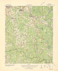 1932 Kensett1932 Print · USGSWhite County in the early thirties is a bustling corridor of rail activity and river commerce. Genealogists and local historians can trace family-named sites across the bottomlands, including Dogwood Ch & Cem, Holloway Sch, and the junction at Kensett.
 - 1935 Map of Kensett
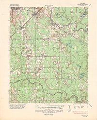 1935 Kensett1935 Print · USGSWhite County in the mid-1930s was defined by the winding Little Red River and a busy network of Missouri Pacific rail lines. Local historians can locate vanished community landmarks like Holloway Sch, Egbert Cem, and the village of Griffithville.2 unique versions available
 - 1953 Map of Memphis, 1966 Print
 1953 Memphis1966 Print · USGSEastern Arkansas and the Memphis riverfront are shown here during the mid-century period of regional growth and river management. Local historians can trace the paths of the Chicago Rock Island & Pacific RR through Forrest City or locate river landmarks like President's Island.3 unique versions available
 - 1956 Map of Memphis
 1956 Memphis1956 Print · USGSThe Mississippi Delta and the bluffs of West Tennessee meet in the mid-fifties, showing a landscape defined by massive river systems and rail hubs. Researchers can trace the path of Crowleys Ridge or locate vanished river landings near Centennial Island and Island No 35.
 - 1964 Map of West Point, 1965 Print
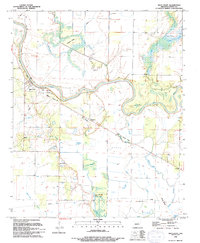
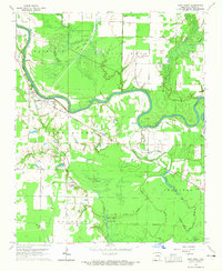 1964 West Point1965 Print · USGSWhite County, Arkansas, during the mid-sixties reveals a riverine landscape dominated by the Little Red River and its intricate wetlands. Genealogists and local historians can trace the foundations of West Point and find markers like New Hope Ch, Riverside Cem, and the Old Railroad Grade.2 unique versions available
 - 1967 Map of Kensett
 1967 Kensett1967 Print · USGSWhite County, Arkansas, comes to life in this mid-century survey as the regional rail network and the Little Red River shape the local economy. Researchers can locate family landmarks like Ellis Chapel, Liberty Cem, and the old Gravel Pits south of Searcy.
 - 1986 Map of Searcy
 1986 Searcy1986 Print · USGSWhite County and its neighbors reached a period of established agricultural and rail prosperity by the mid-1980s. Local researchers can trace the routes of the Missouri Pacific RR and locate rural communities like Velvet Ridge, Sunnydale, and Cotton Plant.2 unique versions available
 - 1994 Map of West Point
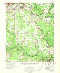
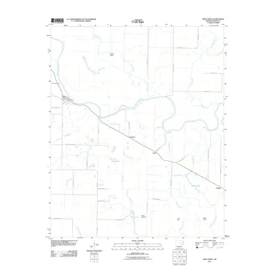
 1994 West Point1994 Print · USGSThe Little Red River valley is shown in the early nineties, revealing a landscape defined by its waterways and flood management. Researchers can trace the Old Railroad Grade and locate local landmarks like New Hope Ch and West Point Cem.
 - 2011 Map of West Point, 2011 Print
 2011 West Point2011 Print · USGSCovers Andrews, including West Point, Pryor, and other nearby areas
 - 2014 Map of West Point, 2014 Print
 2014 West Point2014 Print · USGSCovers Andrews, including West Point, Pryor, and other nearby areas
 - 2017 Map of West Point, 2017 Print
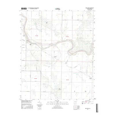 2017 West Point2017 Print · USGSCovers Andrews, including West Point, Pryor, and other nearby areas
 - 2020 Map of West Point, 2020 Print
 2020 West Point2020 Print · USGSCovers Andrews, including West Point, Pryor, and other nearby areas
 - 2024 Map of West Point, 2024 Print
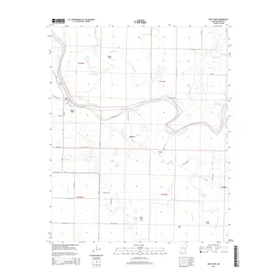
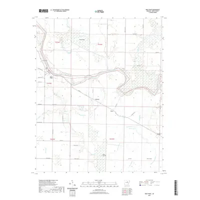
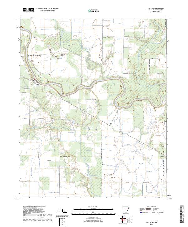 2024 West Point2024 Print · USGSThe Little Red River bottomlands of White County are captured here in the contemporary era. Researchers can trace the layout of West Point, locate the West Point Cem, and explore the wetlands of the Bald Knob National Wildlife Refuge.
End of results
Showing maps 1-13 of 13
Top cities near Andrews
- Searcy historical maps
- Bald Knob historical maps
- Augusta historical maps
- Judsonia historical maps
- Des Arc historical maps
- Kensett historical maps
See more
Frequently asked questions
- What are the different types of historical maps available for Andrews?
- What is the oldest map of Andrews?
- Where can I purchase historical maps of Andrews for my home or office?
- Where can I download high-res historical maps of Andrews?
- Are there historical topographic maps available for Andrews?
- Is there historical aerial imagery available for Andrews?
- Where are historical maps of Andrews sourced from?