1900s (20th Century) Maps of Alameda, California
Explore 35 historic maps of Alameda from the 1900s (20th Century). These maps offer a rare glimpse into what life looked like during the 1900s — showing old roads, neighborhoods, homes, and landmarks that have changed or disappeared over time.
Whether you're researching your family's past, planning a metal detecting trip, or studying how Alameda's landscape evolved across the 1900s, these high-resolution maps are a powerful tool for exploring the history of this region.
- Focus on a specific era: All maps on this page are from the 1900s, giving you a focused view of this time period.
- See what’s changed: Compare century-old streets, trails, and buildings to today's modern landscape using overlays and satellite layers.
- Research with precision: Use these maps for genealogy, historical research, land use analysis, or educational projects.
- View, download, or print: Maps are fully viewable online in high resolution, and can be downloaded or printed for your own records.
Start exploring Alameda's history through authentic maps from the 1900s. This is your window into the past.
Alameda, CA maps
(35)- 1915 Map of San Mateo
 1915 San Mateo1915 Print · USGSThe San Francisco Peninsula at the start of the twentieth century shows a landscape transitioning from rural ranchos to industrial centers and suburbs. Genealogists can trace family footprints at Colma, locate the Hoyt School, or follow the Southern Pacific RR through Baden Sta.6 unique versions available
 - 1915 Map of Haywards
 1915 Haywards1915 Print · USGSThe East Bay shoreline and inland foothills are shown here in the mid-1910s during a height of coastal industry. Genealogists and historians can trace old shipping points like Mulford Landing, early salt operations at Union City Salt Works, and the rail lines of the Western Pacific.4 unique versions available
 - 1915 Map of Concord
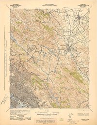
 1915 Concord1915 Print · USGSContra Costa and Alameda counties are shown here just before the mid-century population boom, when the East Bay was a landscape of ranchos and rail stops. Genealogists can trace family footprints in small 1910s settlements like Moraga, Pacheco, and Lafayette.5 unique versions available
 - 1915 Map of San Francisco
 1915 San Francisco1915 Print · USGSSan Francisco and the East Bay appear at a pivotal moment just before the First World War, featuring the grand layout of the Panama-Pacific International Exposition. Genealogists and historians can trace the early rail networks of the Key Route Pier, the industrial waterfront at Winehaven, and historic landmarks like Cliff House.6 unique versions available
 - 1939 Map of San Mateo, 1956 Print
 1939 San Mateo1956 Print · USGSThe San Francisco Peninsula at the brink of the 1940s reveals a landscape of ridge-top vistas and growing railroad towns. Researchers can trace the early layouts of Burlingame, San Bruno, and Millbrae, or locate institutional landmarks like St Josephs Military Academy and the extensive Chinese Cem.3 unique versions available
 - 1942 Map of Concord
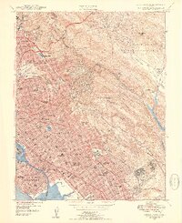
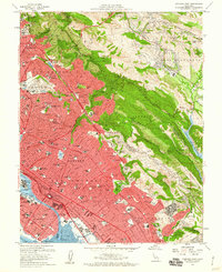
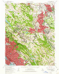
 1942 Concord1942 Print · USGSThe East Bay interior was a landscape of expanding valley towns and deep-rooted ranching tracts in the early 1940s. Genealogists and historians can trace rail-era settlements like Concord, Lafayette, and Walnut Creek alongside local landmarks like St Marys College and Sherman Field.
 - 1942 Map of Hayward
 1942 Hayward1942 Print · USGSThe East Bay shoreline and inland foothills come alive in the early 1940s as industry and infrastructure reshape the landscape. Researchers can trace the original footprints of Russell City and Mt Eden or locate the historic Oakland Speedway and Fairmont Hospital.
 - 1943 Map of Concord
 1943 Concord1943 Print · USGSThe East Bay and Contra Costa interior appear here during the wartime era, showing the transition from urban waterfronts to rural valley communities. Researchers can trace early rail lines like the Sacramento Northern RR and locate local landmarks such as St Marys College and Acalanes Sch.
 - 1943 Map of San Mateo
 1943 San Mateo1943 Print · USGSThe San Francisco Peninsula during the mid-war years shows a region of expanding shoreline industry and established hillside communities. Researchers can trace historic landmarks like St Josephs Military Academy and the Golden Gate National Cem.
 - 1947 Map of San Francisco, 1948 Print
 1947 San Francisco1948 Print · USGSThe Bay Area in the late 1940s reveals a region transitioning from wartime intensity to post-war suburban growth. Trace the historic rail lines of the Southern Pacific RR or locate early military footprints at Fort Funston and Moffett Field.
 - 1947 Map of Oakland East, 1954 Print
 1947 Oakland East1954 Print · USGSThe East Bay waterfront and hills are caught in a moment of rapid postwar expansion during the late 1940s. Genealogists and local historians can locate early neighborhood schools like Cleveland School, historic burial grounds at Mountain View Cemetery, and the extensive Southern Pacific rail network.3 unique versions available
 - 1947 Map of San Leandro, 1956 Print
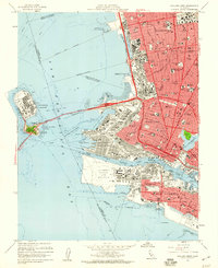
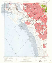
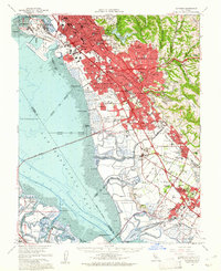
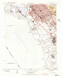 1947 San Leandro1956 Print · USGSThe East Bay shoreline in the late 1940s shows a fascinating mix of industrial salt production and rapid suburban development. Researchers can trace early aviation at the Oakland Municipal Airport or locate community anchors like San Lorenzo Village and the Oakland Speedway.
 - 1948 Map of San Leandro
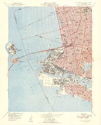
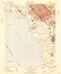 1948 San Leandro1948 Print · USGSPost-war East Bay growth is on full display in this late 1940s survey of the shoreline. Genealogists and historians can trace the emergence of San Lorenzo Village or locate local landmarks like the Oakland Speedway, Powder Works, and the Naval Chapel.
 - 1948 Map of San Francisco, 1951 Print
 1948 San Francisco1951 Print · USGSThe Bay Area in the late 1940s reveals a landscape defined by rapid post-war growth and a heavy military presence at the Golden Gate. Trace the development of early trans-bay infrastructure like the Oakland-Bay Bridge and historic coastal defense sites such as Fort Funston and Alcatraz Island.
 - 1949 Map of Oakland West
 1949 Oakland West1949 Print · USGSThe East Bay waterfront was a bustling landscape of rail yards and military installations in the late 1940s. Genealogists and historians can trace the neighborhood schools and piers of Berkeley and Oakland, from the Oakland Mole to Notre Dame Academy.2 unique versions available
 - 1949 Map of Oakland East
 1949 Oakland East1949 Print · USGSThe East Bay was a thriving hub of education and post-war development in the late 1940s. Genealogists and historians can trace neighborhood growth near Mills College, locate memorials at Mountain View Cemetery, and see the Oak Knoll Naval Hospital at its peak.2 unique versions available
 - 1955 Map of San Francisco
 1955 San Francisco1955 Print · USGSThe San Francisco Bay Area and central coast are captured during the postwar boom as suburbs and infrastructure expanded rapidly. Trace the development of local communities and military installations like the Presidio and Fort Mason, or follow the Southern Pacific rail lines.
 - 1956 Map of San Francisco
 1956 San Francisco1956 Print · USGSThe San Francisco Bay Area is captured in the mid-fifties, showing a landscape of rapid post-war growth and massive military installations. Researchers can trace the sprawling rail lines of the Southern Pacific and locate historic sites like Stanford University or the Hunters Point Naval Shipyard.4 unique versions available
 - 1956 Map of Hunters Point, 1967 Print
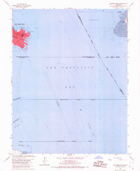 1956 Hunters Point1967 Print · USGSSan Francisco Bay’s industrial and military coastline comes into focus during the mid-fifties, centered on the strategic US Naval Reservation. Maritime researchers can trace deep-water access through the Oyster Point Channel or locate the early structures of the San Francisco International Airport.5 unique versions available
 - 1957 Map of San Francisco
 1957 San Francisco1957 Print · USGSThe Bay Area in the mid-fifties reveals a rapidly growing metropolitan landscape connected by its iconic spans and rail networks. Researchers can trace the layout of military sites like the Presidio and the extent of the Southern Pacific and Western Pacific railroads.
 - 1959 Map of Oakland East, 1960 Print
 1959 Oakland East1960 Print · USGSThe East Bay hills meet the dense urban grids of Oakland and Berkeley in the late fifties, just as new freeways began to reshape the landscape. Genealogists and historians can trace neighborhood growth through dozens of schools, Mountain View Cemetery, and the Oak Knoll Naval Hospital.6 unique versions available
 - 1959 Map of Oakland West, 1960 Print
 1959 Oakland West1960 Print · USGSThe East Bay waterfront thrives at the close of the fifties, defined by massive military installations and a complex rail-to-sea network. Genealogists and historians can locate old neighborhood schools like Technical High Sch or trace the docks of the Oakland Army Terminal and the Oakland Mole.5 unique versions available
 - 1959 Map of San Leandro, 1960 Print
 1959 San Leandro1960 Print · USGSThe East Bay shoreline in the late fifties shows the post-war transition from landings and marshes to a dense suburban corridor. Genealogists and historians can trace numerous neighborhood schools and landmarks like Russell City, Lorenzo Sta, and the Oakland Naval Air Station.4 unique versions available
 - 1959 Map of Concord, 1961 Print
 1959 Concord1961 Print · USGSThe East Bay's mid-century expansion is on full display here as suburban growth reaches into the interior valleys and ridges. Genealogists and local historians can trace legacy sites like Lafayette Cem, the small settlement of Eastport, and the campus of St Marys College.2 unique versions available
 - 1959 Map of Hayward, 1961 Print
 1959 Hayward1961 Print · USGSThe East Bay shoreline in the late fifties reveals a period of massive suburban and industrial growth along the new Nimitz Freeway. Genealogists and historians can trace old neighborhoods and sites like Russell City, Mt Eden Cem, and the Oakland Naval Air Sta.2 unique versions available
Showing maps 1-25 of 35
Top cities near Alameda
- San Francisco historical maps
- Oakland historical maps
- Fremont historical maps
- Hayward historical maps
- Concord historical maps
- Berkeley historical maps
See more
Top neighborhoods of Alameda
- East End historical maps
- Woodstock historical maps
- Gold Coast historical maps
- Fernside historical maps
- Centre Court historical maps
- Bay Farm Island historical maps
See more
Frequently asked questions
- What are the different types of historical maps available for Alameda?
- What is the oldest map of Alameda?
- Where can I purchase historical maps of Alameda for my home or office?
- Where can I download high-res historical maps of Alameda?
- Are there historical topographic maps available for Alameda?
- Is there historical aerial imagery available for Alameda?
- Where are historical maps of Alameda sourced from?