Old Maps of Oakland, California
Explore 56 old maps of Oakland, spanning from 1892 to today. These high-resolution historic maps reveal how streets, neighborhoods, landmarks, and natural features evolved over time — perfect for genealogy, metal detecting, research, and local history exploration.
What you can do with these maps:
- See how Oakland changed over time: Compare historical maps to modern-day views to trace roads, homesites, rail lines & more.
- View detailed metadata: Each map includes creators, publishers, year, scale, and archive source.
- Overlay maps with satellite & LiDAR: Visualize the past alongside modern tools to explore terrain & human change.
- Trusted historical sources: Maps sourced from the USGS, Library of Congress, and other archives.
- Access maps your way: View online, download high-res files, or order prints for personal or research use.
Start exploring old maps of Oakland to uncover forgotten places, hidden landmarks, and the deep history beneath your feet.
Oakland, CA maps
(56)- 1892 Map of San Mateo
 1892 San Mateo1892 Print · USGSCovers Oakland, including San Francisco, San Mateo, and other nearby areas
 - 1895 Map of San Francisco
 1895 San Francisco1895 Print · USGSCovers Oakland, including San Francisco, Berkeley, and other nearby areas
 - 1896 Map of San Mateo
 1896 San Mateo1896 Print · USGSCovers Oakland, including San Francisco, San Mateo, and other nearby areas
 - 1897 Map of Concord
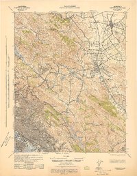
 1897 Concord1897 Print · USGSCovers Oakland, including Concord, Berkeley, and other nearby areas6 unique versions available
 - 1899 Map of San Francisco
 1899 San Francisco1899 Print · USGSCovers Oakland, including San Francisco, Berkeley, and other nearby areas7 unique versions available
 - 1899 Map of Haywards
 1899 Haywards1899 Print · USGSCovers Oakland, including Fremont, Hayward, and other nearby areas5 unique versions available
 - 1899 Map of San Mateo
 1899 San Mateo1899 Print · USGSCovers Oakland, including San Francisco, San Mateo, and other nearby areas6 unique versions available
 - 1915 Map of San Mateo
 1915 San Mateo1915 Print · USGSCovers Oakland, including San Francisco, San Mateo, and other nearby areas6 unique versions available
 - 1915 Map of Haywards
 1915 Haywards1915 Print · USGSCovers Oakland, including Fremont, Hayward, and other nearby areas4 unique versions available
 - 1915 Map of Concord
 1915 Concord1915 Print · USGSCovers Oakland, including Concord, Berkeley, and other nearby areas5 unique versions available
 - 1915 Map of San Francisco
 1915 San Francisco1915 Print · USGSCovers Oakland, including San Francisco, Berkeley, and other nearby areas6 unique versions available
 - 1939 Map of San Mateo, 1956 Print
 1939 San Mateo1956 Print · USGSCovers Oakland, including San Francisco, San Mateo, and other nearby areas3 unique versions available
 - 1942 Map of Concord
 1942 Concord1942 Print · USGSCovers Oakland, including Concord, Berkeley, and other nearby areas
 - 1942 Map of Hayward
 1942 Hayward1942 Print · USGSCovers Oakland, including Fremont, Hayward, and other nearby areas
 - 1943 Map of Concord
 1943 Concord1943 Print · USGSCovers Oakland, including Concord, Berkeley, and other nearby areas
 - 1943 Map of San Mateo
 1943 San Mateo1943 Print · USGSCovers Oakland, including San Francisco, San Mateo, and other nearby areas
 - 1947 Map of San Francisco, 1948 Print
 1947 San Francisco1948 Print · USGSCovers Oakland, including San Jose, San Francisco, and other nearby areas
 - 1947 Map of Briones Valley, 1954 Print
 1947 Briones Valley1954 Print · USGSCovers Oakland, including Berkeley, Richmond, and other nearby areas
 - 1947 Map of Oakland East, 1954 Print
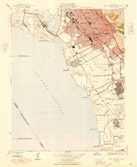
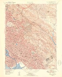 1947 Oakland East1954 Print · USGSCovers Oakland, including Berkeley, Alameda, and other nearby areas3 unique versions available
 - 1947 Map of San Leandro, 1956 Print
 1947 San Leandro1956 Print · USGSCovers Oakland, including Hayward, San Leandro, and other nearby areas
 - 1947 Map of Las Trampas Ridge, 1956 Print
 1947 Las Trampas Ridge1956 Print · USGSCovers Oakland, including San Ramon, Walnut Creek, and other nearby areas
 - 1947 Map of Hayward, 1957 Print
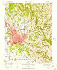 1947 Hayward1957 Print · USGSCovers Oakland, including Hayward, San Leandro, and other nearby areas
 - 1948 Map of San Leandro
 1948 San Leandro1948 Print · USGSCovers Oakland, including Hayward, San Leandro, and other nearby areas
 - 1948 Map of San Francisco, 1951 Print
 1948 San Francisco1951 Print · USGSCovers Oakland, including San Jose, San Francisco, and other nearby areas
 - 1949 Map of Oakland West
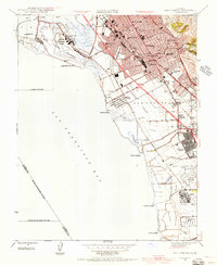
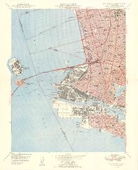 1949 Oakland West1949 Print · USGSCovers Oakland, including San Francisco, Berkeley, and other nearby areas2 unique versions available
Showing maps 1-25 of 56
Top cities near Oakland
- San Francisco historical maps
- Fremont historical maps
- Hayward historical maps
- Concord historical maps
- Berkeley historical maps
- Richmond historical maps
See more
Top neighborhoods of Oakland
- Downtown Oakland historical maps
- North Oakland historical maps
- Oakland Hills historical maps
- East Oakland historical maps
- West Oakland historical maps
- Longfellow historical maps
See more
Frequently asked questions
- What are the different types of historical maps available for Oakland?
- What is the oldest map of Oakland?
- Where can I purchase historical maps of Oakland for my home or office?
- Where can I download high-res historical maps of Oakland?
- Are there historical topographic maps available for Oakland?
- Is there historical aerial imagery available for Oakland?
- Where are historical maps of Oakland sourced from?