
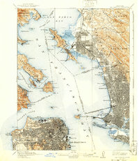
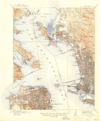
1915 Map of San Francisco
USGS Topo · Published 1915This historical map portrays the area of San Francisco in 1915, primarily covering San Francisco as well as portions of Alameda, Contra Costa County, and Marin County. Featuring a scale of 1:62500, this map provides a highly detailed snapshot of the terrain, roads, buildings, counties, and historical landmarks in the San Francisco region at the time. Published in 1915, it is one of 6 known editions of this map due to revisions or reprints.
Find a feature on this map
123 named features on this map. Tap any name to fly to it.
Don’t see what you’re looking for? This feature index may not catch every label — zoom into the map to look around manually.
Map Details
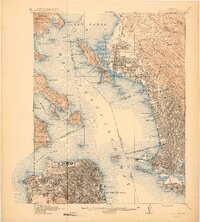
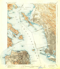
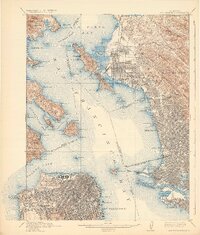
Editions of this 1915 San Francisco Map
6 editions found
Historical Maps of Oakland Through Time
14 maps found

1895 San Francisco
San Francisco County, CA

1899 San Francisco
San Francisco County, CA
1915 San Francisco
San Francisco County, CA

1947 San Francisco
San Francisco County, CA

1948 San Francisco
San Francisco County, CA

1955 San Francisco
San Francisco County, CA
1956 San Francisco
San Francisco County, CA

1957 San Francisco
San Francisco County, CA

1960 San Francisco
San Francisco County, CA

1961 San Francisco
San Francisco County, CA

1964 San Francisco
San Francisco County, CA

1971 San Francisco
San Francisco County, CA

1978 San Francisco
San Francisco County, CA

1985 San Francisco
San Francisco County, CA