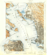
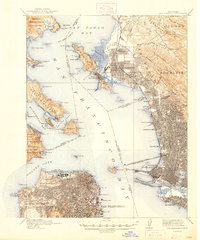
1915 Map of San Francisco
USGS Topo · Published 1915About this map
The Site of Panama-Pacific International Exposition stands as a primary focal point along the northern waterfront, signaling a moment of global transition and civic pride. This urban landscape is heavily defined by its massive rail and maritime infrastructure, with the Oakland Mole and the San Francisco-Oakland Terminal Key Route Pier reaching deep into the water to connect mainland commerce with the city. On the hills to the east, the University of California campus and the Sheldon School overlook the dense grids of Berkeley and Oakland.
Find a feature on this map
134 named features on this map. Tap any name to fly to it.
Don’t see what you’re looking for? This feature index may not catch every label — zoom into the map to look around manually.
Map Details
Editions of this 1915 San Francisco Map
6 editions found

Other maps of this area

1892 · San Mateo
USGS Topo · 1:62,500

1895 · San Francisco
USGS Topo · 1:62,500

1896 · San Mateo
USGS Topo · 1:62,500

1896 · Carquinez Strait
USGS Topo · 1:62,500

1897 · Concord
USGS Topo · 1:62,500

1897 · Tamalpais
USGS Topo · 1:62,500

1898 · Karquines
USGS Topo · 1:62,500

1899 · San Francisco
USGS Topo · 1:62,500

1899 · Haywards
USGS Topo · 1:62,500

1899 · San Mateo
USGS Topo · 1:62,500