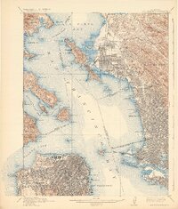
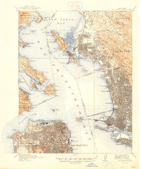
1915 Map of San Francisco
USGS Topo · Published 1932About this map
The Panama-Pacific International Exposition and its accompanying entertainment district, The Zone, dominate the northern shoreline of the city in this 1915 revision. This era represents a pivotal moment for the Bay Area, showing the density of San Francisco alongside the growing industrial and rail hubs of Oakland, Berkeley, and Richmond. The complex maritime and rail infrastructure of the period is visible through the Oakland Mole and the San Francisco-Oakland Terminal Key Route Pier, which bridged the gap between transcontinental rail lines and the city's ferry terminals.
Find a feature on this map
122 named features on this map. Tap any name to fly to it.
Don’t see what you’re looking for? This feature index may not catch every label — zoom into the map to look around manually.
Map Details
Editions of this 1915 San Francisco Map
6 editions found

Other maps of this area

1892 · San Mateo
USGS Topo · 1:62,500

1895 · San Francisco
USGS Topo · 1:62,500

1896 · San Mateo
USGS Topo · 1:62,500

1896 · Carquinez Strait
USGS Topo · 1:62,500

1897 · Concord
USGS Topo · 1:62,500

1897 · Tamalpais
USGS Topo · 1:62,500

1898 · Karquines
USGS Topo · 1:62,500

1899 · San Francisco
USGS Topo · 1:62,500

1899 · Haywards
USGS Topo · 1:62,500

1899 · San Mateo
USGS Topo · 1:62,500