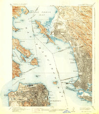
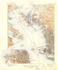
1915 Map of San Francisco
USGS Topo · Published 1929About this map
The Panama-Pacific International Exposition anchors the northern waterfront of San Francisco in this survey, showcasing the temporary city created for the 1915 world's fair. To the west, the Presidio and Golden Gate Park define the city's open spaces, while the densely gridded streets of San Francisco terminate at the busy docks of Steamboat Pt and Rincon Pt. Across the San Francisco Bay, the industrial growth of the East Bay is evident in the sprawling rail yards and piers of Oakland and Berkeley.
Find a feature on this map
142 named features on this map. Tap any name to fly to it.
Don’t see what you’re looking for? This feature index may not catch every label — zoom into the map to look around manually.
Map Details
Editions of this 1915 San Francisco Map
6 editions found

Other maps of this area

1892 · San Mateo
USGS Topo · 1:62,500

1895 · San Francisco
USGS Topo · 1:62,500

1896 · San Mateo
USGS Topo · 1:62,500

1896 · Carquinez Strait
USGS Topo · 1:62,500

1897 · Concord
USGS Topo · 1:62,500

1897 · Tamalpais
USGS Topo · 1:62,500

1898 · Karquines
USGS Topo · 1:62,500

1899 · San Francisco
USGS Topo · 1:62,500

1899 · Haywards
USGS Topo · 1:62,500

1899 · San Mateo
USGS Topo · 1:62,500