Old Maps of Cape Horn, California for Genealogy
Trace your family roots with 14 historic maps of Cape Horn. These high-res maps reveal old neighborhoods, homesites, landmarks, and streets — helping you uncover where your ancestors lived and how the area evolved over time.
- Explore historic neighborhoods: Identify where your relatives may have lived in the 1800s or 1900s.
- Compare maps over time: Trace the changes in streets, buildings, and landmarks for multi-generational research.
- Perfect for genealogy & ancestry research: Used by family historians and researchers to map out lineage and migration.
These maps are an incredible resource for exploring your personal connection to Cape Horn's past.
Cape Horn, CA maps
(14)- 1896 Map of Dardanelles
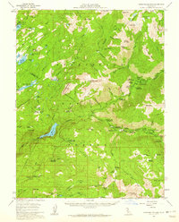
 1896 Dardanelles1896 Print · USGSThe high Sierra wilderness in the late 1890s reveals a landscape of early forest reserves and remote outposts. Trace the early boundaries of Yosemite National Park and find historic stops like Baker Station and Brightman Flat.2 unique versions available
 - 1898 Map of Dardanelles
 1898 Dardanelles1898 Print · USGSThe high Sierra Nevada backcountry comes alive in the late 1890s, centered on the canyons of the Stanislaus and West Walker rivers. Trace early high-country travel routes through Sonora Pass or locate historical stops like Baker Station and the meadows of Brightman Flat.8 unique versions available
 - 1948 Map of Walker Lake
 1948 Walker Lake1948 Print · USGSThe high desert of Nevada and the eastern Sierra Nevada are captured just after the war as mining and ranching shaped the local economy. Genealogists can trace family connections to centers like Hawthorne and Mina or locate the historic Rockland Mines and Aurora.2 unique versions available
 - 1956 Map of Dardanelles Cone, 1959 Print
 1956 Dardanelles Cone1959 Print · USGSThe High Sierra of Tuolumne and Alpine counties appears here in the mid-fifties, during a peak era of summer camp expansion and reservoir development. Researchers can trace the layout of early recreation sites like the Douglas Resort, Sierra Girl Scout Camp, and Dardanelle PO.3 unique versions available
 - 1957 Map of Walker Lake
 1957 Walker Lake1957 Print · USGSThe Nevada-California borderlands in the mid-1950s show a rugged network of mining camps and river-valley towns centered around Walker Lake. Researchers can trace the Southern Pacific rail line and locate historical sites like Bodie, Sodaville, and the Leviathan Sulphur Mine.4 unique versions available
 - 1962 Map of Walker Lake
 1962 Walker Lake1962 Print · USGSThe high desert of western Nevada and the Sierra Nevada crest meet in this mid-century study of the Eastern Sierra frontier. Researchers can trace the Southern Pacific rail lines connecting Hawthorne to remote mining outposts like Bodie, Aurora, and Mina.
 - 1964 Map of Walker Lake
 1964 Walker Lake1964 Print · USGSThe high desert and the Sierra Nevada peaks come together in the mid-1960s, showing a landscape defined by mining, military installations, and vast wilderness. Genealogists and historians can trace the remnants of old mining camps at Bodie or Candelaria and follow the Southern Pacific rail lines.2 unique versions available
 - 1979 Map of Spicer Meadow Res., 1980 Print
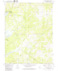 1979 Spicer Meadow Res.1980 Print · USGSHigh Sierra wilderness and water management converge along the Alpine and Tuolumne county line in the late 1970s. Researchers can trace historic pack trails and identify seasonal camps near Lake Alpine, Union Reservoir, and Bull Run Peak.3 unique versions available
 - 1985 Map of Bridgeport
 1985 Bridgeport1985 Print · USGSThe High Sierra and Nevada borderlands are captured in the mid-1980s, documenting a landscape of national forests and high-altitude mining districts. Researchers can trace historic operations like the Bodie Mine and May Lundy Mine or locate early settlements at Aurora and Baker Station.
 - 2001 Map of Spicer Meadow Reservoir, 2004 Print
 2001 Spicer Meadow Reservoir2004 Print · USGSHigh Sierra water management and wilderness recreation define this Alpine County region at the start of the new millennium. Hikers and historians can trace the Pacific Crest Trail as it winds past Spicer Meadow Reservoir and Lake Alpine.
 - 2012 Map of Spicer Meadow Reservoir, 2012 Print
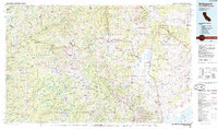
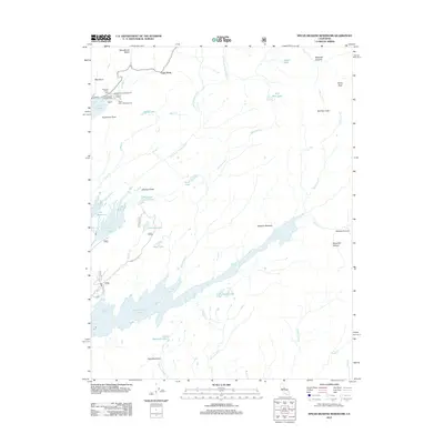 2012 Spicer Meadow Reservoir2012 Print · USGSCovers Cape Horn, including Tuolumne County, Alpine County, and other nearby areas
 - 2015 Map of Spicer Meadow Reservoir, 2015 Print
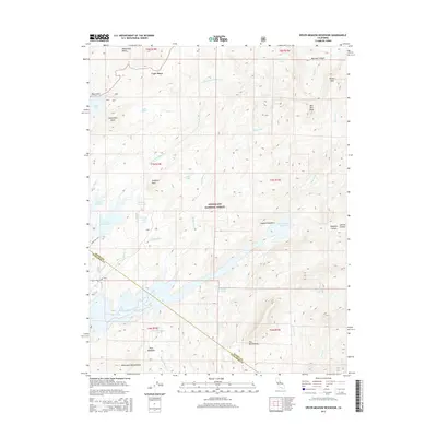 2015 Spicer Meadow Reservoir2015 Print · USGSCovers Cape Horn, including Tuolumne County, Alpine County, and other nearby areas
 - 2018 Map of Spicer Meadow Reservoir, 2018 Print
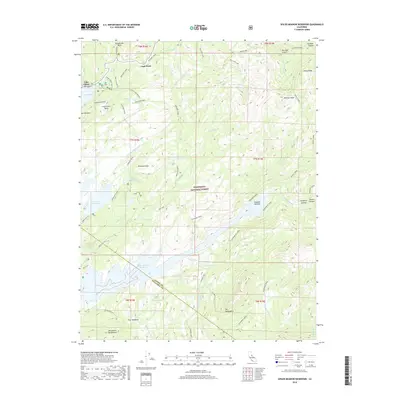 2018 Spicer Meadow Reservoir2018 Print · USGSCovers Cape Horn, including Tuolumne County, Alpine County, and other nearby areas
 - 2021 Map of Spicer Meadow Reservoir, 2021 Print
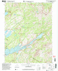
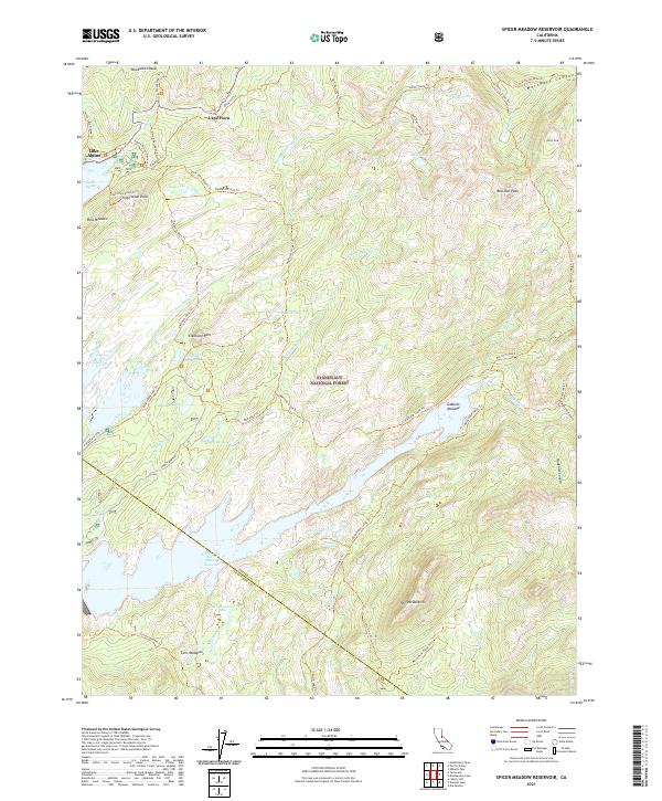 2021 Spicer Meadow Reservoir2021 Print · USGSThe High Sierra near the Alpine and Tuolumne county line is shown here in the early twenty-first century. Researchers can trace the path of the Emigrant Trl and locate secluded landmarks like The Dardanelles and Spicer Meadow Reservoir.
End of results
Showing maps 1-14 of 14
Top cities near Cape Horn
Frequently asked questions
- What are the different types of historical maps available for Cape Horn?
- What is the oldest map of Cape Horn?
- Where can I purchase historical maps of Cape Horn for my home or office?
- Where can I download high-res historical maps of Cape Horn?
- Are there historical topographic maps available for Cape Horn?
- Is there historical aerial imagery available for Cape Horn?
- Where are historical maps of Cape Horn sourced from?