Old Maps of Durham, California for Genealogy
Trace your family roots with 50 historic maps of Durham. These high-res maps reveal old neighborhoods, homesites, landmarks, and streets — helping you uncover where your ancestors lived and how the area evolved over time.
- Explore historic neighborhoods: Identify where your relatives may have lived in the 1800s or 1900s.
- Compare maps over time: Trace the changes in streets, buildings, and landmarks for multi-generational research.
- Perfect for genealogy & ancestry research: Used by family historians and researchers to map out lineage and migration.
These maps are an incredible resource for exploring your personal connection to Durham's past.
Durham, CA maps
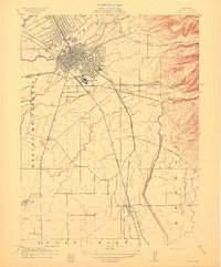
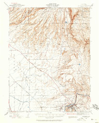
(50)- 1891 Map of Chico
 1891 Chico1891 Print · USGSUpper Sacramento Valley life in the late nineteenth century revolved around the rail lines and river landings of Chico and Oroville. Genealogists and researchers can trace the early layout of mountain settlements like Magalia and Nimshew or locate old industrial sites including Keefers Old Mill and Doons Mill.
 - 1893 Map of Chico
 1893 Chico1893 Print · USGSNorthern California at the height of the nineteenth-century rail and ranching era reveals a network of valley landings and mountain mining camps. Genealogists and historians can trace family locations from Chico to remote spots like Helltown, Old Lovelock, and the Lucretia Mine.
 - 1895 Map of Chico
 1895 Chico1895 Print · USGSNorthern California at the close of the nineteenth century reveals a landscape defined by the Southern Pacific R. R. and early foothill industry. Trace the locations of historic lumber and mining operations like Keefer's Mill, Lucky Jim Mine, and Chapman's Mill.8 unique versions available
 - 1912 Map of Dry Creek
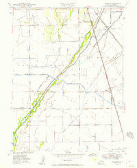
 1912 Dry Creek1912 Print · USGSButte County agriculture and transit are in transition during the early 1900s as interurban rail lines connect rural outposts. Genealogists can locate family-named sites and schools like Rio Seco School, Tres Vias, and the Northern Electric RR.
 - 1912 Map of Durham
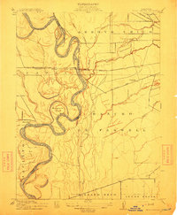
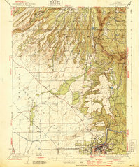
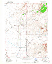
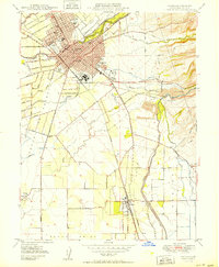
 1912 Durham1912 Print · USGSNorthern Sacramento Valley industry and agriculture thrive in the decade before the Great War. Genealogists can trace the early streets of Chico, the worker housing at Barber, and rural schools like York School near the Diamond Match Factory.
 - 1912 Map of Chico Landing
 1912 Chico Landing1912 Print · USGSThe Sacramento River corridor near Butte County was a landscape of winding sloughs and emerging rail lines in the early twentieth century. Researchers can trace the footprints of riverside settlements like Munroeville, find old schools such as River Road School, and locate historical crossings of the Northern Electric RR.2 unique versions available
 - 1912 Map of Nelson
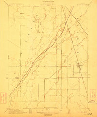 1912 Nelson1912 Print · USGSThe Central Valley's agricultural and rail-driven landscape comes into focus in the years before the Great War. Researchers can trace the diverging paths of the Southern Pacific RR and Northern Electric RR through Nelson and Esquon.2 unique versions available
 - 1912 Map of Clear Creek
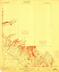 1912 Clear Creek1912 Print · USGSButte County foothills are captured in detail just before the modern era, showing the early road networks and canyon drainages. Trace historic transport routes like Centerville Road and Magalia Road alongside the waters of Butte Creek.2 unique versions available
 - 1912 Map of Newhard
 1912 Newhard1912 Print · USGSThe Sacramento River valley in the early twentieth century was a land of sprawling ranchos and vital river landings. Genealogists and historians can trace the foundations of local education at Aguas Frias School and locate former river hubs like Newhard Landing.
 - 1942 Map of Oroville, 1958 Print
 1942 Oroville1958 Print · USGSButte County foothills and the Sacramento Valley meet here in the early 1940s, just before the landscape was altered by mid-century water projects. Genealogists and historians can trace gold-era remnants at Cherokee, Oregon City, and the Bumble Bee Mines along the river.2 unique versions available
 - 1944 Map of Oroville
 1944 Oroville1944 Print · USGSButte County at the height of the mid-century mining and rail era shows a landscape defined by the Feather River and the massive Table Mountains. Researchers can locate historic sites like Oregon City, the New Era Mine, and the Concow Sch.2 unique versions available
 - 1948 Map of Chico, 1955 Print
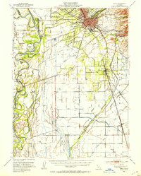
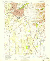 1948 Chico1955 Print · USGSNorthern California at the dawn of the fifties shows a bustling college town integrated with heavy industry and agriculture. Genealogists can trace family footprints from the Diamond Match Factory to the Durham Cem or the classrooms of the State College.5 unique versions available
 - 1948 Map of Nelson, 1957 Print
 1948 Nelson1957 Print · USGSThe Sacramento Valley's agricultural heartland is captured here in the late 1940s, showing a landscape defined by irrigation and rail. Genealogists and historians can trace the rail sidings at Nelson and Esquon or the complex water network of the Western Canal and Butte Creek.4 unique versions available
 - 1948 Map of Shippee, 1957 Print
 1948 Shippee1957 Print · USGSButte County at the end of the 1940s reveals a landscape of industrial agriculture and intersecting railroads. Researchers can trace the junction at Oroville Junc (Tres Vias), find the Floral Sch, and follow the canal systems through Shippee and Ramada.3 unique versions available
 - 1948 Map of Llano Seco, 1958 Print
 1948 Llano Seco1958 Print · USGSThe Sacramento River valley in the late 1940s remained a landscape of historic land grants and winding sloughs. Genealogists and researchers can trace large estates like Rancho De Farwell or find riverside sites such as Parrott Landing.3 unique versions available
 - 1949 Map of Chico, 1953 Print
 1949 Chico1953 Print · USGSMid-century Butte County thrives along the river and rail, from the academic center of Chico to the agricultural hubs of Durham and Nelson. Genealogists and researchers can trace local landmarks like Chico Cem, the Match Factory, and the Sacramento Northern railroad.3 unique versions available
 - 1949 Map of Ord Ferry, 1957 Print
 1949 Ord Ferry1957 Print · USGSThe Sacramento River valley at mid-century reveals a landscape of historic land grants and shifting river channels. Genealogists and researchers can trace local landmarks like Bidwell Sch, the Chico Landing site, and the river crossing at Ord Ferry.3 unique versions available
 - 1950 Map of Chico
 1950 Chico1950 Print · USGSChico and its surrounding ranchos are captured in detail during the post-war era, showing the city's expansion alongside the Southern Pacific tracks. Genealogists and researchers can trace local landmarks like the Diamond Match Factory, Durham Cem, and the State College campus.2 unique versions available
 - 1950 Map of Nelson
 1950 Nelson1950 Print · USGSThe northern Sacramento Valley in the mid-century shows a landscape shaped by water engineering and dual rail lines. Researchers can trace the layout of the settlement at Nelson and follow the routes of the Southern Pacific and Western Pacific railroads.
 - 1950 Map of Llano Seco
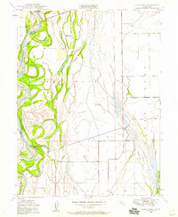
 1950 Llano Seco1950 Print · USGSThe Sacramento River bottomlands come to life in this mid-century survey of the Butte and Glenn county line. Genealogists and historians can locate old river access points like Hites Landing, trace the path of Ord Ferry Road, or study the grounds of Rancho Llano Seco.2 unique versions available
 - 1950 Map of Ord Ferry
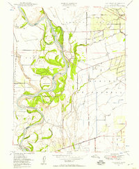
 1950 Ord Ferry1950 Print · USGSThe Sacramento River bottomlands near the Butte and Glenn county line come into focus just after the war. Local historians can trace early valley river life through sites like Ord Ferry, the Bidwell Sch, and the historical site of Chico Landing.
 - 1950 Map of Shippee
 1950 Shippee1950 Print · USGSThe Butte County agricultural heartland is documented here just after the war, showing a dense network of competing railroads and irrigation works. Genealogists and rail historians can trace the paths of the Sacramento Northern and find local landmarks like Floral Sch or the settlement of Shippee.
 - 1951 Map of Hamlin Canyon, 1952 Print
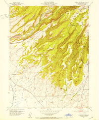 1951 Hamlin Canyon1952 Print · USGSThe foothills of Butte County are shown in the early fifties as the community of Paradise expanded along the ridgelines. Researchers can trace historical sites like the Clear Creek Sch (Aband), the Elliot Spring House, and geographic landmarks such as Robbers Roost.5 unique versions available
 - 1958 Map of Chico, 1962 Print
 1958 Chico1962 Print · USGSMid-century Northern California comes to life across the Central Valley and high Sierras as the postwar economy transformed the landscape. Trace the rail lines of the Southern Pacific RR, locate family roots near Chico Cem, or explore the early layout of Paradise and Beale Air Force Base.4 unique versions available
 - 1960 Map of Chico
 1960 Chico1960 Print · USGSThe Northern California high country and Sacramento Valley meet in this 1960s-era landscape of mining towns and river settlements. Trace the rail-and-water economy of the gold country through the Empire Mine, Beale Air Force Base, and the Western Pacific Railroad.
Showing maps 1-25 of 50
Top cities near Durham
- Chico historical maps
- Oroville historical maps
- Paradise historical maps
- Biggs historical maps
- Butte City historical maps
Top neighborhoods of Durham
- Esquon historical maps
- Ramada historical maps
- Blavo historical maps
- Nelson historical maps
- Dayton historical maps
- Roble historical maps
Frequently asked questions
- What are the different types of historical maps available for Durham?
- What is the oldest map of Durham?
- Where can I purchase historical maps of Durham for my home or office?
- Where can I download high-res historical maps of Durham?
- Are there historical topographic maps available for Durham?
- Is there historical aerial imagery available for Durham?
- Where are historical maps of Durham sourced from?