Old Maps of Parkhill, California for Genealogy
Trace your family roots with 17 historic maps of Parkhill. These high-res maps reveal old neighborhoods, homesites, landmarks, and streets — helping you uncover where your ancestors lived and how the area evolved over time.
- Explore historic neighborhoods: Identify where your relatives may have lived in the 1800s or 1900s.
- Compare maps over time: Trace the changes in streets, buildings, and landmarks for multi-generational research.
- Perfect for genealogy & ancestry research: Used by family historians and researchers to map out lineage and migration.
These maps are an incredible resource for exploring your personal connection to Parkhill's past.
Parkhill, CA maps
(17)- 1888 Map of Bidwell Bar, 1956 Print
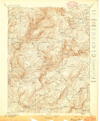
 1888 Bidwell Bar1956 Print · USGSThe northern Sierra foothills and Feather River canyons come alive in the late nineteenth century before modern reservoirs altered the landscape. Genealogists and researchers can trace family-named sites like Fields Ranch, Spanish Ranch, and Snows Mine.
 - 1891 Map of Bidwell Bar
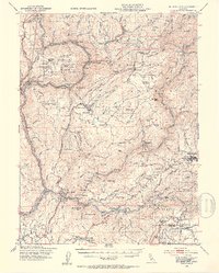
 1891 Bidwell Bar1891 Print · USGSThe gold-country ridges and deep river canyons of the northern Sierras are shown in the late nineteenth century as mining and timber production shaped the land. Researchers can trace early family-named waystations and industrial sites like American House, Bidwell Bar, and Clipper Mill.
 - 1893 Map of Bidwell Bar
 1893 Bidwell Bar1893 Print · USGSThe Plumas mountains during the late nineteenth century show a landscape defined by gold-era mining and remote stage stops. Genealogists and historians can locate early homesteads and industrial sites like Snows Mine, American House, and Bidwell Bar.
 - 1895 Map of Bidwell Bar
 1895 Bidwell Bar1895 Print · USGSThe Sierra foothills and high ridges of Northern California are captured here in the late nineteenth century. Genealogists and historians can trace isolated waystations and timber camps like American House, Spanish Ranch, and the Old Defiance Mill.
 - 1897 Map of Bidwell Bar
 1897 Bidwell Bar1897 Print · USGSThe Sierra Nevada foothills and river canyons come alive in the 1890s as a landscape of remote mines and mountain ranching. Genealogists can trace early homesteads and social hubs like Spanish Ranch, Forbestown, and Old Defiance Mill.7 unique versions available
 - 1948 Map of Big Bend Mtn, 1953 Print
 1948 Big Bend Mtn1953 Print · USGSIn the Sierra Nevada foothills during the late 1940s, this area remained a landscape of deep river canyons and historic mining camps. Genealogists and researchers can trace the old settlements of Forbestown and Enterprise, find the Indian Cemetery, or locate the Gold Bank Mine.4 unique versions available
 - 1948 Map of Las Plumas, 1955 Print
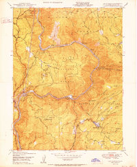
 1948 Las Plumas1955 Print · USGSButte County in the late 1940s is defined by the steep canyons of the Feather River and active mountain mining. Local historians can trace old homesteads and school sites like Rose Ranch, Berry Creek Sch, and the Evening Star Mine.
 - 1950 Map of Las Plumas
 1950 Las Plumas1950 Print · USGSButte County was a hub of mining and railroad engineering in the years following World War II. Researchers can locate active lode claims like the Surcease Mine and trace the Western Pacific line as it serves Berry Creek Station and Las Plumas.2 unique versions available
 - 1958 Map of Chico, 1962 Print
 1958 Chico1962 Print · USGSMid-century Northern California comes to life across the Central Valley and high Sierras as the postwar economy transformed the landscape. Trace the rail lines of the Southern Pacific RR, locate family roots near Chico Cem, or explore the early layout of Paradise and Beale Air Force Base.4 unique versions available
 - 1960 Map of Chico
 1960 Chico1960 Print · USGSThe Northern California high country and Sacramento Valley meet in this 1960s-era landscape of mining towns and river settlements. Trace the rail-and-water economy of the gold country through the Empire Mine, Beale Air Force Base, and the Western Pacific Railroad.
 - 1970 Map of Berry Creek, 1973 Print
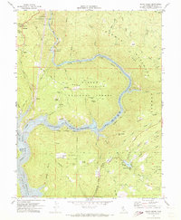 1970 Berry Creek1973 Print · USGSThe Butte County hills meet the rising waters of the Feather River during the transition to a reservoir-based economy. Researchers can trace the legacy of local mining at the Bunker Hill Mine and follow the old Western Pacific Railroad route.2 unique versions available
 - 1980 Map of Chico
 1980 Chico1980 Print · USGSButte County and the Sierra foothills are shown here in the 1980s as the region's water and timber economies matured. Genealogists and researchers can trace old land grants like Rancho Capay or locate mountain mining sites and settlements such as Cherokee, Magalia, and the Big Bend Mine.2 unique versions available
 - 1994 Map of Berry Creek, 1997 Print
 1994 Berry Creek1997 Print · USGSThe northern Sierra Nevada foothills appear in the mid-nineties as a landscape of hydro-electric power and mining claims. Trace historic gold operations like Bunker Hill Mine and community landmarks including Berry Creek Sch and the Rockefeller School.
 - 2012 Map of Berry Creek, 2012 Print
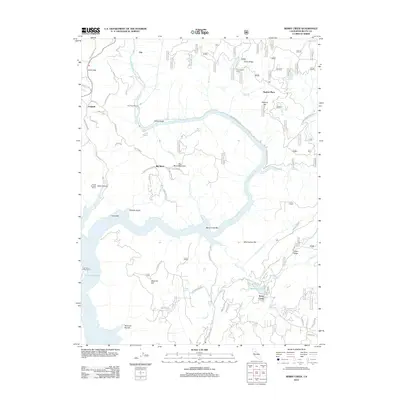 2012 Berry Creek2012 Print · USGSCovers Parkhill, including Moseley, Berry Creek, and other nearby areas
 - 2015 Map of Berry Creek, 2015 Print
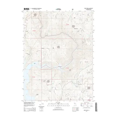 2015 Berry Creek2015 Print · USGSCovers Parkhill, including Moseley, Berry Creek, and other nearby areas
 - 2018 Map of Berry Creek, 2018 Print
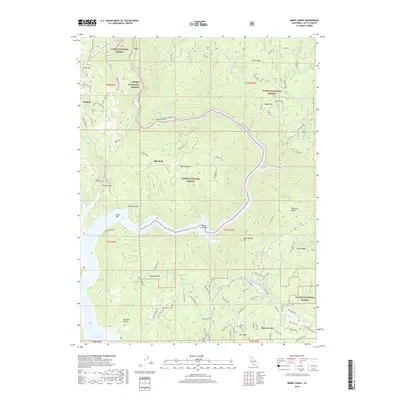 2018 Berry Creek2018 Print · USGSCovers Parkhill, including Moseley, Berry Creek, and other nearby areas
 - 2021 Map of Berry Creek, 2021 Print
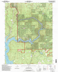
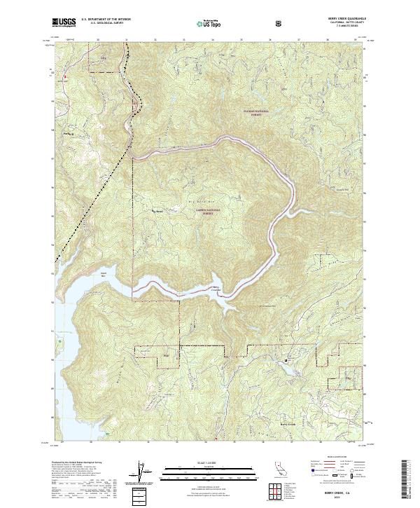 2021 Berry Creek2021 Print · USGSThe Butte County foothills and the Feather River canyon come into focus in the early 2020s. Genealogists and local historians can trace old community sites like Poe, locate the Madrone Cem, and identify historic riverside landings like Island Bar.
End of results
Showing maps 1-17 of 17
Top cities near Parkhill
- Chico historical maps
- Oroville historical maps
- Durham historical maps
- Paradise historical maps
- Stirling City historical maps
Frequently asked questions
- What are the different types of historical maps available for Parkhill?
- What is the oldest map of Parkhill?
- Where can I purchase historical maps of Parkhill for my home or office?
- Where can I download high-res historical maps of Parkhill?
- Are there historical topographic maps available for Parkhill?
- Is there historical aerial imagery available for Parkhill?
- Where are historical maps of Parkhill sourced from?