2000s (21st Century) Maps of Douglas Flat, California
Explore 5 historic maps of Douglas Flat from the 2000s (21st Century). These maps offer a rare glimpse into what life looked like during the 2000s — showing old roads, neighborhoods, homes, and landmarks that have changed or disappeared over time.
Whether you're researching your family's past, planning a metal detecting trip, or studying how Douglas Flat's landscape evolved across the 2000s, these high-resolution maps are a powerful tool for exploring the history of this region.
- Focus on a specific era: All maps on this page are from the 2000s, giving you a focused view of this time period.
- See what’s changed: Compare century-old streets, trails, and buildings to today's modern landscape using overlays and satellite layers.
- Research with precision: Use these maps for genealogy, historical research, land use analysis, or educational projects.
- View, download, or print: Maps are fully viewable online in high resolution, and can be downloaded or printed for your own records.
Start exploring Douglas Flat's history through authentic maps from the 2000s. This is your window into the past.
Douglas Flat, CA maps
(5)- 2001 Map of Columbia, 2004 Print
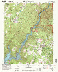 2001 Columbia2004 Print · USGSCalaveras and Tuolumne counties meet along the rugged Stanislaus River canyon in this early 2000s survey of California's Gold Country. Genealogists and researchers can trace the historic footprint of Columbia State Historic Park, locate the Catholic Cemetery, and explore old mining sites like Yankee Hill.2 unique versions available
 - 2012 Map of Columbia, 2012 Print
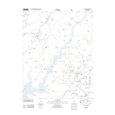 2012 Columbia2012 Print · USGSCovers Douglas Flat, including Sonora, Yankee Hill, and other nearby areas
 - 2015 Map of Columbia, 2015 Print
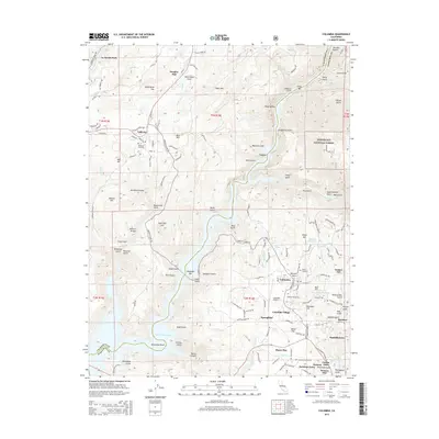 2015 Columbia2015 Print · USGSCovers Douglas Flat, including Sonora, Yankee Hill, and other nearby areas
 - 2018 Map of Columbia, 2018 Print
 2018 Columbia2018 Print · USGSCovers Douglas Flat, including Sonora, Yankee Hill, and other nearby areas
 - 2021 Map of Columbia, 2021 Print
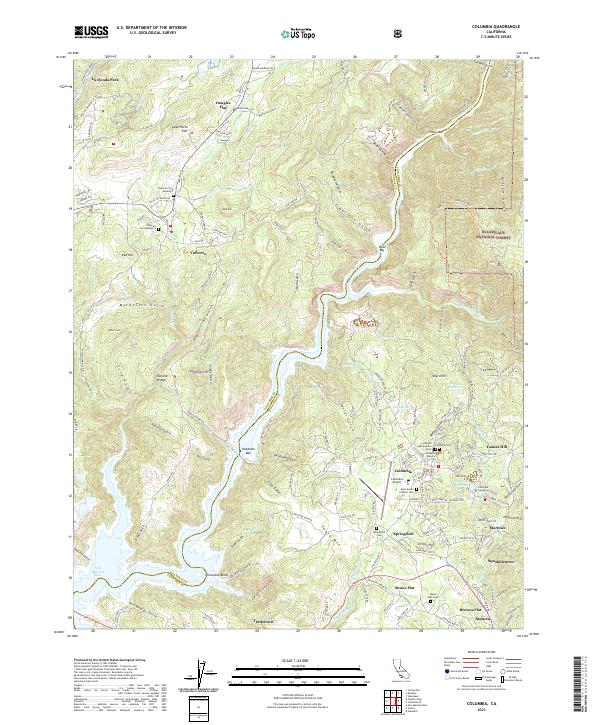 2021 Columbia2021 Print · USGSThe Mother Lode region of Tuolumne and Calaveras counties is seen here in recent decades, showing the intricate intersection of gold-era settlements and modern preservation. Genealogists can locate several historic burial sites like Columbia Masonic Cem and Springfield Cem while tracing landforms like Table Mtn.
End of results
Showing maps 1-5 of 5
Top cities near Douglas Flat
Frequently asked questions
- What are the different types of historical maps available for Douglas Flat?
- What is the oldest map of Douglas Flat?
- Where can I purchase historical maps of Douglas Flat for my home or office?
- Where can I download high-res historical maps of Douglas Flat?
- Are there historical topographic maps available for Douglas Flat?
- Is there historical aerial imagery available for Douglas Flat?
- Where are historical maps of Douglas Flat sourced from?