Old Maps of Willows, California
Explore 20 old maps of Willows, spanning from 1906 to today. These high-resolution historic maps reveal how streets, neighborhoods, landmarks, and natural features evolved over time — perfect for genealogy, metal detecting, research, and local history exploration.
What you can do with these maps:
- See how Willows changed over time: Compare historical maps to modern-day views to trace roads, homesites, rail lines & more.
- View detailed metadata: Each map includes creators, publishers, year, scale, and archive source.
- Overlay maps with satellite & LiDAR: Visualize the past alongside modern tools to explore terrain & human change.
- Trusted historical sources: Maps sourced from the USGS, Library of Congress, and other archives.
- Access maps your way: View online, download high-res files, or order prints for personal or research use.
Start exploring old maps of Willows to uncover forgotten places, hidden landmarks, and the deep history beneath your feet.
Willows, CA maps
(20)- 1906 Map of Maxwell
 1906 Maxwell1906 Print · USGSColusa and Glenn Counties at the dawn of the century show a landscape defined by massive land grants and new irrigation. Trace family roots and vanished river stops like Boggs Landing and Compton Landing along the Sacramento River.3 unique versions available
 - 1906 Map of Willows
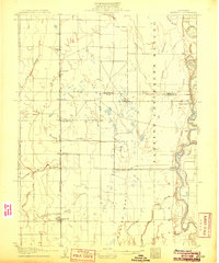
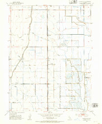
 1906 Willows1906 Print · USGSThe northern Sacramento Valley is captured here at the dawn of the irrigation era, centered on the growing railroad hubs of the western plains. Researchers can trace early water infrastructure like the Central Irrigation Canal alongside vanished river landings such as Sidds Ldg and Jacinto.2 unique versions available
 - 1917 Map of Lyman
 1917 Lyman1917 Print · USGSGlenn County agriculture was entering a transformative period of rail and water development during the late teens. Historians can trace the early rail junctions at Willows and follow the path of the Woodland Line and the Irrigation Canal.2 unique versions available
 - 1917 Map of Logandale
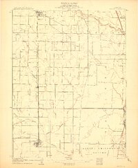
 1917 Logandale1917 Print · USGSThe northern Sacramento Valley during the early twentieth century shows an emerging agricultural grid shaped by water and rail. Researchers can trace the path of the Southern Pacific Woodland Line through Logandale and locate the path of the Central Irrigation Canal.
 - 1951 Map of Willows, 1952 Print
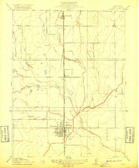
 1951 Willows1952 Print · USGSThe Sacramento Valley town of Willows and the nearby settlement of Artois are shown at a peak of agricultural development in the early fifties. Researchers can trace the civic heart of the county near the Court House or follow the Southern Pacific rail line past the Willows Airport and Kanawha School.4 unique versions available
 - 1951 Map of Willows, 1959 Print
 1951 Willows1959 Print · USGSIn the early fifties, Glenn County was a thriving network of orchards and rail-side towns. Genealogists and historians can trace the foundations of Willows and Hamilton City, while locating rural landmarks like Artois Cemetery and Jacinto Grange.
 - 1952 Map of Logandale, 1953 Print
 1952 Logandale1953 Print · USGSThe Central Valley landscape near Logandale comes into sharp focus during the early fifties as irrigation and conservation efforts transformed the terrain. Genealogists and local historians can trace family-named sites like Minor Farm or find landmarks such as Liberty School and the Peratis Duck Club.2 unique versions available
 - 1952 Map of Maxwell, 1958 Print
 1952 Maxwell1958 Print · USGSThe Sacramento Valley comes alive in this mid-century survey of the Maxwell and Princeton areas, showcasing a landscape of river bends and rail sidings. Genealogists can trace family roots through several rural schools like Liberty Sch and Codora Sch, or locate the historic Cachil Dehe Rancheria.2 unique versions available
 - 1957 Map of Ukiah, 1966 Print
 1957 Ukiah1966 Print · USGSNorthern California's diverse terrain comes into focus in the mid-1950s, from the rugged timberlands of the Jackson State Forest to the productive Sacramento Valley. Genealogists and historians can trace the rail lines of the Northwestern Pacific or locate early valley settlements like Arbuckle and Paskenta.3 unique versions available
 - 1960 Map of Ukiah
 1960 Ukiah1960 Print · USGSNorthern California during the late fifties reveals a landscape of deep timber forests and valley agriculture before modern expansion. Trace the historic rail lines of the California Western RR and the Northwestern Pacific RR through settlements like Fort Bragg and Ukiah.2 unique versions available
 - 1987 Map of Willows, 1988 Print
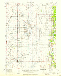
 1987 Willows1988 Print · USGSThe northern Sacramento Valley meets the Coast Range in the late eighties, showing a landscape defined by water and transit. Researchers can trace the Southern Pacific railroad past Artois and Corning, or locate family-named landmarks like Larkins Childrens Rancho and Snaden Island.2 unique versions available
 - 1994 Map of Lakeport
 1994 Lakeport1994 Print · USGSCoastal mountains meet the fertile Sacramento Valley in the 1990s, where the waters of Clear Lake define the western landscape. Researchers can trace the industrial footprint of the Sulphur Bank Mine, follow the Southern Pacific RR tracks, or locate old settlements like Fouts Springs and Lodoga.
 - 2012 Map of Logandale, 2012 Print
 2012 Logandale2012 Print · USGSCovers Willows, including Norman, Logandale, and other nearby areas
 - 2012 Map of Willows, 2012 Print
 2012 Willows2012 Print · USGSCovers Willows, including Artois, Bluegum, and other nearby areas
 - 2015 Map of Logandale, 2015 Print
 2015 Logandale2015 Print · USGSCovers Willows, including Norman, Logandale, and other nearby areas
 - 2015 Map of Willows, 2015 Print
 2015 Willows2015 Print · USGSCovers Willows, including Artois, Bluegum, and other nearby areas
 - 2018 Map of Willows, 2018 Print
 2018 Willows2018 Print · USGSCovers Willows, including Artois, Bluegum, and other nearby areas
 - 2018 Map of Logandale, 2018 Print
 2018 Logandale2018 Print · USGSCovers Willows, including Norman, Logandale, and other nearby areas
 - 2022 Map of Willows, 2022 Print
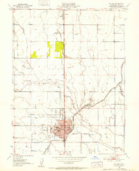
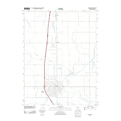
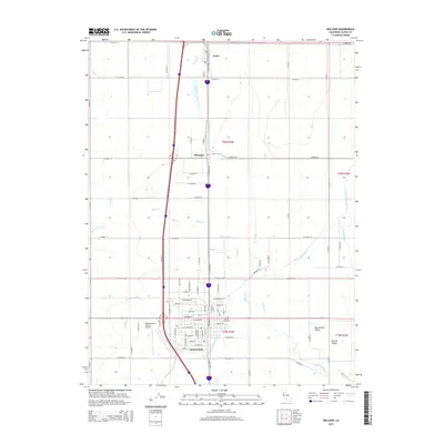
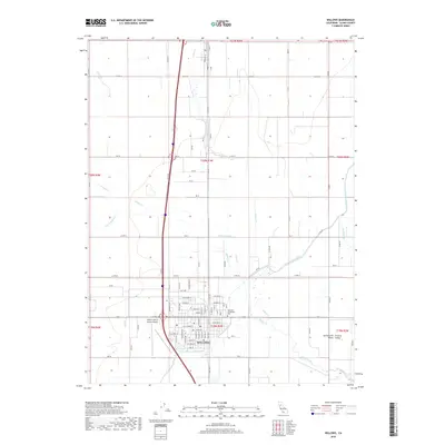
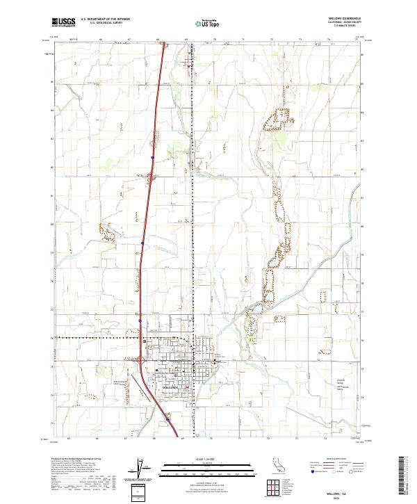 2022 Willows2022 Print · USGSWillows and the surrounding Sacramento Valley are shown here in the early 2020s, highlighting the essential role of irrigation in this agricultural corridor. Local historians can locate the Glenn County Courthouse and trace the paths of the Glenn-Colusa Canal and Quint Canal.
 - 2022 Map of Logandale, 2022 Print
 2022 Logandale2022 Print · USGSAgricultural life in the Sacramento Valley comes into focus in this modern survey of the Glenn and Colusa county line. Researchers can trace the complex irrigation networks of the Glenn-Colusa Canal and explore local landmarks like Pelican Mound and the settlement of Norman.
End of results
Showing maps 1-20 of 20
Top cities near Willows
Frequently asked questions
- What are the different types of historical maps available for Willows?
- What is the oldest map of Willows?
- Where can I purchase historical maps of Willows for my home or office?
- Where can I download high-res historical maps of Willows?
- Are there historical topographic maps available for Willows?
- Is there historical aerial imagery available for Willows?
- Where are historical maps of Willows sourced from?