1900s (20th Century) Maps of Alderpoint, California
Explore 7 historic maps of Alderpoint from the 1900s (20th Century). These maps offer a rare glimpse into what life looked like during the 1900s — showing old roads, neighborhoods, homes, and landmarks that have changed or disappeared over time.
Whether you're researching your family's past, planning a metal detecting trip, or studying how Alderpoint's landscape evolved across the 1900s, these high-resolution maps are a powerful tool for exploring the history of this region.
- Focus on a specific era: All maps on this page are from the 1900s, giving you a focused view of this time period.
- See what’s changed: Compare century-old streets, trails, and buildings to today's modern landscape using overlays and satellite layers.
- Research with precision: Use these maps for genealogy, historical research, land use analysis, or educational projects.
- View, download, or print: Maps are fully viewable online in high resolution, and can be downloaded or printed for your own records.
Start exploring Alderpoint's history through authentic maps from the 1900s. This is your window into the past.
Alderpoint, CA maps
(7)- 1920 Map of Harris
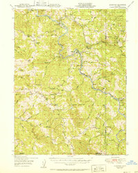
 1920 Harris1920 Print · USGSHumboldt County ranching and rail life are recorded here during the early twentieth century as the railroad carved its path through the Eel River canyon. Researchers can trace historic family holdings like Carey Ranch or locate early industrial sites such as the Steelhead US Fish Hatchery and Fort Seward.
 - 1949 Map of Alderpoint, 1955 Print
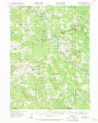 1949 Alderpoint1955 Print · USGSHumboldt County ranching and timber life are captured here in the late 1940s as the railroad follows the winding Eel River. Researchers can trace old family holdings like Ware Ranch and Marr Ranch or locate the site of the Harris PO and Fort Seward.3 unique versions available
 - 1951 Map of Alderpoint
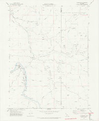
 1951 Alderpoint1951 Print · USGSSouthern Humboldt County is captured here at a time when the river-and-rail economy still shaped life along the Eel River. Researchers can trace old family holdings like Ware Ranch and Marr Ranch or locate the Harris PO and the Lumber Mill at Alderpoint.2 unique versions available
 - 1958 Map of Redding
 1958 Redding1958 Print · USGSNorthern California's valley and mountain landscapes are captured in the late fifties, showing the region as new reservoirs reshaped the river systems. Genealogists and historians can trace rail-side towns like Cottonwood, the military presence at Red Bluff Air Force Station, and mountain outposts like Weaverville.5 unique versions available
 - 1969 Map of Alderpoint, 1974 Print
 1969 Alderpoint1974 Print · USGSThe Eel River canyon and surrounding ranches come into sharp focus in the late 1960s. Genealogists and local historians can trace the foundations of this community through family landmarks like Stockton Ranch, the Jewett Sch, and the Cain Rock Crossing.2 unique versions available
 - 1979 Map of Garberville, 1996 Print
 1979 Garberville1996 Print · USGSThe redwood forests and river canyons of Humboldt and Trinity counties are shown here in the late seventies. Genealogists and historians can trace rail-side life along the Northwestern Pacific RR or locate small settlements like Fort Seward, Alderpoint, and Zenia.
 - 1997 Map of Alderpoint, 2001 Print
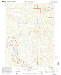 1997 Alderpoint2001 Print · USGSThe Eel River valley in the late 1990s was a landscape of remote ranches and mountainous forest service land. Researchers can find old educational sites like Jewett Sch and family landmarks such as Ware Ranch or the Cain Rock Crossing.
End of results
Showing maps 1-7 of 7
Top cities near Alderpoint
Frequently asked questions
- What are the different types of historical maps available for Alderpoint?
- What is the oldest map of Alderpoint?
- Where can I purchase historical maps of Alderpoint for my home or office?
- Where can I download high-res historical maps of Alderpoint?
- Are there historical topographic maps available for Alderpoint?
- Is there historical aerial imagery available for Alderpoint?
- Where are historical maps of Alderpoint sourced from?