Old Maps of Lone Star Junction, California for Academic Research
Study the evolution of Lone Star Junction with 9 high-resolution historic maps. Whether you're teaching, researching, or modeling changes in land use, these maps provide essential visual documentation of urban, environmental, and geographic change.
- Analyze long-term change: Track patterns in development, transportation, and natural features.
- Ideal for environmental or urban studies: Support academic projects with primary historical map data.
- Use in the classroom or lab: Educators and researchers rely on these maps to bring historical context to life.
These maps are a powerful tool for teaching, research, and visualizing how Lone Star Junction has changed over the decades.
Lone Star Junction, CA maps
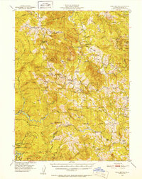
(9)- 1922 Map of Kneeland, 1938 Print
 1922 Kneeland1938 Print · USGSHumboldt County’s mountain ridges and river valleys are captured here in the early twenties, showing a landscape of remote outposts and forest boundaries. Genealogists and researchers can locate old sites like Fort Baker, Redwood House, and the settlement of Kneeland.
 - 1950 Map of Iaqua Buttes, 1952 Print
 1950 Iaqua Buttes1952 Print · USGSHumboldt County ranching and timber lands are captured here in the early fifties, showing a landscape of remote ridges and river valleys. Researchers can locate family outposts like Iaqua Ranch and Shaws Ranch or trace the old school districts of Kneeland Sch and Showers Pass Sch.3 unique versions available
 - 1958 Map of Redding
 1958 Redding1958 Print · USGSNorthern California's valley and mountain landscapes are captured in the late fifties, showing the region as new reservoirs reshaped the river systems. Genealogists and historians can trace rail-side towns like Cottonwood, the military presence at Red Bluff Air Force Station, and mountain outposts like Weaverville.5 unique versions available
 - 1979 Map of Iaqua Buttes
 1979 Iaqua Buttes1979 Print · USGSHumboldt County's high ridges and river headwaters are captured here in the late seventies, showing a landscape of specialized communication and aviation. Researchers can trace the legacy of local landmarks like Kneeland Airport, Lone Star June, and the Iaqua Buttes.2 unique versions available
 - 1982 Map of Hayfork, 1983 Print
 1982 Hayfork1983 Print · USGSTrinity and Humboldt counties appear here in the early eighties as a landscape of timber and mining. Researchers can trace remote river settlements like Hyampom and Burnt Ranch or locate old operations such as the Yellowstone Mine and Index Mine.
 - 2012 Map of Iaqua Buttes, 2012 Print
 2012 Iaqua Buttes2012 Print · USGSCovers Lone Star Junction, including Humboldt County, United States, and other nearby areas
 - 2015 Map of Iaqua Buttes, 2015 Print
 2015 Iaqua Buttes2015 Print · USGSCovers Lone Star Junction, including Humboldt County, United States, and other nearby areas
 - 2018 Map of Iaqua Buttes, 2018 Print
 2018 Iaqua Buttes2018 Print · USGSCovers Lone Star Junction, including Humboldt County, United States, and other nearby areas
 - 2021 Map of Iaqua Buttes, 2021 Print
 2021 Iaqua Buttes2021 Print · USGSHumboldt County’s high ridges and river headwaters are documented in this 2021 study of the rugged country east of the coast. Researchers can locate the Iaqua Kneeland Cem, trace old routes like the Pacific Lambert Company Rd, and identify local peaks from Pine Butte to the Iaqua Buttes.
End of results
Showing maps 1-9 of 9
Top cities near Lone Star Junction
Frequently asked questions
- What are the different types of historical maps available for Lone Star Junction?
- What is the oldest map of Lone Star Junction?
- Where can I purchase historical maps of Lone Star Junction for my home or office?
- Where can I download high-res historical maps of Lone Star Junction?
- Are there historical topographic maps available for Lone Star Junction?
- Is there historical aerial imagery available for Lone Star Junction?
- Where are historical maps of Lone Star Junction sourced from?