
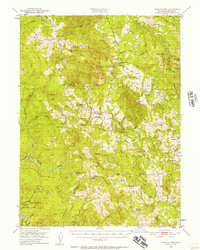
1950 Map of Iaqua Buttes
USGS Topo · Published 1952About this map
The Mad River and Duzen River define the eastern and southern reaches of this Humboldt County terrain, where mid-century life revolved around a network of isolated ranches and ridges. Land use is anchored by remote outposts like Iaqua Ranch, Shaws Ranch, and the Redwood House, reflecting a period when cattle ranching and timber shaped the local economy. The presence of the Iaqua School (Aband) near the Iaqua Buttes points to a shift in rural settlement patterns by 1950, while active schools like Kneeland Sch and Showers Pass Sch continued to serve the scattered families of the backcountry.
Find a feature on this map
96 named features on this map. Tap any name to fly to it.
Don’t see what you’re looking for? This feature index may not catch every label — zoom into the map to look around manually.
Map Details
Editions of this 1950 Iaqua Buttes Map
3 editions found
Other maps of this area

1914 · Pilot Creek
USGS Topo · 1:62,500

1915 · Big Bar and Vicinity
USGS Topo · 1:250,000

1919 · Glynn
USGS Topo · 1:62,500

1921 · Dyerville
USGS Topo · 1:62,500

1922 · Eureka
USGS Topo · 1:62,500

1922 · Korbel
USGS Topo · 1:62,500

1922 · China Flat
USGS Topo · 1:62,500

1922 · Kneeland
USGS Topo · 1:62,500

1933 · Eureka
USGS Topo · 1:48,000

1942 · Eureka
USGS Topo · 1:62,500