1940s Maps of Ocotillo, California
Explore 7 historic maps of Ocotillo from the 1940s. These maps offer a rare glimpse into what life looked like during the 1940s — showing old roads, neighborhoods, homes, and landmarks that have changed or disappeared over time.
Whether you're researching your family's past, planning a metal detecting trip, or studying how Ocotillo's landscape evolved across the 1940s, these high-resolution maps are a powerful tool for exploring the history of this region.
- Focus on a specific era: All maps on this page are from the 1940s, giving you a focused view of this time period.
- See what’s changed: Compare century-old streets, trails, and buildings to today's modern landscape using overlays and satellite layers.
- Research with precision: Use these maps for genealogy, historical research, land use analysis, or educational projects.
- View, download, or print: Maps are fully viewable online in high resolution, and can be downloaded or printed for your own records.
Start exploring Ocotillo's history through authentic maps from the 1940s. This is your window into the past.
Ocotillo, CA maps
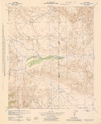
(7)- 1940 Map of Plaster City, 1956 Print
 1940 Plaster City1956 Print · USGSThe Imperial Desert at the start of the 1940s reveals a unique blend of mining industry, military testing, and early irrigation. Genealogists and historians can trace the Overland Stage Route or explore the rail-dependent economy of Plaster City and the County Rock Quarry.
 - 1940 Map of Coyote Wells, 1956 Print
 1940 Coyote Wells1956 Print · USGSThe Colorado Desert during the early 1940s reveals a landscape of high-heat basins and essential transit corridors along the international border. Researchers can trace the path of the Old Stage Road and locate the railway stop at Coyote Wells or the geologic Shell Beds.
 - 1942 Map of El Centro
 1942 El Centro1942 Print · USGSThe Imperial Valley and the California-Mexico border are captured during the peak of World War II-era desert development. Genealogists and historians can trace defunct school districts like Meloland Sch and Sandia, or follow the path of the Inter-California Railroad across the international line.2 unique versions available
 - 1942 Map of Carrizo Mtn, 1944 Print
 1942 Carrizo Mtn1944 Print · USGSThe high desert at the San Diego and Imperial County border comes alive in this wartime survey of the early 1940s. Follow the Old Overland Stage Route to the Old Carrizo Stage Station or locate the site of Prehistoric Animal Tracks.4 unique versions available
 - 1942 Map of Jacumba, 1944 Print
 1942 Jacumba1944 Print · USGSThe high desert borderlands come alive in the 1940s as the railroad traverses the mountains into Imperial County. Researchers can trace the path of the San Diego and Arizona Eastern through Jacumba Hot Springs to remote sidings and desert claims like Mica Gem Mine.
 - 1943 Map of Coyote Wells, 1945 Print
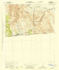
 1943 Coyote Wells1945 Print · USGSImperial County during the war years reveals a desert landscape defined by the Old Stage Road and international border. Trace local history through landmark sites like Coyote Wells, the Shell Beds, and Yuha Spring.
 - 1944 Map of Plaster City
 1944 Plaster City1944 Print · USGSThe Imperial Valley desert at mid-century reveals a landscape of industrial gypsum processing and historic trails. Trace the Old Overland Stage Route or explore the rail spurs serving Plaster City and the Dixieland irrigation canals.
End of results
Showing maps 1-7 of 7
Frequently asked questions
- What are the different types of historical maps available for Ocotillo?
- What is the oldest map of Ocotillo?
- Where can I purchase historical maps of Ocotillo for my home or office?
- Where can I download high-res historical maps of Ocotillo?
- Are there historical topographic maps available for Ocotillo?
- Is there historical aerial imagery available for Ocotillo?
- Where are historical maps of Ocotillo sourced from?