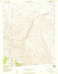
1950s Maps of Ocotillo, California
Explore 15 historic maps of Ocotillo from the 1950s. These maps offer a rare glimpse into what life looked like during the 1950s — showing old roads, neighborhoods, homes, and landmarks that have changed or disappeared over time.
Whether you're researching your family's past, planning a metal detecting trip, or studying how Ocotillo's landscape evolved across the 1950s, these high-resolution maps are a powerful tool for exploring the history of this region.
- Focus on a specific era: All maps on this page are from the 1950s, giving you a focused view of this time period.
- See what’s changed: Compare century-old streets, trails, and buildings to today's modern landscape using overlays and satellite layers.
- Research with precision: Use these maps for genealogy, historical research, land use analysis, or educational projects.
- View, download, or print: Maps are fully viewable online in high resolution, and can be downloaded or printed for your own records.
Start exploring Ocotillo's history through authentic maps from the 1950s. This is your window into the past.
Ocotillo, CA maps
(15)- 1950 Map of San Diego, 1954 Print
 1950 San Diego1954 Print · USGSCoastal San Diego and the Baja California border region come alive in this mid-century survey. Trace the early layout of National City and Chula Vista, or locate historic landmarks like the San Diego and Arizona Eastern RR and Fort Rosecrans.
 - 1954 Map of El Centro
 1954 El Centro1954 Print · USGSThe Imperial Valley was at its mid-century agricultural peak when this survey recorded its vast irrigation network and desert borderlands. Researchers can trace the path of the All American Canal or locate local landmarks like Lantana School and the Tumco Mines.
 - 1954 Map of San Diego
 1954 San Diego1954 Print · USGSSan Diego and the northern reaches of Baja California are captured here during a decade of rapid post-war growth and military expansion. Researchers can trace the mid-century shoreline of Mission Beach, find established tribal lands like Capitan Grande Indian Reservation, and follow the border crossing into Tijuana.
 - 1955 Map of San Diego
 1955 San Diego1955 Print · USGSSouthern California underwent massive growth in the post-war years, as suburban development pushed into the canyons and foothills. Researchers can trace the mid-century infrastructure of Lindbergh Field, the Otay River, and numerous sites like Lemon Grove.
 - 1955 Map of El Centro
 1955 El Centro1955 Print · USGSThe Imperial Valley and the Colorado River borderlands are captured here in the mid-fifties during the peak of the region's irrigation-driven expansion. Researchers can trace the desert's industrial history through the Tumco Mines, the Yuma Test Branch, and rural landmarks like the Palmetto School.
 - 1957 Map of Painted Gorge, 1958 Print
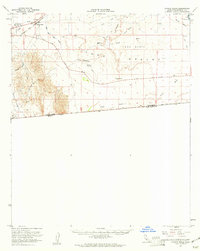
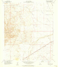 1957 Painted Gorge1958 Print · USGSImperial County desert landscapes are captured here during the late fifties, showing a region shaped by historic travel and military use. You can trace the Overland Stage Route across the West Mesa or locate the San Diego and Arizona Eastern rail line.6 unique versions available
 - 1957 Map of Coyote Wells, 1958 Print
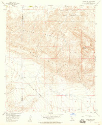
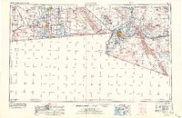
 1957 Coyote Wells1958 Print · USGSThe Imperial Valley desert comes alive in the late fifties at the junction of the San Diego and Arizona Eastern rail line. Trace the path of early travelers through the Yuha Basin via the Yuha Cutoff or locate the Vista De Anza Historical Marker.6 unique versions available
 - 1957 Map of Carrizo Mtn, 1958 Print
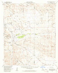
 1957 Carrizo Mtn1958 Print · USGSImperial County's desert floor and mountain peaks were a mix of military training grounds and state parkland in the late fifties. You can locate the Carrizo Impact Area Naval Reservation and trace the original Imperial Highway past Fossil Canyon.5 unique versions available
 - 1957 Map of Plaster City, 1960 Print
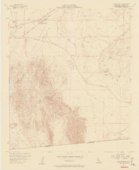
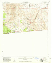
 1957 Plaster City1960 Print · USGSImperial County's desert was a hub of industrial mining and military testing during the late fifties. Researchers can trace the Old Overland Stage Route and find specialized landmarks like the Gypsum Plant at Plaster City or the Forget-Me-Not Drain.2 unique versions available
 - 1957 Map of Coyote Wells, 1961 Print
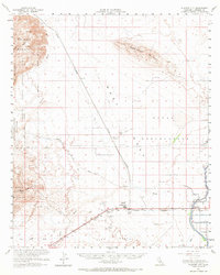
 1957 Coyote Wells1961 Print · USGSThe Imperial Valley desert comes into focus during the late fifties as the regional transportation and water infrastructure took shape. Researchers can trace the Arizona and Eastern rail line and locate desert landmarks like Yuha Well and the Vista de Anza Historical Marker.2 unique versions available
 - 1958 Map of San Diego, 1961 Print
 1958 San Diego1961 Print · USGSSan Diego and its inland mountain ranges are captured here in the late fifties as coastal suburbs began to climb the mesas. Researchers can trace the mid-century footprint of Miramar Naval Air Station, the winding San Diego & Arizona Eastern Ry, and local landmarks like Cabrillo Nat Mon.4 unique versions available
 - 1958 Map of El Centro, 1972 Print
 1958 El Centro1972 Print · USGSThe Imperial Valley's agricultural heartland and the Colorado River's edge are captured here during a period of massive water infrastructure and military expansion. Genealogists and historians can trace old mining sites like the Ferguson Mine, desert outposts such as Ogilby, and early rail lines including the San Diego and Arizona Eastern.4 unique versions available
 - 1959 Map of Carrizo Mountain, 1961 Print
 1959 Carrizo Mountain1961 Print · USGSThe Colorado Desert at the end of the fifties reveals a landscape of historic transit and rugged terrain. Genealogists and desert historians can trace the Old Overland Stage Route and find the Old Carrizo Stage Sta and Dos Cabezas Mine.2 unique versions available
 - 1959 Map of Jacumba, 1961 Print
 1959 Jacumba1961 Print · USGSThe High Desert and international borderlands are captured here in the late fifties. Trace the rail line through Carrizo Gorge or locate old mining sites like the Mica Gem Mine and Jade Mine.2 unique versions available
 - 1959 Map of In-ko-pah Gorge, 1961 Print
 1959 In-ko-pah Gorge1961 Print · USGSThe high desert borderlands come alive in this late-fifties survey of the steep transition from the Jacumba Mountains to the desert floor. Researchers can trace the path of old transit routes through In-Ko-Pah Gorge, finding the Stage Station Historical Marker and remote workings like the Easy Pickins Mine.3 unique versions available
End of results
Showing maps 1-15 of 15
Frequently asked questions
- What are the different types of historical maps available for Ocotillo?
- What is the oldest map of Ocotillo?
- Where can I purchase historical maps of Ocotillo for my home or office?
- Where can I download high-res historical maps of Ocotillo?
- Are there historical topographic maps available for Ocotillo?
- Is there historical aerial imagery available for Ocotillo?
- Where are historical maps of Ocotillo sourced from?