Old Maps of Sage Flats, California for Hiking & Exploration
Hike through history with 17 historic maps of Sage Flats. Explore old trails, ghost towns, and forgotten backroads — perfect for outdoor adventurers and local explorers.
- Rediscover forgotten places: Map out old mining camps, roads, and footpaths that no longer exist on modern maps.
- Layer with modern tools: Combine with LiDAR or satellite views to plan hikes through historical terrain.
- Made for exploration: Popular among hikers, overlanders, and local history lovers.
Use these maps to find adventure and explore the hidden past of Sage Flats.
Sage Flats, CA maps
(17)- 1905 Map of Olancha, 1957 Print
 1905 Olancha1957 Print · USGSThe high Sierra and Owens Valley meet in this 1905 survey, showing the early rail lines and remote outposts before modern infrastructure reached the Kern River. Researchers can trace the path of the Southern Pacific RR through Cartago or locate the remote Kern Canyon Ranger Station.
 - 1907 Map of Olancha
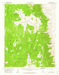
 1907 Olancha1907 Print · USGSThe Sierra Nevada high country at the turn of the century shows a wilderness of meadows and peaks before the modern park era. Trace early trails and remote camps like Funston Camp, Siberian Outpost, and the lake-front settlement of Olancha.9 unique versions available
 - 1948 Map of Fresno
 1948 Fresno1948 Print · USGSThe San Joaquin Valley and the High Sierra met during a period of rapid post-war growth and industrial expansion. Genealogists and researchers can trace family lines through small rail towns like Calwa City, find early aviation sites at Fresno-Chandler, or locate the Fresno Copper Mine.
 - 1955 Map of Fresno
 1955 Fresno1955 Print · USGSThe Central Valley and High Sierra meet in this mid-fifties study of California’s agricultural and wilderness heart. Researchers can trace the rail-side growth of Sanger, Selma, and Reedley or locate high-altitude landmarks like Mt Whitney and Hume Lake.
 - 1956 Map of Fresno
 1956 Fresno1956 Print · USGSThe Central Valley and High Sierra meet in this mid-fifties survey of a rapidly developing California interior. Researchers can trace the rail-and-water networks of Visalia, the footprint of Tulare Lake, and the remote heights of Sequoia National Park.
 - 1956 Map of Monache Mtn, 1961 Print
 1956 Monache Mtn1961 Print · USGSIn the mid-fifties, this pocket of the Sierra Nevada near the Tulare and Inyo county line was a hub for high-country camps and seasonal grazing. Researchers can trace the layout of Sam Lewis Camp, the remote Landing Strip at Monache Meadows, and the paths through Haiwee Pass.3 unique versions available
 - 1958 Map of Fresno
 1958 Fresno1958 Print · USGSThe Central Valley and High Sierra meet in this mid-century survey of the California heartland. Researchers can trace the rail-and-road network connecting Fresno and Visalia or locate high-country landmarks like Mt Whitney and Sequoia National Park.
 - 1960 Map of Fresno
 1960 Fresno1960 Print · USGSThe San Joaquin Valley's mid-century agricultural boom meets the high peaks of the Sierra Nevada in this detailed survey. Genealogists and historians can trace the rail-driven growth of Fresno, Tulare, and Visalia or locate family roots in smaller towns like Raisin City and Calwa City.2 unique versions available
 - 1962 Map of Fresno, 1968 Print
 1962 Fresno1968 Print · USGSThe Central Valley and High Sierra meet in this mid-century survey, capturing the region's massive irrigation systems and mountain wilderness. Researchers can trace the rail corridors of the Southern Pacific and locate landmarks like the Tulare Lake Bed and Mount Whitney.3 unique versions available
 - 1966 Map of Fresno
 1966 Fresno1966 Print · USGSCentral California in the mid-1960s showcases a high-production agricultural valley rising into the granite peaks of the High Sierra. Researchers can trace irrigation networks, rail spurs like the Southern Pacific, and landmarks from Mount Whitney to the Lemoore Naval Air Station.
 - 1978 Map of Three Rivers, 1994 Print
 1978 Three Rivers1994 Print · USGSTulare County's dramatic ascent from the San Joaquin Valley to the High Sierra is captured here during the late seventies. Researchers can trace the layout of the Tule River Indian Reservation and locate early mountain outposts like Camp Nelson or Globe.2 unique versions available
 - 1987 Map of Haiwee Pass
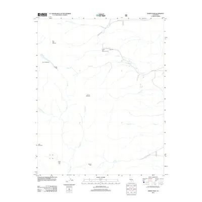
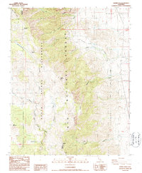 1987 Haiwee Pass1987 Print · USGSThe high Sierra Nevada backcountry meets the Owens Valley in the late twentieth century, showing the transition from wilderness to infrastructure. Trace the early path of the Pacific Crest National Scenic Trail past Bear Trap Meadow and the remote Dutch John Flat.2 unique versions available
 - 1994 Map of Haiwee Pass, 1997 Print
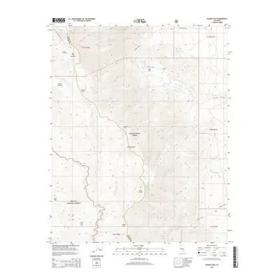
 1994 Haiwee Pass1997 Print · USGSThe high Sierra peaks meet the Owens Valley in the early 1990s, capturing a landscape of alpine meadows and engineering. Follow the Pacific Crest Scenic Trail past Haiwee Pass and trace the legacy of early transit along the Old Railroad Grade.
 - 2012 Map of Haiwee Pass, 2012 Print
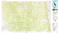
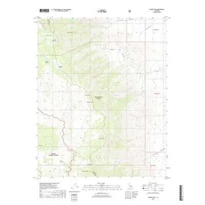
 2012 Haiwee Pass2012 Print · USGSCovers Sage Flats, including Walker Creek, Olancha, and other nearby areas
 - 2015 Map of Haiwee Pass, 2015 Print
 2015 Haiwee Pass2015 Print · USGSCovers Sage Flats, including Walker Creek, Olancha, and other nearby areas
 - 2018 Map of Haiwee Pass, 2018 Print
 2018 Haiwee Pass2018 Print · USGSCovers Sage Flats, including Walker Creek, Olancha, and other nearby areas
 - 2021 Map of Haiwee Pass, 2021 Print
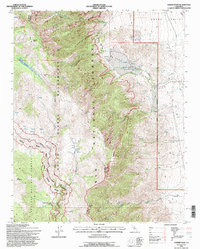
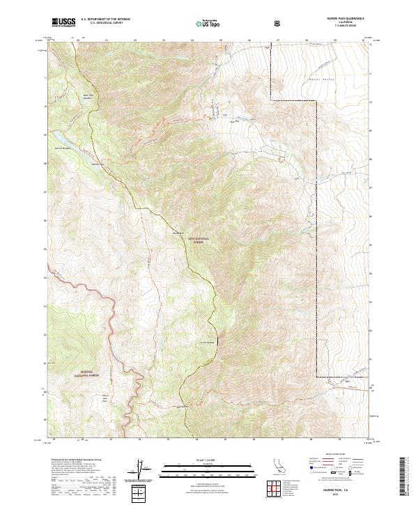 2021 Haiwee Pass2021 Print · USGSThe high Sierra Nevada passes and wilderness boundaries come alive in this 2020s study of the Inyo and Sequoia borderlands. Researchers can trace historical routes like the Olancha Pass Trl and Haiwee Pass Trl past landmarks such as Dutch John Flat and Soda Spring.
End of results
Showing maps 1-17 of 17
Frequently asked questions
- What are the different types of historical maps available for Sage Flats?
- What is the oldest map of Sage Flats?
- Where can I purchase historical maps of Sage Flats for my home or office?
- Where can I download high-res historical maps of Sage Flats?
- Are there historical topographic maps available for Sage Flats?
- Is there historical aerial imagery available for Sage Flats?
- Where are historical maps of Sage Flats sourced from?