Old Maps of Golden Hills, California
Explore 34 old maps of Golden Hills, spanning from 1914 to today. These high-resolution historic maps reveal how streets, neighborhoods, landmarks, and natural features evolved over time — perfect for genealogy, metal detecting, research, and local history exploration.
What you can do with these maps:
- See how Golden Hills changed over time: Compare historical maps to modern-day views to trace roads, homesites, rail lines & more.
- View detailed metadata: Each map includes creators, publishers, year, scale, and archive source.
- Overlay maps with satellite & LiDAR: Visualize the past alongside modern tools to explore terrain & human change.
- Trusted historical sources: Maps sourced from the USGS, Library of Congress, and other archives.
- Access maps your way: View online, download high-res files, or order prints for personal or research use.
Start exploring old maps of Golden Hills to uncover forgotten places, hidden landmarks, and the deep history beneath your feet.
Golden Hills, CA maps
(34)- 1914 Map of Caliente
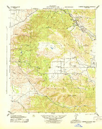
 1914 Caliente1914 Print · USGSBakersfield and the southern Joaquin Valley are captured in the early nineteen-teens as the region's rail and oil industries expanded. Genealogists can trace family landmarks like the Tejon Ranch and Rio Bravo Ranch or locate vanished stops such as Woodford Keene P O and Cottonwood Station.7 unique versions available
 - 1915 Map of Mojave
 1915 Mojave1915 Print · USGSThe eastern Tehachapi Mountains meet the desert in the early twentieth century as a hub of rail and mining. Trace the historic paths of the Southern Pacific railroad through Tehachapi and Mojave, or locate remote sites like the Joe Walker Mine and Claraville.7 unique versions available
 - 1943 Map of Tehachapi
 1943 Tehachapi1943 Print · USGSTehachapi and the surrounding mountain passes are captured in the early 1940s during a period of vital rail and industrial activity. Trace the SOUTHERN PACIFIC line through the Tehachapi Pass or locate rural sites like Jameson Ranch and the Pine Tree Mine.4 unique versions available
 - 1943 Map of Cummings Mountain
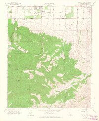
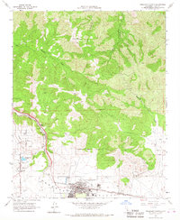
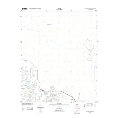
 1943 Cummings Mountain1943 Print · USGSThe Southern Pacific railroad traverses the Tehachapi Mountains during the mid-forties, carving through steep canyons and mountain passes. Researchers can trace the rail line through Walong or locate local landmarks like the Keene PO, Stonybrook Retreat, and Cummings Valley School.5 unique versions available
 - 1948 Map of Bakersfield
 1948 Bakersfield1948 Print · USGSBakersfield and the southern San Joaquin Valley appear in the late 1940s, showing a landscape of burgeoning oil towns, rail junctions, and early irrigation canals. Genealogists and historians can trace the foundations of local industry through Gardner Field, the Sunset Railway, and the shores of Buena Vista Lake.2 unique versions available
 - 1955 Map of Bakersfield
 1955 Bakersfield1955 Print · USGSThe southern San Joaquin Valley in the mid-fifties shows an era of massive oil production and industrial irrigation. Trace family roots in Allensworth, the oil fields of Oildale, or the shorelines of Tulare Lake and Buena Vista Lake.
 - 1956 Map of Bakersfield
 1956 Bakersfield1956 Print · USGSThe southern San Joaquin Valley and High Sierra come alive in the mid-fifties, showing the region's complex agricultural and rail networks. Genealogists and historians can trace family roots in towns like Bakersfield, Taft, and Delano, or locate early infrastructure along the Sunset Railway.
 - 1960 Map of Bakersfield
 1960 Bakersfield1960 Print · USGSThe Southern San Joaquin Valley at mid-century reveals a complex landscape of petroleum development and massive irrigation projects. Researchers can trace the rail lines of the Southern Pacific, explore oil-era landmarks like Oil City, and locate early settlements including Allensworth and Pixley.2 unique versions available
 - 1962 Map of Bakersfield, 1969 Print
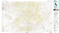
 1962 Bakersfield1969 Print · USGSThe Southern San Joaquin Valley is shown in the 1960s as a bustling intersection of petroleum production, irrigation agriculture, and mountain recreation. Researchers can trace the rail lines of the Southern Pacific through the valley or locate early desert developments like California City and Tehachapi.4 unique versions available
 - 1966 Map of Bakersfield
 1966 Bakersfield1966 Print · USGSThe southern San Joaquin Valley in the mid-sixties reveals a massive industrial and agricultural landscape shaped by water and oil. Genealogists and historians can trace the growth of Bakersfield and Oildale, or locate remote airfields like Minter Field and Mojave-Kern County No. 7 Airport.
 - 1966 Map of Tehachapi South, 1967 Print
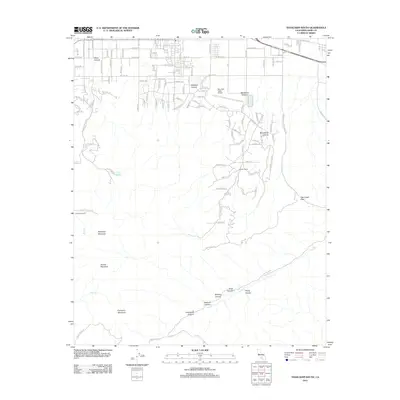
 1966 Tehachapi South1967 Print · USGSKern County's high-desert landscape in the mid-sixties reveals a period of water infrastructure development and mountain ranching. Researchers can trace the paths of the Uncle Sam Mine, Tompkins Sch, and the historic crossing at Oak Creek Pass.2 unique versions available
 - 1966 Map of Cummings Mtn, 1967 Print
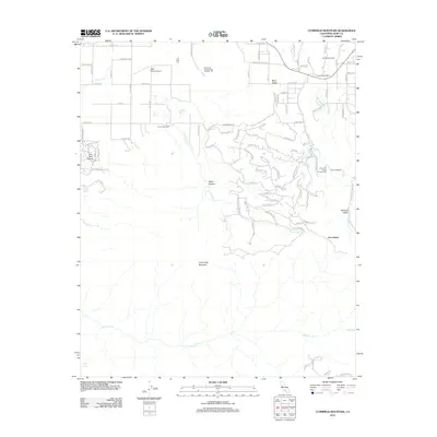
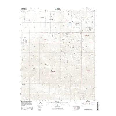
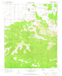 1966 Cummings Mtn1967 Print · USGSThe Tehachapi foothills come into focus in the mid-1960s, showing a landscape of high valleys and seasonal watercourses. Local historians can trace the rural layout of Cummings Valley near the California Correctional Institution and find the old Cummings Valley Sch.4 unique versions available
 - 1966 Map of Keene, 1967 Print
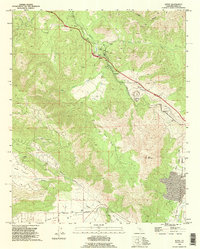
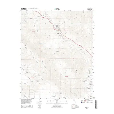
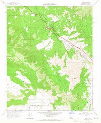 1966 Keene1967 Print · USGSThe Tehachapi Mountains in the mid-1960s are defined by the heavy rail traffic of the Southern Pacific and its famous spiral at The Loop. Genealogists and historians can trace small communities like Keene and Woodford, or locate rural landmarks like the Keene Sch and the Pipeline through Bear Valley.2 unique versions available
 - 1966 Map of Tehachapi North, 1967 Print
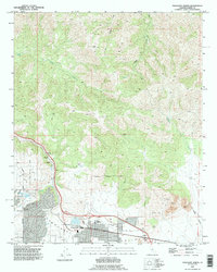
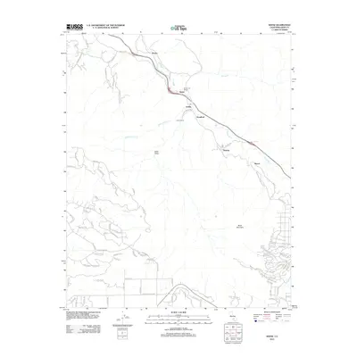
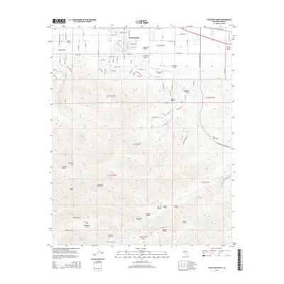
 1966 Tehachapi North1967 Print · USGSTehachapi and the surrounding valley floor are captured in the mid-1960s as a bustling hub of rail transport and mountain agriculture. Genealogists and historians can trace the foundations of Old Town, locate the Cem, and see the early layout of Tehachapi-Kern County Airport No 4.3 unique versions available
 - 1978 Map of Tehachapi, 1993 Print
 1978 Tehachapi1993 Print · USGSThe Kern County landscape in the late seventies reveals the transition from valley agriculture to high mountain passes. Trace the rail lines of the Southern Pacific and explore early settlements like Weed Patch, Loraine, and Edmundson Acres.
 - 1992 Map of Tehachapi South, 1995 Print
 1992 Tehachapi South1995 Print · USGSThe southern fringes of the high desert and mountain passes are captured here during the 1990s. Researchers can trace old mining sites like the Uncle Sam Mine, find remote water sources such as Indian John Spring, and locate the historic Oak Creek Pass.
 - 1992 Map of Tehachapi North, 1995 Print
 1992 Tehachapi North1995 Print · USGSThe Tehachapi Pass region is shown here in the early nineties, where the high-altitude rail line and local industry meet. Genealogists and rail historians can trace the Southern Pacific RR through Cable and Summit, or locate local landmarks like the Cem and Old Town.
 - 1992 Map of Keene, 1995 Print
 1992 Keene1995 Print · USGSIn the mountains of Kern County during the 1990s, the railroad remains the heart of the landscape. Trace the path of the Southern Pacific through The Loop and find historical rail stops at Walong, Keene, and Woodford.
 - 2012 Map of Cummings Mountain, 2012 Print
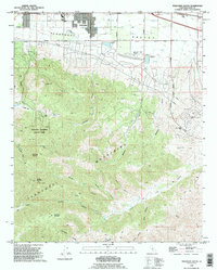
 2012 Cummings Mountain2012 Print · USGSCovers Golden Hills, including Tehachapi, Stallion Springs, and other nearby areas
 - 2012 Map of Tehachapi South, 2012 Print
 2012 Tehachapi South2012 Print · USGSCovers Golden Hills, including Tehachapi, Kern County, and other nearby areas
 - 2012 Map of Keene, 2012 Print
 2012 Keene2012 Print · USGSCovers Golden Hills, including Keene, Hart Flat, and other nearby areas
 - 2012 Map of Tehachapi North, 2012 Print
 2012 Tehachapi North2012 Print · USGSCovers Golden Hills, including Tehachapi, Kern County, and other nearby areas
 - 2015 Map of Keene, 2015 Print
 2015 Keene2015 Print · USGSCovers Golden Hills, including Keene, Hart Flat, and other nearby areas
 - 2015 Map of Cummings Mountain, 2015 Print
 2015 Cummings Mountain2015 Print · USGSCovers Golden Hills, including Tehachapi, Stallion Springs, and other nearby areas
 - 2015 Map of Tehachapi South, 2015 Print
 2015 Tehachapi South2015 Print · USGSCovers Golden Hills, including Tehachapi, Kern County, and other nearby areas
Showing maps 1-25 of 34
Top cities near Golden Hills
Frequently asked questions
- What are the different types of historical maps available for Golden Hills?
- What is the oldest map of Golden Hills?
- Where can I purchase historical maps of Golden Hills for my home or office?
- Where can I download high-res historical maps of Golden Hills?
- Are there historical topographic maps available for Golden Hills?
- Is there historical aerial imagery available for Golden Hills?
- Where are historical maps of Golden Hills sourced from?