1960s Maps of Golden Hills, California
Explore 7 historic maps of Golden Hills from the 1960s. These maps offer a rare glimpse into what life looked like during the 1960s — showing old roads, neighborhoods, homes, and landmarks that have changed or disappeared over time.
Whether you're researching your family's past, planning a metal detecting trip, or studying how Golden Hills's landscape evolved across the 1960s, these high-resolution maps are a powerful tool for exploring the history of this region.
- Focus on a specific era: All maps on this page are from the 1960s, giving you a focused view of this time period.
- See what’s changed: Compare century-old streets, trails, and buildings to today's modern landscape using overlays and satellite layers.
- Research with precision: Use these maps for genealogy, historical research, land use analysis, or educational projects.
- View, download, or print: Maps are fully viewable online in high resolution, and can be downloaded or printed for your own records.
Start exploring Golden Hills's history through authentic maps from the 1960s. This is your window into the past.
Golden Hills, CA maps
(7)- 1960 Map of Bakersfield
 1960 Bakersfield1960 Print · USGSThe Southern San Joaquin Valley at mid-century reveals a complex landscape of petroleum development and massive irrigation projects. Researchers can trace the rail lines of the Southern Pacific, explore oil-era landmarks like Oil City, and locate early settlements including Allensworth and Pixley.2 unique versions available
 - 1962 Map of Bakersfield, 1969 Print
 1962 Bakersfield1969 Print · USGSThe Southern San Joaquin Valley is shown in the 1960s as a bustling intersection of petroleum production, irrigation agriculture, and mountain recreation. Researchers can trace the rail lines of the Southern Pacific through the valley or locate early desert developments like California City and Tehachapi.4 unique versions available
 - 1966 Map of Bakersfield
 1966 Bakersfield1966 Print · USGSThe southern San Joaquin Valley in the mid-sixties reveals a massive industrial and agricultural landscape shaped by water and oil. Genealogists and historians can trace the growth of Bakersfield and Oildale, or locate remote airfields like Minter Field and Mojave-Kern County No. 7 Airport.
 - 1966 Map of Tehachapi South, 1967 Print
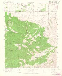 1966 Tehachapi South1967 Print · USGSKern County's high-desert landscape in the mid-sixties reveals a period of water infrastructure development and mountain ranching. Researchers can trace the paths of the Uncle Sam Mine, Tompkins Sch, and the historic crossing at Oak Creek Pass.2 unique versions available
 - 1966 Map of Cummings Mtn, 1967 Print
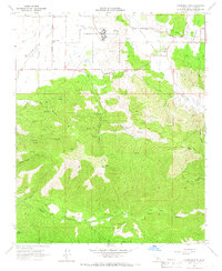 1966 Cummings Mtn1967 Print · USGSThe Tehachapi foothills come into focus in the mid-1960s, showing a landscape of high valleys and seasonal watercourses. Local historians can trace the rural layout of Cummings Valley near the California Correctional Institution and find the old Cummings Valley Sch.4 unique versions available
 - 1966 Map of Keene, 1967 Print
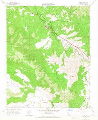 1966 Keene1967 Print · USGSThe Tehachapi Mountains in the mid-1960s are defined by the heavy rail traffic of the Southern Pacific and its famous spiral at The Loop. Genealogists and historians can trace small communities like Keene and Woodford, or locate rural landmarks like the Keene Sch and the Pipeline through Bear Valley.2 unique versions available
 - 1966 Map of Tehachapi North, 1967 Print
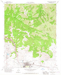 1966 Tehachapi North1967 Print · USGSTehachapi and the surrounding valley floor are captured in the mid-1960s as a bustling hub of rail transport and mountain agriculture. Genealogists and historians can trace the foundations of Old Town, locate the Cem, and see the early layout of Tehachapi-Kern County Airport No 4.3 unique versions available
End of results
Showing maps 1-7 of 7
Top cities near Golden Hills
Frequently asked questions
- What are the different types of historical maps available for Golden Hills?
- What is the oldest map of Golden Hills?
- Where can I purchase historical maps of Golden Hills for my home or office?
- Where can I download high-res historical maps of Golden Hills?
- Are there historical topographic maps available for Golden Hills?
- Is there historical aerial imagery available for Golden Hills?
- Where are historical maps of Golden Hills sourced from?