Old Maps of Sageland, California for Academic Research
Study the evolution of Sageland with 14 high-resolution historic maps. Whether you're teaching, researching, or modeling changes in land use, these maps provide essential visual documentation of urban, environmental, and geographic change.
- Analyze long-term change: Track patterns in development, transportation, and natural features.
- Ideal for environmental or urban studies: Support academic projects with primary historical map data.
- Use in the classroom or lab: Educators and researchers rely on these maps to bring historical context to life.
These maps are a powerful tool for teaching, research, and visualizing how Sageland has changed over the decades.
Sageland, CA maps
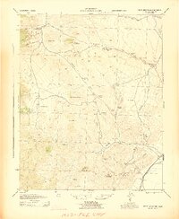
(14)- 1915 Map of Mojave
 1915 Mojave1915 Print · USGSThe eastern Tehachapi Mountains meet the desert in the early twentieth century as a hub of rail and mining. Trace the historic paths of the Southern Pacific railroad through Tehachapi and Mojave, or locate remote sites like the Joe Walker Mine and Claraville.7 unique versions available
 - 1943 Map of Cross Mountain
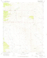
 1943 Cross Mountain1943 Print · USGSKern County's high desert reveals its mining and water-management history in the 1940s. Genealogists and researchers can trace the locations of the Landers School, the abandoned settlement of Sageland, and several historic mines including the San Antonio Mine.5 unique versions available
 - 1948 Map of Bakersfield
 1948 Bakersfield1948 Print · USGSBakersfield and the southern San Joaquin Valley appear in the late 1940s, showing a landscape of burgeoning oil towns, rail junctions, and early irrigation canals. Genealogists and historians can trace the foundations of local industry through Gardner Field, the Sunset Railway, and the shores of Buena Vista Lake.2 unique versions available
 - 1955 Map of Bakersfield
 1955 Bakersfield1955 Print · USGSThe southern San Joaquin Valley in the mid-fifties shows an era of massive oil production and industrial irrigation. Trace family roots in Allensworth, the oil fields of Oildale, or the shorelines of Tulare Lake and Buena Vista Lake.
 - 1956 Map of Bakersfield
 1956 Bakersfield1956 Print · USGSThe southern San Joaquin Valley and High Sierra come alive in the mid-fifties, showing the region's complex agricultural and rail networks. Genealogists and historians can trace family roots in towns like Bakersfield, Taft, and Delano, or locate early infrastructure along the Sunset Railway.
 - 1960 Map of Bakersfield
 1960 Bakersfield1960 Print · USGSThe Southern San Joaquin Valley at mid-century reveals a complex landscape of petroleum development and massive irrigation projects. Researchers can trace the rail lines of the Southern Pacific, explore oil-era landmarks like Oil City, and locate early settlements including Allensworth and Pixley.2 unique versions available
 - 1962 Map of Bakersfield, 1969 Print
 1962 Bakersfield1969 Print · USGSThe Southern San Joaquin Valley is shown in the 1960s as a bustling intersection of petroleum production, irrigation agriculture, and mountain recreation. Researchers can trace the rail lines of the Southern Pacific through the valley or locate early desert developments like California City and Tehachapi.4 unique versions available
 - 1966 Map of Bakersfield
 1966 Bakersfield1966 Print · USGSThe southern San Joaquin Valley in the mid-sixties reveals a massive industrial and agricultural landscape shaped by water and oil. Genealogists and historians can trace the growth of Bakersfield and Oildale, or locate remote airfields like Minter Field and Mojave-Kern County No. 7 Airport.
 - 1972 Map of Pinyon Mountain, 1975 Print
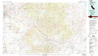
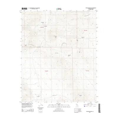
 1972 Pinyon Mountain1975 Print · USGSKern County's high desert and mining country are captured here in the early seventies as the region supported remote ranching and prospecting. Researchers can trace the location of Sageland, find the Ora Grande Mine, and locate the Cem near Kelso Valley.3 unique versions available
 - 1978 Map of Tehachapi, 1993 Print
 1978 Tehachapi1993 Print · USGSThe Kern County landscape in the late seventies reveals the transition from valley agriculture to high mountain passes. Trace the rail lines of the Southern Pacific and explore early settlements like Weed Patch, Loraine, and Edmundson Acres.
 - 2012 Map of Pinyon Mountain, 2012 Print
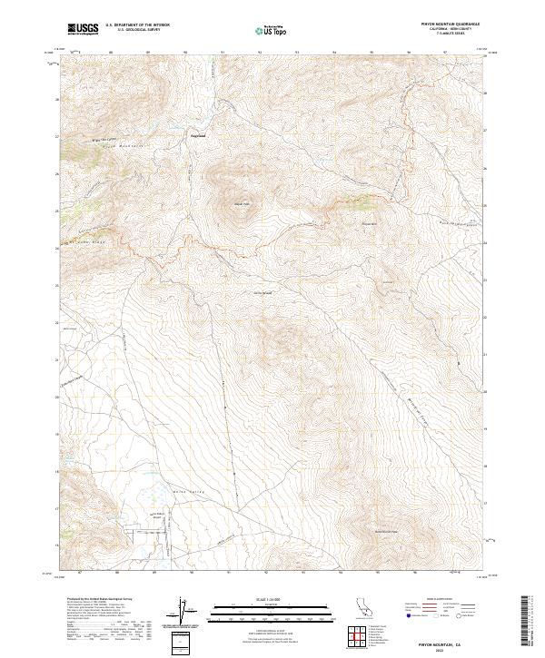
 2012 Pinyon Mountain2012 Print · USGSCovers Sageland, including Kern County, United States, and other nearby areas
 - 2015 Map of Pinyon Mountain, 2015 Print
 2015 Pinyon Mountain2015 Print · USGSCovers Sageland, including Kern County, United States, and other nearby areas
 - 2018 Map of Pinyon Mountain, 2018 Print
 2018 Pinyon Mountain2018 Print · USGSCovers Sageland, including Kern County, United States, and other nearby areas
 - 2022 Map of Pinyon Mountain, 2022 Print
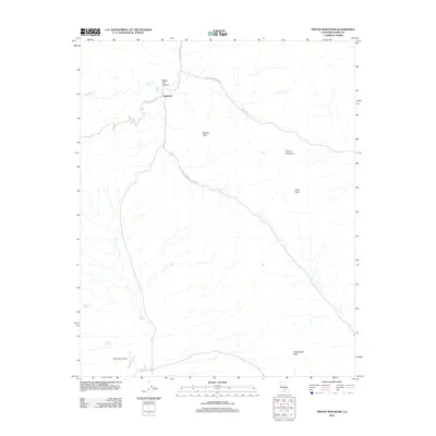
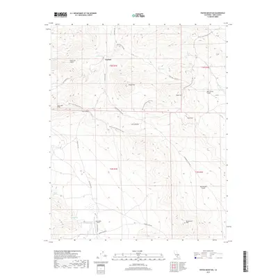
 2022 Pinyon Mountain2022 Print · USGSThe eastern Piute Mountains and the high desert floor of Kern County are captured here in the early twenty-first century. Researchers can trace the path of the Pacific Crest National Scenic Trl and locate remote landmarks like Sageland, Kelso Valley Airport, and Willow Spring.
End of results
Showing maps 1-14 of 14
Top cities near Sageland
Frequently asked questions
- What are the different types of historical maps available for Sageland?
- What is the oldest map of Sageland?
- Where can I purchase historical maps of Sageland for my home or office?
- Where can I download high-res historical maps of Sageland?
- Are there historical topographic maps available for Sageland?
- Is there historical aerial imagery available for Sageland?
- Where are historical maps of Sageland sourced from?