Old Maps of California City, California
Explore 74 old maps of California City, spanning from 1903 to today. These high-resolution historic maps reveal how streets, neighborhoods, landmarks, and natural features evolved over time — perfect for genealogy, metal detecting, research, and local history exploration.
What you can do with these maps:
- See how California City changed over time: Compare historical maps to modern-day views to trace roads, homesites, rail lines & more.
- View detailed metadata: Each map includes creators, publishers, year, scale, and archive source.
- Overlay maps with satellite & LiDAR: Visualize the past alongside modern tools to explore terrain & human change.
- Trusted historical sources: Maps sourced from the USGS, Library of Congress, and other archives.
- Access maps your way: View online, download high-res files, or order prints for personal or research use.
Start exploring old maps of California City to uncover forgotten places, hidden landmarks, and the deep history beneath your feet.
California City, CA maps
(74)- 1903 Map of Randsburg
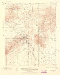
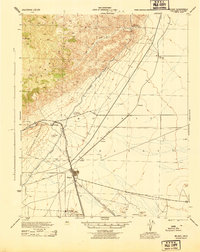
 1903 Randsburg1903 Print · USGSThe Rand Mining District comes to life in this survey of the California desert during the early twentieth-century gold rush. Genealogists and mining historians can trace the early footprints of Randsburg and Johannesburg, the path of the Randsburg R. R., and the locations of the Yellow Aster Mine and Summit Diggings.
 - 1911 Map of Randsburg, 1958 Print
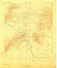
 1911 Randsburg1958 Print · USGSHigh desert mining towns in Kern and San Bernardino counties flourished during this era of peak mineral extraction. Genealogists and historians can trace the early footprints of Randsburg and Johannesburg, or locate the Yellow Aster Mine and the rail-side settlement of Atolia.2 unique versions available
 - 1912 Map of Randsburg
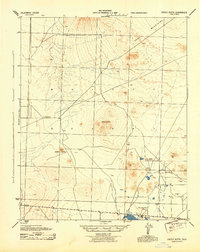
 1912 Randsburg1912 Print · USGSThe Rand mining district comes to life in this early century survey of the Kern County desert. Trace the rail lines of the Southern Pacific and the footprint of the massive Yellow Aster Mine near Randsburg and Atolia.3 unique versions available
 - 1915 Map of Searles Lake
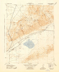
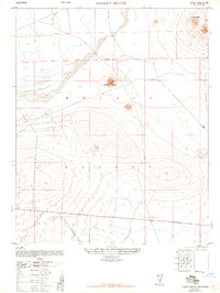
 1915 Searles Lake1915 Print · USGSThe Mojave Desert at the height of its early mining boom features a landscape defined by the Trona RR and the thriving gold camps of the Rand Mountains. Genealogists and historians can trace the foundations of Randsburg, the soda works at Trona, and remote outposts like Muerto Leliter PO and Garlock.6 unique versions available
 - 1915 Map of Mojave
 1915 Mojave1915 Print · USGSThe eastern Tehachapi Mountains meet the desert in the early twentieth century as a hub of rail and mining. Trace the historic paths of the Southern Pacific railroad through Tehachapi and Mojave, or locate remote sites like the Joe Walker Mine and Claraville.7 unique versions available
 - 1943 Map of Saltdale
 1943 Saltdale1943 Print · USGSKern County's high desert was a center of mineral extraction and wartime logistics during the early 1940s. Genealogists and historians can trace rail-side outposts like Saltdale, numerous prospects such as the Copper Basin Mine, and the Red Rock Sch.4 unique versions available
 - 1943 Map of Castle Butte
 1943 Castle Butte1943 Print · USGSKern County ranching and early desert industry are preserved in this wartime survey of the Mojave. Genealogists and researchers can trace isolated landmarks like G Mendiburu, the Thundering Herd Ranch, and the operations of the Muroc Clay Co.2 unique versions available
 - 1943 Map of Mojave
 1943 Mojave1943 Print · USGSMid-century Kern County comes alive through this detailed survey of the high desert and mountain passes during the war years. Genealogists and historians can trace the rail lines connecting Mojave to outlying points like Gold Town and the Lucky Dog Mine.2 unique versions available
 - 1947 Map of Castle Butte
 1947 Castle Butte1947 Print · USGSThe high desert of Kern County during the post-war era reveals a landscape of industrial outposts and isolated ranching. Trace early mineral operations at Muroc Clay Co and family landmarks like G Mendiburu or the Thundering Herd Ranch.
 - 1947 Map of Plano
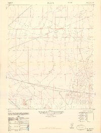 1947 Plano1947 Print · USGSKern County's desert terrain is captured here in the late 1940s as military mapping methods were adapted for civilian use. Genealogists and industrial historians can trace the parallel routes of the Southern Pacific and the Lucky Dog Mine.3 unique versions available
 - 1947 Map of Mojave
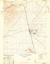 1947 Mojave1947 Print · USGSIn the high desert just after the war, Mojave stands as a vital rail and water hub at the edge of the Tehachapi Mountains. Genealogists and researchers can trace the Los Angeles Aqueduct, the streets of Reefer City, and the layout of the Muroc Naval Air Station (Abandoned).
 - 1947 Map of Desert Butte
 1947 Desert Butte1947 Print · USGSThe post-war Mojave Desert comes into focus here, showing a landscape defined by volcanic landforms and early infrastructure. Trace the early development of roads labeled Under Construction near landmarks like Desert Butte and Castle Butte.
 - 1947 Map of Trona, 1948 Print
 1947 Trona1948 Print · USGSThe Mojave Desert and Southern Sierra foothills come alive in the late 1940s, showing the industrial nodes of the Argus Range and the burgeoning Camp Irwin. Trace the legacy of desert mining and railroading through Trona, the Ashford Mill, and the historic districts of Randsburg and Garlock.
 - 1948 Map of Trona
 1948 Trona1948 Print · USGSThe Mojave Desert and Death Valley frontier appear here during a mid-century era of military expansion and industrial mining. Trace the remnants of the Old Spanish Trail or locate isolated landmarks like Ashford Mill and the mining hub of Randsburg.
 - 1948 Map of Bakersfield
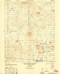
 1948 Bakersfield1948 Print · USGSBakersfield and the southern San Joaquin Valley appear in the late 1940s, showing a landscape of burgeoning oil towns, rail junctions, and early irrigation canals. Genealogists and historians can trace the foundations of local industry through Gardner Field, the Sunset Railway, and the shores of Buena Vista Lake.2 unique versions available
 - 1953 Map of Trona, 1956 Print
 1953 Trona1956 Print · USGSThe high desert of San Bernardino and Inyo counties during the early Cold War reveals a landscape of mineral industry and military expansion. You can trace the Old Spanish Trail, locate the Trona potash works, and find remote outposts like Ashford Mill.
 - 1954 Map of Boron, 1955 Print
 1954 Boron1955 Print · USGSThe Mojave Desert's borax mining hub comes alive in the mid-1950s, showing the early development of the modern mining complex. Researchers can trace the industrial footprint of the Jennifer Mine, the community at Gephart School, and the remote Boron A F Station.3 unique versions available
 - 1955 Map of Bakersfield
 1955 Bakersfield1955 Print · USGSThe southern San Joaquin Valley in the mid-fifties shows an era of massive oil production and industrial irrigation. Trace family roots in Allensworth, the oil fields of Oildale, or the shorelines of Tulare Lake and Buena Vista Lake.
 - 1956 Map of Bakersfield
 1956 Bakersfield1956 Print · USGSThe southern San Joaquin Valley and High Sierra come alive in the mid-fifties, showing the region's complex agricultural and rail networks. Genealogists and historians can trace family roots in towns like Bakersfield, Taft, and Delano, or locate early infrastructure along the Sunset Railway.
 - 1956 Map of Castle Butte, 1957 Print
 1956 Castle Butte1957 Print · USGSKern County’s High Desert was a focal point of military testing and ranching in the mid-fifties. Researchers can trace the early footprint of Edwards Air Force Base and find remote landmarks like Thundering Herd Ranch and Muroc Junction.3 unique versions available
 - 1956 Map of Mojave, 1957 Print
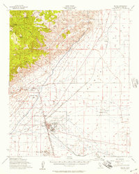 1956 Mojave1957 Print · USGSThe high desert rail hub of Mojave comes alive in the mid-fifties as a vital intersection for the Southern Pacific and Santa Fe lines. Genealogists and historians can trace local life through the Marine Corps Auxiliary Air Station, the Los Angeles Aqueduct, and outposts like Reefer City and Neuralia.3 unique versions available
 - 1957 Map of Trona, 1964 Print
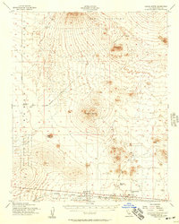
 1957 Trona1964 Print · USGSThe High Desert in the mid-fifties is captured here as a landscape of remote mining outposts and growing military installations. Trace the industrial rail lines to Trona, the mining history of Randsburg, or the isolated expanse of the Naval Ordnance Test Station.5 unique versions available
 - 1960 Map of Trona
 1960 Trona1960 Print · USGSThe Mojave Desert at mid-century reveals a landscape of massive military installations and industrial mineral works. Researchers can trace the heritage of mining and ranching at Ashford Mill, Randsburg, and Paxton Ranch while following the Old Spanish Trail.2 unique versions available
 - 1960 Map of Bakersfield
 1960 Bakersfield1960 Print · USGSThe Southern San Joaquin Valley at mid-century reveals a complex landscape of petroleum development and massive irrigation projects. Researchers can trace the rail lines of the Southern Pacific, explore oil-era landmarks like Oil City, and locate early settlements including Allensworth and Pixley.2 unique versions available
 - 1962 Map of Bakersfield, 1969 Print
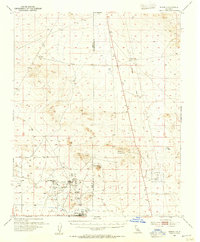
 1962 Bakersfield1969 Print · USGSThe Southern San Joaquin Valley is shown in the 1960s as a bustling intersection of petroleum production, irrigation agriculture, and mountain recreation. Researchers can trace the rail lines of the Southern Pacific through the valley or locate early desert developments like California City and Tehachapi.4 unique versions available
Showing maps 1-25 of 74
Top cities near California City
Frequently asked questions
- What are the different types of historical maps available for California City?
- What is the oldest map of California City?
- Where can I purchase historical maps of California City for my home or office?
- Where can I download high-res historical maps of California City?
- Are there historical topographic maps available for California City?
- Is there historical aerial imagery available for California City?
- Where are historical maps of California City sourced from?