
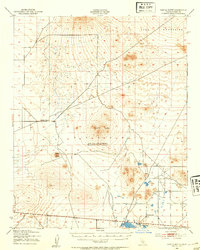
1943 Map of Castle Butte
USGS Topo · Published 1943About this map
Castle Butte dominates the central landscape of this 1943 War Department survey, representing a wartime assessment of the eastern Kern County desert. This era of mapping, conducted by the Corps of Engineers and the Army Map Service, highlights a sparse but functional network of early development in the Mojave Desert. Industrial activity is centered around the Muroc Clay Co near the edge of Rogers Lake, where the flat basin provided essential space for extractive and aerial operations.
Find a feature on this map
11 named features on this map. Tap any name to fly to it.
Don’t see what you’re looking for? This feature index may not catch every label — zoom into the map to look around manually.
Map Details
Editions of this 1943 Castle Butte Map
2 editions found
Other maps of this area

1903 · Randsburg
USGS Topo · 1:62,500

1911 · Randsburg
USGS Topo · 1:62,500

1912 · Randsburg
USGS Topo · 1:62,500

1915 · Elizabeth Lake
USGS Topo · 1:125,000

1915 · Searles Lake
USGS Topo · 1:250,000

1915 · Mojave
USGS Topo · 1:125,000

1917 · Elizabeth Lake
USGS Topo · 1:125,000

1937 · Kramer
USGS Topo · 1:48,000

1937 · Rogers Lake
USGS Topo · 1:48,000

1942 · Kramer
USGS Topo · 1:62,500