
1943 Map of Saltdale
USGS Topo · Published 1943About this map
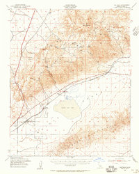
Koehn Dry Lake dominates the central basin of this high-desert landscape, serving as the focal point for the Southern Pacific rail line and the settlement of Saltdale. During this wartime era, the region was an active hub of mineral extraction and defense preparation. To the north, the El Paso Mountains are peppered with numerous mining operations including the Apache Mine, Holly Mine, and Copper Basin Mine. The presence of an Army Ground Observation Station near the Petrified Forest highlights the strategic importance of this terrain in 1943. Transport and logistics were anchored by the rail corridor, connecting small outposts like Cantil and Gypsite to the historic mining hubs of Garlock and Old Garlock. Along the western edge, Red Rock Sch and Ricardo mark the entrance to the striking geology of Redrock Canyon.
Find a feature on this map
44 named features on this map. Tap any name to fly to it.
Don’t see what you’re looking for? This feature index may not catch every label — zoom into the map to look around manually.
Map Details
Editions of this 1943 Saltdale Map
4 editions found
Other maps of this area

1903 · Randsburg
USGS Topo · 1:62,500

1906 · Kernville
USGS Topo · 1:125,000

1908 · Kernville
USGS Topo · 1:125,000

1911 · Randsburg
USGS Topo · 1:62,500

1912 · Randsburg
USGS Topo · 1:62,500

1915 · Searles Lake
USGS Topo · 1:250,000

1915 · Mojave
USGS Topo · 1:125,000

1943 · Inyokern
USGS Topo · 1:62,500

1943 · Cross Mountain
USGS Topo · 1:62,500

1943 · Onyx
USGS Topo · 1:62,500