2020s Maps of California City, California
Explore 9 historic maps of California City from the 2020s. These maps offer a rare glimpse into what life looked like during the 2020s — showing old roads, neighborhoods, homes, and landmarks that have changed or disappeared over time.
Whether you're researching your family's past, planning a metal detecting trip, or studying how California City's landscape evolved across the 2020s, these high-resolution maps are a powerful tool for exploring the history of this region.
- Focus on a specific era: All maps on this page are from the 2020s, giving you a focused view of this time period.
- See what’s changed: Compare century-old streets, trails, and buildings to today's modern landscape using overlays and satellite layers.
- Research with precision: Use these maps for genealogy, historical research, land use analysis, or educational projects.
- View, download, or print: Maps are fully viewable online in high resolution, and can be downloaded or printed for your own records.
Start exploring California City's history through authentic maps from the 2020s. This is your window into the past.
California City, CA maps
(9)- 2021 Map of California City North, 2021 Print
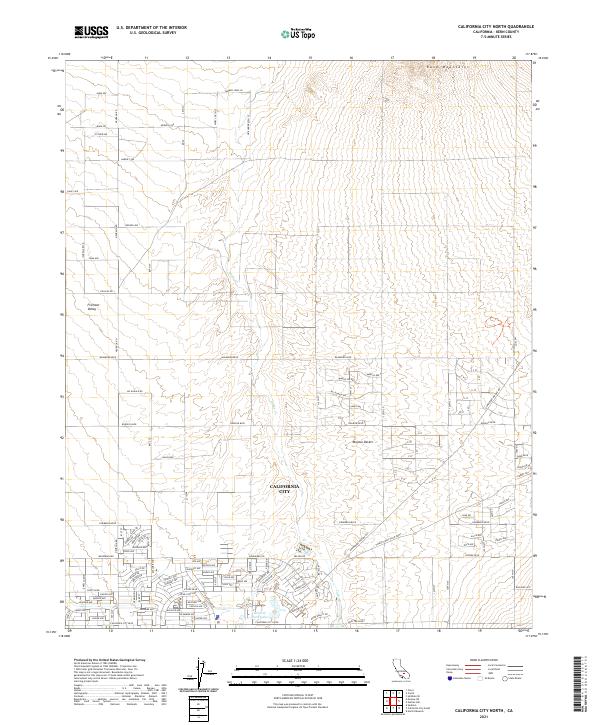 2021 California City North2021 Print · USGSCalifornia City and the surrounding Mojave Desert landscape are documented here in the early 2020s. Researchers can trace the vast grid of planned residential streets like Neuralia Rd and find landmarks like Central Park Lake and the Rand Mountains.
 - 2021 Map of Johannesburg, 2021 Print
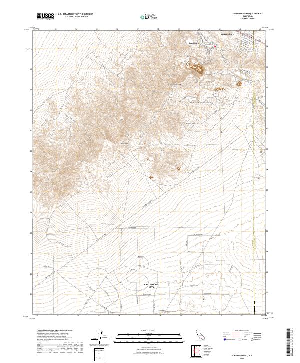 2021 Johannesburg2021 Print · USGSThe mining camps of the Rand District and the early foundations of California City meet in this modern desert survey. Trace historical gold country routes like Sunshine Mine Rd or explore the distinct grids of Randsburg and Johannesburg.
 - 2021 Map of Saltdale SE, 2021 Print
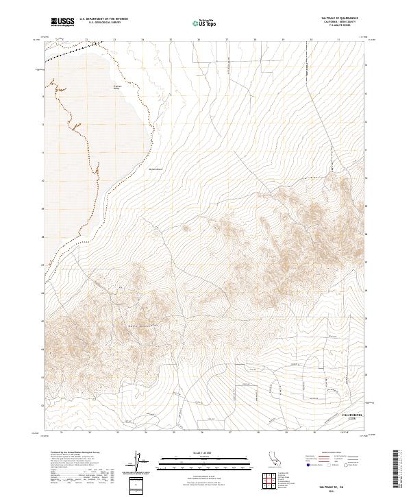 2021 Saltdale SE2021 Print · USGSCalifornia City meets the high desert in the early twenty-first century, showing the grid-like expansion of residential streets. Trace the urban edge along W Point Blvd as it reaches toward the Rand Mountains and the Mojave Desert.
 - 2021 Map of Boron NW, 2021 Print
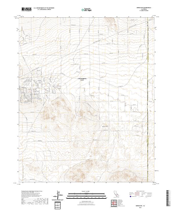 2021 Boron NW2021 Print · USGSKern County's high desert reveals its mid-century urban planning ambitions within the planned grid of California City. Trace the vast network of residential street names and key regional routes like Twenty Mule Team Pkwy and Columbia Rd.
 - 2021 Map of California City South, 2021 Print
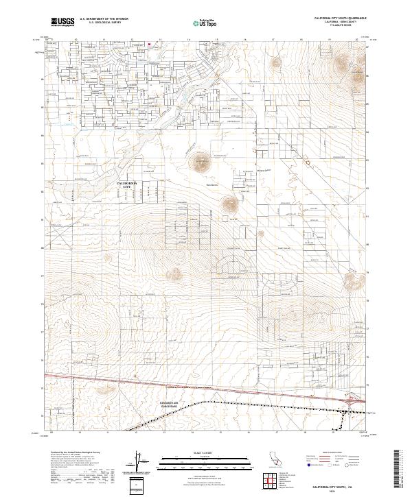 2021 California City South2021 Print · USGSKern County’s high desert landscape shows a unique suburban grid layout in the early twenty-first century. Researchers can trace the vast master-planned streets of California City and locate landmarks like Castle Butte and Desert Butte.
 - 2021 Map of Mojave NE, 2021 Print
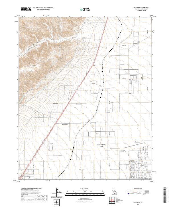 2021 Mojave NE2021 Print · USGSCalifornia City stands at the edge of the desert during its modern expansion. Genealogists and researchers can trace the vast residential grid and key landmarks like California City Municipal Airport or the Los Angeles Aqueduct.
 - 2021 Map of Galileo Hill, 2021 Print
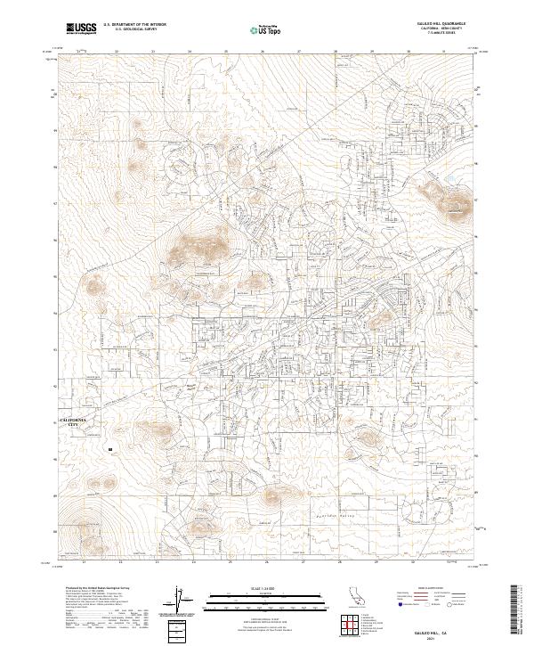 2021 Galileo Hill2021 Print · USGSIn the early twenty-first century, California City shows its expansive residential layout carved into the Mojave Desert. You can trace the development of this planned community through its grid of named streets, from Roosevelt Dr to the slopes of Galileo Hill.
 - 2022 Map of Sanborn, 2022 Print
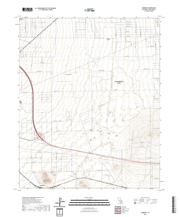 2022 Sanborn2022 Print · USGSCalifornia City and the surrounding Mojave Desert landscape are captured here in the early 2020s. Researchers can trace the massive, largely unbuilt street grid and locate features like Sanborn Hill, the community of Sanborn, and Cache Cr.
 - 2022 Map of Mojave, 2022 Print
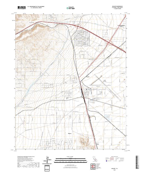 2022 Mojave2022 Print · USGSThe high desert of Kern County comes into focus in this recent survey of a vital California transit and aviation hub. Trace the massive engineering of the Los Angeles Aqueduct as it passes near Mojave, the Mojave Air and Space Port, and the Southern Pacific RR.
End of results
Showing maps 1-9 of 9
Top cities near California City
Frequently asked questions
- What are the different types of historical maps available for California City?
- What is the oldest map of California City?
- Where can I purchase historical maps of California City for my home or office?
- Where can I download high-res historical maps of California City?
- Are there historical topographic maps available for California City?
- Is there historical aerial imagery available for California City?
- Where are historical maps of California City sourced from?