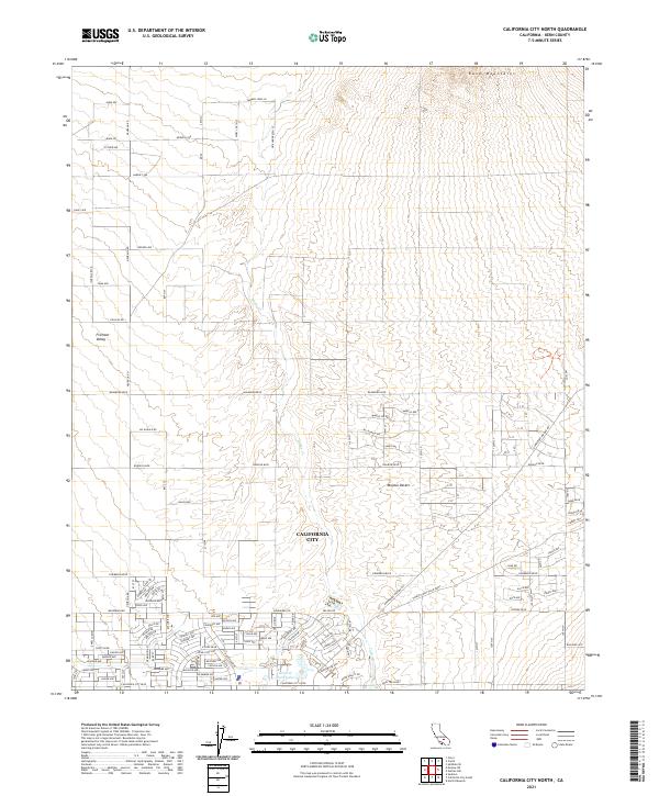
2021 Map of California City North
USGS Topo · Published 2021About this map
California City sprawls across the transition between the Fremont Valley and the southern slopes of the Rand Mountains. This 2021 survey reveals a planned grid of residential streets extending far into the Mojave Desert, many of which remain unpaved or undeveloped despite their formal names. The southern portion of the map shows the more established core of the community, centered around Central Park Lake and a concentration of arterial roads like Neuralia Rd and Washburn Blvd.
Find a feature on this map
124 named features on this map. Tap any name to fly to it.
Don’t see what you’re looking for? This feature index may not catch every label — zoom into the map to look around manually.
Map Details
Editions of this 2021 California City North Map
This is the sole edition of this map. No revisions or reprints were ever made.
Other maps of this area

1915 · Searles Lake
USGS Topo · 1:250,000

1915 · Mojave
USGS Topo · 1:125,000

1943 · Cross Mountain
USGS Topo · 1:62,500

1943 · Saltdale
USGS Topo · 1:62,500

1943 · Castle Butte
USGS Topo · 1:62,500

1943 · Mojave
USGS Topo · 1:62,500

1947 · Castle Butte
USGS Topo · 1:50,000

1947 · Plano
USGS Topo · 1:24,000

1947 · Desert Butte
USGS Topo · 1:24,000
1947 · Castle Butte SE
USGS Topo · 1:24,000