Old Maps of Clearlake, California
Explore 22 old maps of Clearlake, spanning from 1945 to today. These high-resolution historic maps reveal how streets, neighborhoods, landmarks, and natural features evolved over time — perfect for genealogy, metal detecting, research, and local history exploration.
What you can do with these maps:
- See how Clearlake changed over time: Compare historical maps to modern-day views to trace roads, homesites, rail lines & more.
- View detailed metadata: Each map includes creators, publishers, year, scale, and archive source.
- Overlay maps with satellite & LiDAR: Visualize the past alongside modern tools to explore terrain & human change.
- Trusted historical sources: Maps sourced from the USGS, Library of Congress, and other archives.
- Access maps your way: View online, download high-res files, or order prints for personal or research use.
Start exploring old maps of Clearlake to uncover forgotten places, hidden landmarks, and the deep history beneath your feet.
Clearlake, CA maps
(22)- 1945 Map of Lower Lake
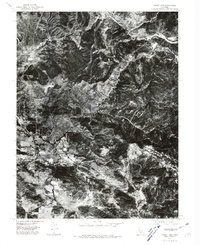
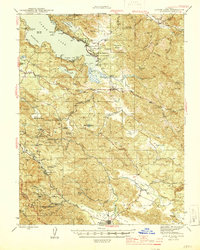 1945 Lower Lake1945 Print · USGSLake County's famous resort and mercury-mining districts are shown in high detail during the mid-1940s. Researchers can locate vanished structures at Hould Gibson Camp, trace the namesake springs at Anderson Springs, and find rural institutions like Cobb Valley Sch.2 unique versions available
 - 1947 Map of Santa Rosa
 1947 Santa Rosa1947 Print · USGSNorthern California in the late 1940s was a landscape of agricultural valleys and vital rail hubs. Trace the historic routes of the Northwestern Pacific through Healdsburg or explore the mid-century waterfronts of Vallejo and Benicia near Mare Island.
 - 1949 Map of Santa Rosa
 1949 Santa Rosa1949 Print · USGSThe North Bay and Wine Country appear here in the late 1940s, when the Northwestern Pacific RR still dominated regional transit. Genealogists and historians can trace old coastal outposts like Anchor Bay Settlement and the early layout of Santa Rosa.2 unique versions available
 - 1958 Map of Lower Lake, 1961 Print
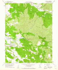 1958 Lower Lake1961 Print · USGSLower Lake and the surrounding Lake County valleys are captured here in the late fifties, showcasing a landscape defined by the winding waters of Cache Creek. Researchers can trace the layout of the town near Union High Sch or locate rural landmarks like the Baker Mine and Pearce Airport.5 unique versions available
 - 1958 Map of Clearlake Highlands, 1961 Print
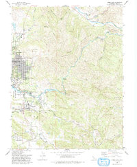
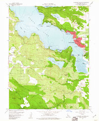 1958 Clearlake Highlands1961 Print · USGSClear Lake's eastern shoreline and the surrounding volcanic highlands are captured here during the late 1950s. Genealogists and local historians can trace the development of Clearlake Highlands and find legacy landmarks like the Burns Valley Sch and Salminas Resort.5 unique versions available
 - 1958 Map of Lower Lake, 1962 Print
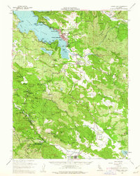 1958 Lower Lake1962 Print · USGSLake County was a burgeoning destination for mineral spring resorts and lakeside living in the late fifties. Genealogists and historians can trace the foundations of Clearlake Highlands, the winding Putah Creek, and historic sites like Hobergs and Sulphur Bank Mine.2 unique versions available
 - 1958 Map of Santa Rosa, 1968 Print
 1958 Santa Rosa1968 Print · USGSThe North Bay and Wine Country are captured in the mid-twentieth century as the region balanced its agricultural roots with a growing military and recreational footprint. Researchers can trace the Northwestern Pacific RR through the Russian River valley or locate landmarks like the Petaluma Adobe Historical Monument and The Geysers Resort.3 unique versions available
 - 1962 Map of Santa Rosa
 1962 Santa Rosa1962 Print · USGSThe North Bay and Wine Country were entering a period of significant growth in the early sixties, anchored by established rail corridors and coastal maritime commerce. Genealogists and historians can trace the development of Santa Rosa, locate the Mare Island Naval Shipyard, and follow the Northwestern Pacific RR through the Cotati Valley.
 - 1964 Map of Santa Rosa
 1964 Santa Rosa1964 Print · USGSThe North Bay and Wine Country appear in the mid-fifties during a period of significant military and educational growth. Trace old rail lines like the Northwestern Pacific RR and explore historic sites from Petaluma to the Benicia Arsenal.
 - 1972 Map of Healdsburg, 1975 Print
 1972 Healdsburg1975 Print · USGSNorthern California wine country and the lower Lake County basins appear here during the early seventies. Trace the Northwestern Pacific rail line and discover foothill communities like Middletown and Loch Lomond.2 unique versions available
 - 1977 Map of Clearlake Highlands, 1980 Print
 1977 Clearlake Highlands1980 Print · USGSThe eastern shores of Clear Lake are captured in high-altitude detail in the late 1970s, showing the intersection of lake life and development. Genealogists and local historians can trace the street layouts of Clearlake Highlands and the secluded basins of Borax Lake and Thurston Lake.
 - 1977 Map of Lower Lake, 1980 Print
 1977 Lower Lake1980 Print · USGSThe township of Lower Lake and the pastoral Excelsior Valley appear in sharp detail in this late-1970s aerial survey. Researchers can trace the mid-century development of the town and follow the path of Cache Creek through the landscape.
 - 1993 Map of Clearlake Highlands
 1993 Clearlake Highlands1993 Print · USGSThe southeastern shores of Clear Lake come alive in the early nineties as residential growth transforms the waterfront. Researchers can trace the development of Clearlake Highlands, locate the Burns Valley School, and explore the protected wetlands of Anderson Marsh State Historical Park.
 - 1993 Map of Lower Lake
 1993 Lower Lake1993 Print · USGSLake County in the early nineties shows a landscape of expanding lakeside communities and rugged backcountry peaks. Genealogists and historians can trace the developments around Lower Lake, the grounds of Yuba College, and the rural site of Baker Mine.2 unique versions available
 - 2012 Map of Clearlake Highlands, 2012 Print
 2012 Clearlake Highlands2012 Print · USGSCovers Clearlake, including Clearlake Riviera, Riviera Estates, and other nearby areas
 - 2012 Map of Lower Lake, 2012 Print
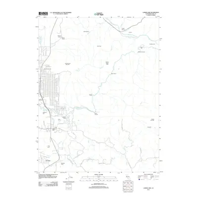 2012 Lower Lake2012 Print · USGSCovers Clearlake, including Lower Lake, Twin Lakes, and other nearby areas
 - 2015 Map of Lower Lake, 2015 Print
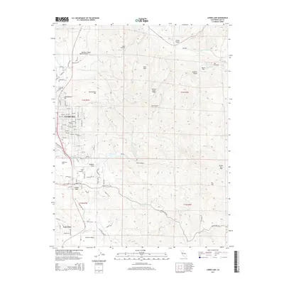 2015 Lower Lake2015 Print · USGSCovers Clearlake, including Lower Lake, Twin Lakes, and other nearby areas
 - 2015 Map of Clearlake Highlands, 2015 Print
 2015 Clearlake Highlands2015 Print · USGSCovers Clearlake, including Clearlake Riviera, Riviera Estates, and other nearby areas
 - 2018 Map of Clearlake Highlands, 2018 Print
 2018 Clearlake Highlands2018 Print · USGSCovers Clearlake, including Clearlake Riviera, Riviera Estates, and other nearby areas
 - 2018 Map of Lower Lake, 2018 Print
 2018 Lower Lake2018 Print · USGSCovers Clearlake, including Lower Lake, Twin Lakes, and other nearby areas
 - 2021 Map of Clearlake Highlands, 2021 Print
 2021 Clearlake Highlands2021 Print · USGSLake County's eastern shores are detailed here in the early 2020s, showing the modern layout of lakeside communities and mountain retreats. Researchers can trace local landmarks like Salminas Resort, the Anderson Marsh wetlands, and the streets of Clearlake Highlands.
 - 2021 Map of Lower Lake, 2021 Print
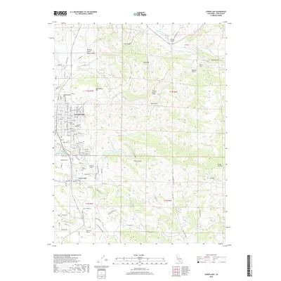
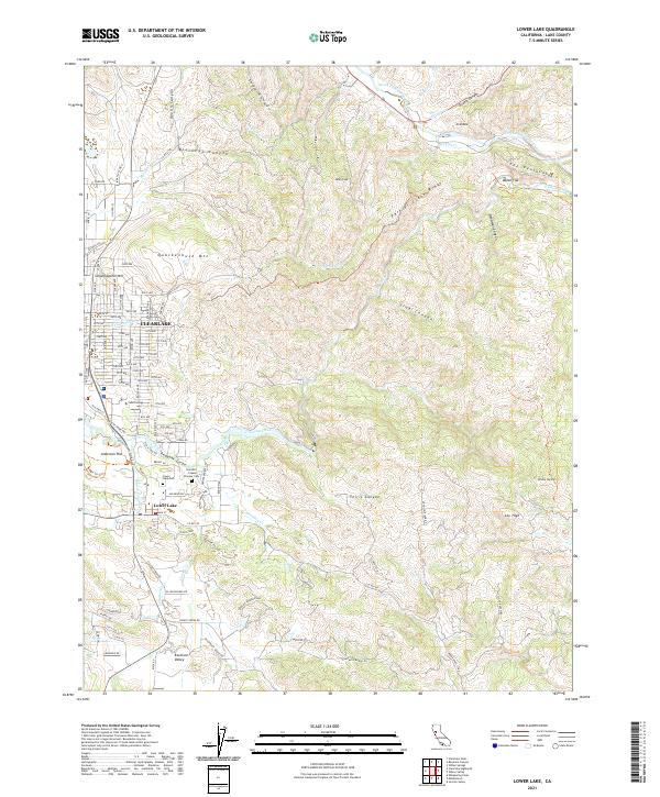 2021 Lower Lake2021 Print · USGSLake County comes into focus in the early 2020s, showing the intersection of suburban growth and the deep-rooted ranching landscape. Genealogists and local historians can trace family plots at the Herndon - Copsey Pioneer Cem or locate the original town sites near Lower Lake and Baton Flat.
End of results
Showing maps 1-22 of 22
Top cities near Clearlake
- Clearlake Riviera historical maps
- Kelseyville historical maps
- Lucerne historical maps
- Nice historical maps
- Clearlake Oaks historical maps
- Cobb historical maps
See more
Top neighborhoods of Clearlake
Frequently asked questions
- What are the different types of historical maps available for Clearlake?
- What is the oldest map of Clearlake?
- Where can I purchase historical maps of Clearlake for my home or office?
- Where can I download high-res historical maps of Clearlake?
- Are there historical topographic maps available for Clearlake?
- Is there historical aerial imagery available for Clearlake?
- Where are historical maps of Clearlake sourced from?