Old Maps of Finley, California
Explore 20 old maps of Finley, spanning from 1938 to today. These high-resolution historic maps reveal how streets, neighborhoods, landmarks, and natural features evolved over time — perfect for genealogy, metal detecting, research, and local history exploration.
What you can do with these maps:
- See how Finley changed over time: Compare historical maps to modern-day views to trace roads, homesites, rail lines & more.
- View detailed metadata: Each map includes creators, publishers, year, scale, and archive source.
- Overlay maps with satellite & LiDAR: Visualize the past alongside modern tools to explore terrain & human change.
- Trusted historical sources: Maps sourced from the USGS, Library of Congress, and other archives.
- Access maps your way: View online, download high-res files, or order prints for personal or research use.
Start exploring old maps of Finley to uncover forgotten places, hidden landmarks, and the deep history beneath your feet.
Finley, CA maps
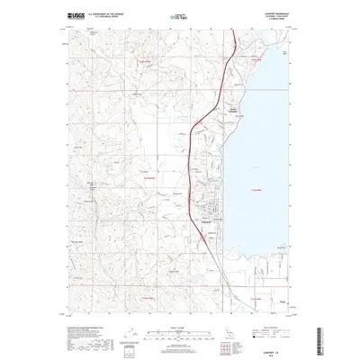
(20)- 1938 Map of Lakeport
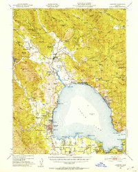
 1938 Lakeport1938 Print · USGSLake County in the late thirties is captured here at a peak of lakeside development and rural industry. Genealogists and historians can trace family-named sites like Jones Ranch and Mission Rancheria, or locate old schoolhouses like Westlake Sch and Glen Eden Sch.3 unique versions available
 - 1951 Map of Lakeport, 1953 Print
 1951 Lakeport1953 Print · USGSNorthern California lake life and tribal history meet in the early fifties around the shores of Clear Lake. Trace the locations of the Upper Lake Rancheria, the Bloody Island Massacre Historic Marker, and the early layout of Lakeport.2 unique versions available
 - 1957 Map of Ukiah, 1966 Print
 1957 Ukiah1966 Print · USGSNorthern California's diverse terrain comes into focus in the mid-1950s, from the rugged timberlands of the Jackson State Forest to the productive Sacramento Valley. Genealogists and historians can trace the rail lines of the Northwestern Pacific or locate early valley settlements like Arbuckle and Paskenta.3 unique versions available
 - 1958 Map of Lucerne, 1961 Print
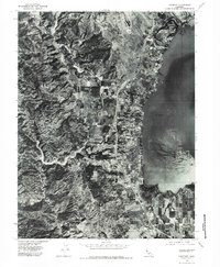
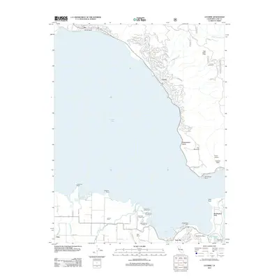
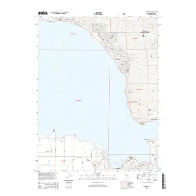
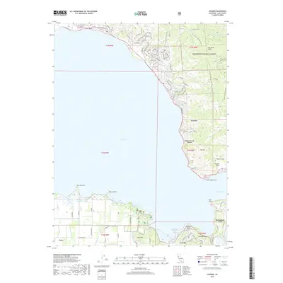
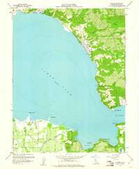 1958 Lucerne1961 Print · USGSClear Lake's eastern shoreline is captured in the late fifties, showing the region's balance between forest wilderness and emerging lakeside communities. Genealogists and researchers can trace local developments from Lucerne and Nice down to the agricultural plots around Finley and the geologically unique Little Borax Lake.4 unique versions available
 - 1958 Map of Lakeport, 1961 Print
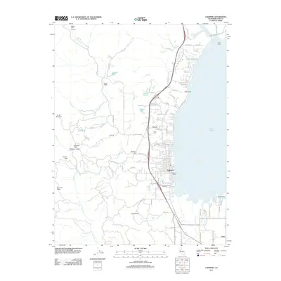
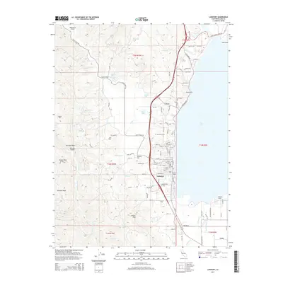
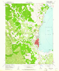 1958 Lakeport1961 Print · USGSThe western shores of Clear Lake come alive in the late 1950s, detailing a period of agricultural and civic growth. Genealogists and historians can trace family-named sites and landmarks like Hartley Cemetery, Scotts Valley Rancheria, and Westlake Sch.5 unique versions available
 - 1958 Map of Lakeport, 1962 Print
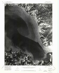
 1958 Lakeport1962 Print · USGSClear Lake and its surrounding rancherias are shown in detail during the late fifties as the region's agricultural and resort communities thrived. Researchers can trace local landmarks like Saratoga Springs, the Bloody Island Massacre Historical Marker, and Robinson Rancheria.3 unique versions available
 - 1960 Map of Ukiah
 1960 Ukiah1960 Print · USGSNorthern California during the late fifties reveals a landscape of deep timber forests and valley agriculture before modern expansion. Trace the historic rail lines of the California Western RR and the Northwestern Pacific RR through settlements like Fort Bragg and Ukiah.2 unique versions available
 - 1977 Map of Lakeport, 1979 Print
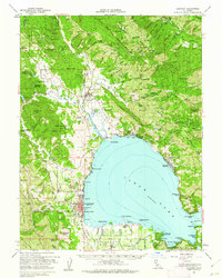
 1977 Lakeport1979 Print · USGSThe western shores of California’s largest natural freshwater lake appear in sharp detail during the late seventies. Researchers can trace the development of Lakeport and the agricultural landscape surrounding Scotts Creek and Lakeport Peak.2 unique versions available
 - 1977 Map of Lucerne, 1980 Print
 1977 Lucerne1980 Print · USGSThe northeastern shores of Clear Lake are captured here during the late seventies, showing the development of lakeside communities. Genealogists and local historians can trace the street layouts of Nice and Lucerne or study the agricultural fields along Kelsey Creek.
 - 1983 Map of Lakeport
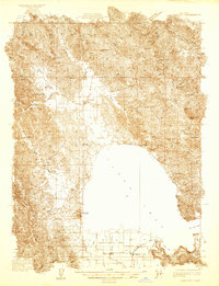 1983 Lakeport1983 Print · USGSClear Lake and the surrounding hills of Lake County are captured in the early 1930s during a period of agricultural growth and lakeshore development. Genealogists can locate family sites near Lakeport or trace rural landmarks like Witter Springs and Kelsey Creek Sch.
 - 1994 Map of Lakeport
 1994 Lakeport1994 Print · USGSCoastal mountains meet the fertile Sacramento Valley in the 1990s, where the waters of Clear Lake define the western landscape. Researchers can trace the industrial footprint of the Sulphur Bank Mine, follow the Southern Pacific RR tracks, or locate old settlements like Fouts Springs and Lodoga.
 - 1996 Map of Lucerne, 2001 Print
 1996 Lucerne2001 Print · USGSClear Lake’s shoreline in the late nineties is a landscape of established lakeside communities and agricultural valley floors. Genealogists and local historians can trace the development of Lucerne and Nice, locate Quercus Ranch, or study the unique Ferndale Resort Seaplane Base.
 - 2012 Map of Lucerne, 2012 Print
 2012 Lucerne2012 Print · USGSCovers Finley, including Lucerne, Nice, and other nearby areas
 - 2012 Map of Lakeport, 2012 Print
 2012 Lakeport2012 Print · USGSCovers Finley, including Lakeport, Lake County, and other nearby areas
 - 2015 Map of Lucerne, 2015 Print
 2015 Lucerne2015 Print · USGSCovers Finley, including Lucerne, Nice, and other nearby areas
 - 2015 Map of Lakeport, 2015 Print
 2015 Lakeport2015 Print · USGSCovers Finley, including Lakeport, Lake County, and other nearby areas
 - 2018 Map of Lakeport, 2018 Print
 2018 Lakeport2018 Print · USGSCovers Finley, including Lakeport, Lake County, and other nearby areas
 - 2018 Map of Lucerne, 2018 Print
 2018 Lucerne2018 Print · USGSCovers Finley, including Lucerne, Nice, and other nearby areas
 - 2021 Map of Lucerne, 2021 Print
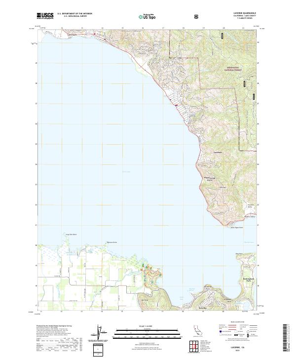 2021 Lucerne2021 Print · USGSClear Lake's eastern and southern shores are shown here in the 2020s as modern residential communities meet the edge of the Mendocino National Forest. Researchers can trace the layout of lakeside neighborhoods from Lucerne and Pepperwood Grove to the springs and sloughs near Soda Bay.
 - 2022 Map of Lakeport, 2022 Print
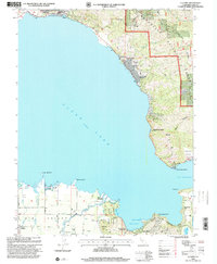
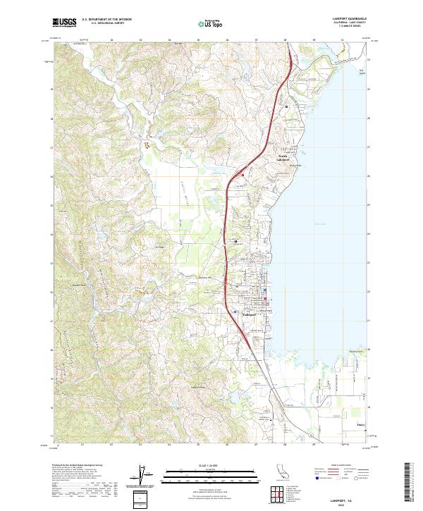 2022 Lakeport2022 Print · USGSThe western shores of Clear Lake and the fertile Scotts Valley are captured here in the early 2020s. Genealogists and local historians can locate the Lake County Courthouse and trace family sites near Hartley Cem or the settlement of Finley.
End of results
Showing maps 1-20 of 20
Top cities near Finley
- Clearlake historical maps
- Cloverdale historical maps
- Lakeport historical maps
- Clearlake Riviera historical maps
- Kelseyville historical maps
- Lucerne historical maps
See more
Frequently asked questions
- What are the different types of historical maps available for Finley?
- What is the oldest map of Finley?
- Where can I purchase historical maps of Finley for my home or office?
- Where can I download high-res historical maps of Finley?
- Are there historical topographic maps available for Finley?
- Is there historical aerial imagery available for Finley?
- Where are historical maps of Finley sourced from?