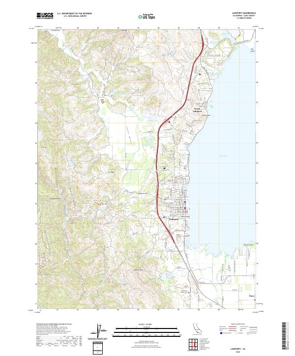
2022 Map of Lakeport
USGS Topo · Published 2022About this map
Clear Lake dominates the eastern landscape of this quadrangle, shaping the development of Lakeport and North Lakeport along its shoreline. The civic heart of the area is marked by the Lake County Courthouse, while local history is etched into the grounds of Hartley Cem and Saint Mary's Catholic Cem. To the west, the terrain rises sharply from Scotts Valley into the high country of McGregor Ridge and Boundary Ridge, where drainage systems like Scotts Cr and Hendricks Cr carve through deep canyons. The map documents a transition from the lakeside settlements to the agricultural and upland reaches of Scotts Valley, including notable local landmarks such as Brewery Hill and the peak of Poe Mtn. This geography illustrates the historical reliance on the lake's edge for commerce and habitation while the western ridges remained defined by their complex relief and water courses.
Find a feature on this map
123 named features on this map. Tap any name to fly to it.
Don’t see what you’re looking for? This feature index may not catch every label — zoom into the map to look around manually.
Map Details
Editions of this 2022 Lakeport Map
This is the sole edition of this map. No revisions or reprints were ever made.
Other maps of this area

1920 · Ukiah
USGS Topo · 1:62,500

1921 · Kelseyville
USGS Topo · 1:62,500

1938 · Lakeport
USGS Topo · 1:62,500

1938 · Hopland
USGS Topo · 1:62,500

1943 · Kelseyville
USGS Topo · 1:62,500

1943 · Hopland
USGS Topo · 1:62,500

1944 · Ukiah
USGS Topo · 1:62,500

1944 · Hopland
USGS Topo · 1:62,500

1947 · Santa Rosa
USGS Topo · 1:250,000

1949 · Santa Rosa
USGS Topo · 1:250,000