1990s Maps of Bieber, California
Explore 2 historic maps of Bieber from the 1990s. These maps offer a rare glimpse into what life looked like during the 1990s — showing old roads, neighborhoods, homes, and landmarks that have changed or disappeared over time.
Whether you're researching your family's past, planning a metal detecting trip, or studying how Bieber's landscape evolved across the 1990s, these high-resolution maps are a powerful tool for exploring the history of this region.
- Focus on a specific era: All maps on this page are from the 1990s, giving you a focused view of this time period.
- See what’s changed: Compare century-old streets, trails, and buildings to today's modern landscape using overlays and satellite layers.
- Research with precision: Use these maps for genealogy, historical research, land use analysis, or educational projects.
- View, download, or print: Maps are fully viewable online in high resolution, and can be downloaded or printed for your own records.
Start exploring Bieber's history through authentic maps from the 1990s. This is your window into the past.
Bieber, CA maps
(2)- 1990 Map of Bieber
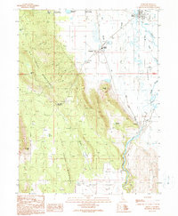 1990 Bieber1990 Print · USGSBieber and Nubieber are shown in the 1990s as the rail and agricultural hubs of this valley landscape. Researchers can trace the local infrastructure from the Bieber Station and Pit River to the Cem and Intermountain Conservation Camp.
 - 1993 Map of Bieber, 1996 Print
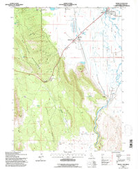 1993 Bieber1996 Print · USGSIn the early 1990s, the river-and-rail hub of Lassen County remained centered on the confluence of the Pit River and Big Valley. Genealogists and local historians can trace family-named sites and infrastructure like the Cem at Nubieber, Bieber Station, and the Intermountain Conservation Camp.
End of results
Showing maps 1-2 of 2
Top cities near Bieber
Frequently asked questions
- What are the different types of historical maps available for Bieber?
- What is the oldest map of Bieber?
- Where can I purchase historical maps of Bieber for my home or office?
- Where can I download high-res historical maps of Bieber?
- Are there historical topographic maps available for Bieber?
- Is there historical aerial imagery available for Bieber?
- Where are historical maps of Bieber sourced from?