Old Maps of Halls Flat, California for Metal Detecting
Plan your next treasure hunt with 17 historic maps of Halls Flat. Find old homesites, ghost towns, trails, and gathering spots that may be lost to time — perfect for identifying promising metal detecting locations.
- Locate forgotten sites: Uncover places like long-lost settlements, abandoned rail lines, or gathering spots.
- Plan better hunts: Use map overlays combined with LiDAR or satellite views to narrow in on historically rich areas.
- Made for detectorists: Thousands of hobbyists use these maps to discover relics, coins, and hidden history.
Use these historic maps to boost your research and find new opportunities beneath the surface of Halls Flat.
Halls Flat, CA maps
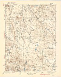
(17)- 1886 Map of Lassen Peak
 1886 Lassen Peak1886 Print · USGSThe Cascades of the late nineteenth century appear here as a landscape of timber mills and volcanic peaks. Genealogists and historians can trace early mountain life at Shingletown, Prattville, and isolated industrial sites like Eureka Mill or the Caribou Bridge.
 - 1892 Map of Lassen Peak
 1892 Lassen Peak1892 Print · USGSThe volcanic highlands of the southern Cascades are captured in the late nineteenth century, showing early milling and mountain settlements. Genealogists and historians can trace pioneer sites like Prattville, the old Eureka Mill, and the crossings at Caribou Bridge.
 - 1894 Map of Lassen Peak
 1894 Lassen Peak1894 Print · USGSThe volcanic highlands of Northern California are captured here in the 1890s, shortly after the initial topographic surveys. Genealogists and historians can locate early industry and mountain outposts like Eureka Mill, Prattville, and the remote Hat Creek Post Office.8 unique versions available
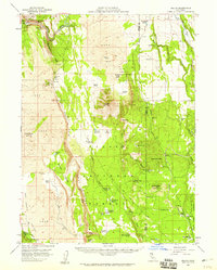
 - 1939 Map of Halls Flat
 1939 Halls Flat1939 Print · USGSThe high plateau of eastern Shasta and Lassen counties is shown here in the late 1930s, defined by timber management and remote ranching. Researchers can trace early forest outposts like Halls Flat Ranger Sta, family holdings at DeLashmutt Ranch, and the Western Pacific rail line.3 unique versions available
 - 1955 Map of Westwood, 1959 Print
 1955 Westwood1959 Print · USGSIn the mid-fifties, the northeastern California interior supported a landscape of mountain timber and high-desert basins. Genealogists and historians can locate early settlements and industrial sites like Susanville, Herlong, and the Sierra Ordinance Depot.
 - 1957 Map of Jellico, 1959 Print
 1957 Jellico1959 Print · USGSThe volcanic highlands of Shasta and Lassen counties come into focus during the late 1950s, highlighting a rugged landscape of lava fields and remote ranches. Researchers can locate family landmarks like St John Ranch, the isolated outpost of Jellico, and geological curiosities like Popcorn Cave.3 unique versions available
 - 1958 Map of Westwood
 1958 Westwood1958 Print · USGSNorthern California in the late fifties shows a landscape of volcanic peaks and rising reservoirs. Researchers can locate the Sierra Ordinance Depot and trace mountain infrastructure through the Hat Creek Ranger Station and Stacy Siding.
 - 1959 Map of Westwood
 1959 Westwood1959 Print · USGSNortheastern California during the late 1950s was a hub of timber, military logistics, and mountain railroading. Researchers can trace the path of the Southern Pacific through the Honey Lake Valley and locate landmarks like the Sierra Ordinance Depot and Lassen Peak.
 - 1962 Map of Susanville, 1965 Print
 1962 Susanville1965 Print · USGSNortheastern California's high desert and volcanic peaks meet in the early sixties, showing the region's timber and rail hubs in transition. Local historians can trace the Southern Pacific lines through Susanville and Litchfield, or explore the sprawling Sierra Army Depot and Lassen Volcanic National Park.2 unique versions available
 - 1968 Map of Susanville
 1968 Susanville1968 Print · USGSThe high Sierras and the Great Basin collide in the late 1960s, showing a landscape of volcanic peaks, timber settlements, and desert plains. Genealogists and researchers can trace historic rail lines like the Western Pacific or locate residents in Susanville, Westwood, and Janesville.
 - 1976 Map of Burney, 1992 Print
 1976 Burney1992 Print · USGSShasta and Lassen counties come alive in the mid-seventies, documenting a rugged landscape of volcanic peaks and timbered wilderness. Genealogists and hikers can trace the Pacific Crest Trail, early ranger outposts like Poison Station, and tribal lands at Montgomery Creek Indian Rancheria.3 unique versions available
 - 1990 Map of Jellico
 1990 Jellico1990 Print · USGSLassen County timber and ranch lands are mapped here during the late twentieth century as they appeared within the national forest. Researchers can trace remote locales like the Cone and Ward Ranch, the Butte Camp (Site), and the high grounds of Negro Camp Mountain.
 - 1995 Map of Jellico, 1997 Print
 1995 Jellico1997 Print · USGSThe high timber and volcanic ridges of Lassen County are captured here in the mid-1990s, centered on the railroad siding at Jellico. Genealogists and historians can locate former homesteads and camps like the Cone and Ward Ranch, Halls Flat, and Negro Camp (Site).
 - 2012 Map of Jellico, 2012 Print
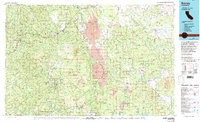
 2012 Jellico2012 Print · USGSCovers Halls Flat, including Jellico, Shasta County, and other nearby areas
 - 2015 Map of Jellico, 2015 Print
 2015 Jellico2015 Print · USGSCovers Halls Flat, including Jellico, Shasta County, and other nearby areas
 - 2018 Map of Jellico, 2018 Print
 2018 Jellico2018 Print · USGSCovers Halls Flat, including Jellico, Shasta County, and other nearby areas
 - 2021 Map of Jellico, 2021 Print
 2021 Jellico2021 Print · USGSIn the high country of Lassen County during the early 2020s, this area shows a landscape defined by forest management and mountain hydrology. Researchers can locate remote points of interest like Jellico, Halls Flat, and family-named landmarks like Ericksons Spring.
End of results
Showing maps 1-17 of 17
Frequently asked questions
- What are the different types of historical maps available for Halls Flat?
- What is the oldest map of Halls Flat?
- Where can I purchase historical maps of Halls Flat for my home or office?
- Where can I download high-res historical maps of Halls Flat?
- Are there historical topographic maps available for Halls Flat?
- Is there historical aerial imagery available for Halls Flat?
- Where are historical maps of Halls Flat sourced from?