Old Maps of Claremont, California for Metal Detecting
Plan your next treasure hunt with 44 historic maps of Claremont. Find old homesites, ghost towns, trails, and gathering spots that may be lost to time — perfect for identifying promising metal detecting locations.
- Locate forgotten sites: Uncover places like long-lost settlements, abandoned rail lines, or gathering spots.
- Plan better hunts: Use map overlays combined with LiDAR or satellite views to narrow in on historically rich areas.
- Made for detectorists: Thousands of hobbyists use these maps to discover relics, coins, and hidden history.
Use these historic maps to boost your research and find new opportunities beneath the surface of Claremont.
Claremont, CA maps
(44)- 1894 Map of Pomona, 1960 Print
 1894 Pomona1960 Print · USGSThe eastern San Gabriel Valley is shown here in the 1890s, when the orchard economy and railroads were first reshaping the landscape. Genealogists and historians can trace early settlements and rail stops like Lordsburg, Alosta, and Rowland Siding.
 - 1897 Map of Pomona
 1897 Pomona1897 Print · USGSThe San Gabriel Valley is captured here in the late nineteenth century as a patchwork of citrus-growing colonies and emerging rail towns. Genealogists and historians can trace early property lines and settlements like Lordsburg, Alosta, and Spadra along the Covina Branch line.
 - 1897 Map of Cucamonga
 1897 Cucamonga1897 Print · USGSIn the late nineteenth century, the Inland Empire was a rapidly emerging rail and citrus hub defined by major land grants. Genealogists and researchers can trace the early footprints of Cucamonga, Ontario, and Pomona alongside the Narrow Gauge and Southern Pacific lines.
 - 1898 Map of Pomona
 1898 Pomona1898 Print · USGSThe San Gabriel Valley is captured here during its late nineteenth-century rail boom, before the suburban expansion of the Los Angeles basin. Genealogists can trace the early streets of Pomona, Lordsburg, and San Dimas along the busy Southern Pacific Railroad.2 unique versions available
 - 1900 Map of Cucamonga
 1900 Cucamonga1900 Print · USGSSan Bernardino and Los Angeles Counties are shown here during the late nineteenth-century citrus boom, before urban sprawl merged these distinct agricultural colonies. Trace early rail lines through Ioamosa, Claremont, and Chino, or locate the isolated Toll House and Power House in the northern canyons.
 - 1901 Map of Southern California Sheet No. 1
 1901 Southern California Sheet No. 11901 Print · USGSGreater Los Angeles at the dawn of the twentieth century is a landscape of growing citrus towns and a burgeoning rail network. Genealogists and historians can trace the early gridded streets of Hollywood and Pasadena or locate landmarks like Bear Lake and the Cahuilla Indian Reservation.6 unique versions available
 - 1903 Map of Cucamonga
 1903 Cucamonga1903 Print · USGSThe Inland Empire is shown at a pivotal moment of agricultural expansion in the early twentieth century, when irrigation was transforming the valley. Trace the early rail networks of the Southern Pacific and the Santa Fe through citrus-growing centers like Ontario, Cucamonga, and Ioamosa.11 unique versions available
 - 1904 Map of Pomona
 1904 Pomona1904 Print · USGSThe eastern San Gabriel Valley is shown here at the turn of the century as a burgeoning network of citrus towns and vital rail lines. Genealogists can trace early homesteads and vanished stops such as Lordsburg, Alosta, and the Rowland Siding along the Southern Pacific RR.7 unique versions available
 - 1904 Map of Southern California Sheet No. 1, 1905 Print
 1904 Southern California Sheet No. 11905 Print · USGSSouthern California at the dawn of the twentieth century shows a landscape of citrus groves and coastal towns connected by rail. Genealogists and historians can trace early settlements like San Juan Capistrano, find remote sites like the Rose Mine, and study the original water systems of the Santa Ana River.2 unique versions available
 - 1928 Map of La Verne
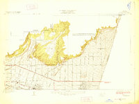 1928 La Verne1928 Print · USGSIn the mid-1920s, the foothill communities east of Los Angeles were emerging from their agricultural roots into structured townsites. Researchers can trace the early Pacific Electric rail lines and locate local landmarks such as Bonita High School and the Cem in La Verne.2 unique versions available
 - 1928 Map of Claremont
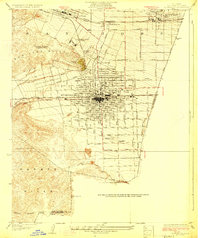 1928 Claremont1928 Print · USGSEastern Los Angeles County appears here in the late twenties, during a period of rapid suburban and academic growth. Researchers can trace the early layouts of Claremont and Pomona, locating Pomona College, the Pacific Electric lines, and the Pomona Cemetery.3 unique versions available
 - 1933 Map of Ontario
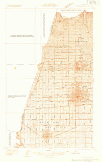 1933 Ontario1933 Print · USGSThe citrus heart of the Inland Empire comes into focus in the early thirties as it transitions into a major transit hub. Genealogists and historians can trace the early footprints of Ontario, Upland, and Chino, while locating landmarks like Bellevue Cem and the Pacific Electric line.
 - 1933 Map of La Verne and Evey Canyon
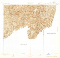 1933 La Verne and Evey Canyon1933 Print · USGSThe northern reaches of the San Gabriel Valley met the mountain wilderness in the early thirties. Trace early forest infrastructure and recreation spots like Wolfskill Camp, the San Dimas Lookout, and the newly constructed San Dimas Dam.
 - 1940 Map of Evey Canyon
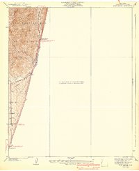 1940 Evey Canyon1940 Print · USGSThe foothills of the San Gabriel Mts meet the growing community of Claremont in this 1940s-era survey. Genealogists and local historians can trace the early road network of the valley and find mountain landmarks like the Norton Sch and Lower San Antonio Guard Station.3 unique versions available
 - 1940 Map of La Verne
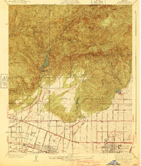 1940 La Verne1940 Print · USGSLa Verne and Claremont are captured here just before the mid-century population boom, showing a landscape defined by foothill canyons and early college campuses. Genealogists and historians can trace local landmarks like Scripps College, the Metropolitan Aqueduct, and Wolfskill Camp.4 unique versions available
 - 1942 Map of Ontario and Vicinity
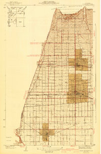 1942 Ontario and Vicinity1942 Print · USGSThe Inland Empire is shown at a pivotal moment in the early 1940s, when orange groves and vineyards still dominated the landscape between the mountains and the valley floor. Researchers can trace the rail corridors of the SOUTHERN PACIFIC and the Pacific Electric while locating old neighborhood markers like Narod, Sunsweet, and the Sierra Vista Sch.2 unique versions available
 - 1944 Map of Cucamonga
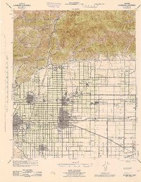 1944 Cucamonga1944 Print · USGSThe San Gabriel Valley and Inland Empire are shown here during the mid-forties, capturing the peak of the region's citrus era and rail-based transit. Researchers can trace early campus layouts at Pomona College or locate vanished landmarks like the Monta Vista Resort and Padua Hills Theater.
 - 1953 Map of San Bernardino
 1953 San Bernardino1953 Print · USGSSouthern California underwent massive post-war growth as suburban sprawl reached the foothills of the San Bernardino Mountains. Genealogists and historians can trace the rail-and-road roots of the Inland Empire through the Union Pacific RR and Lake Arrowhead resorts.2 unique versions available
 - 1954 Map of Ontario, 1955 Print
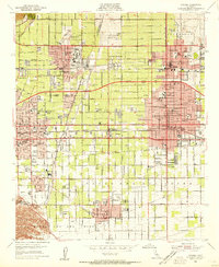 1954 Ontario1955 Print · USGSThe Pomona Valley was undergoing rapid postwar transformation in the mid-fifties as academic and industrial expansion reshaped the landscape. Researchers can find prominent landmarks like Pomona College, the Ontario International Airport, and the sprawling grounds of the Chino Prison.2 unique versions available
 - 1954 Map of Mt. Baldy, 1955 Print
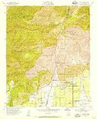 1954 Mt. Baldy1955 Print · USGSThe foothills of the San Gabriel Mountains meet the San Bernardino County line in the mid-fifties, just as suburban growth pushed toward the canyon mouths. Researchers can trace local landmarks like San Antonio Heights, the Padua Hills Theater, and the infrastructure of the San Antonio Dam.2 unique versions available
 - 1954 Map of San Dimas, 1956 Print
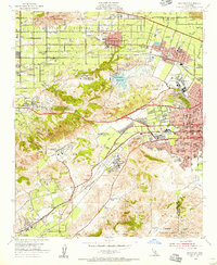 1954 San Dimas1956 Print · USGSEastern Los Angeles County appears at a moment of transition in the mid-fifties as suburban growth begins to surround the area's agricultural roots. Researchers can trace historic schools and cemeteries, from Evergreen Cemetery to the Naval Ordnance Plant and Diamond Bar Ranch.2 unique versions available
 - 1954 Map of Ontario, 1959 Print
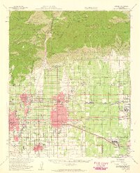 1954 Ontario1959 Print · USGSThe Pomona Valley in the mid-fifties is captured here as a sprawling network of citrus-era settlements and rising post-war industry. Genealogists and local researchers can trace the early footprints of the Claremont Associated Colleges, the Steel Plant, and Ontario International Airport.5 unique versions available
 - 1956 Map of San Bernardino
 1956 San Bernardino1956 Print · USGSSouthern California's Inland Empire and High Desert come into focus in the mid-fifties as agriculture gives way to suburban and military growth. Trace early rail lines like the Pacific Electric or find remote landmarks like Camp Rock Mine and George AFB.
 - 1957 Map of San Bernardino
 1957 San Bernardino1957 Print · USGSSouthern California's Inland Empire and High Desert met during the postwar expansion of the late fifties. Genealogists and historians can trace the growth of San Bernardino and Redlands alongside remote landmarks like Edwards AFB and the Camp Rock Mine.
 - 1958 Map of San Bernardino, 1975 Print
 1958 San Bernardino1975 Print · USGSSouthern California’s Inland Empire and High Desert come into focus during the mid-century boom, showing the rise of suburbs and massive military installations. Researchers can trace the rail networks of the Union Pacific RR or locate landmarks like Norton AFB and Big Bear Lake.
Showing maps 1-25 of 44
Top cities near Claremont
- Riverside historical maps
- Fontana historical maps
- Ontario historical maps
- Rancho Cucamonga historical maps
- Pomona historical maps
- Corona historical maps
See more
Frequently asked questions
- What are the different types of historical maps available for Claremont?
- What is the oldest map of Claremont?
- Where can I purchase historical maps of Claremont for my home or office?
- Where can I download high-res historical maps of Claremont?
- Are there historical topographic maps available for Claremont?
- Is there historical aerial imagery available for Claremont?
- Where are historical maps of Claremont sourced from?