Old Maps of Lopez/Kagel Canyons, California for Metal Detecting
Plan your next treasure hunt with 37 historic maps of Lopez/Kagel Canyons. Find old homesites, ghost towns, trails, and gathering spots that may be lost to time — perfect for identifying promising metal detecting locations.
- Locate forgotten sites: Uncover places like long-lost settlements, abandoned rail lines, or gathering spots.
- Plan better hunts: Use map overlays combined with LiDAR or satellite views to narrow in on historically rich areas.
- Made for detectorists: Thousands of hobbyists use these maps to discover relics, coins, and hidden history.
Use these historic maps to boost your research and find new opportunities beneath the surface of Lopez/Kagel Canyons.
Lopez/Kagel Canyons, CA maps
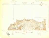
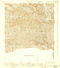
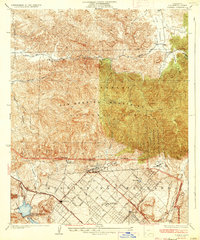
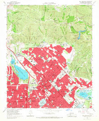
(37)- 1900 Map of Fernando
 1900 Fernando1900 Print · USGSThe San Fernando Valley and San Gabriel mountains appear here in the final years of the nineteenth century, showing the early town site of Fernando and the San Fernando Mission. Genealogists and historians can trace the Southern Pacific RR through Soledad Canyon or locate early settlements like Lang and Honby.6 unique versions available
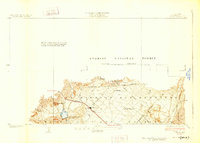
 - 1901 Map of Southern California Sheet No. 1
 1901 Southern California Sheet No. 11901 Print · USGSGreater Los Angeles at the dawn of the twentieth century is a landscape of growing citrus towns and a burgeoning rail network. Genealogists and historians can trace the early gridded streets of Hollywood and Pasadena or locate landmarks like Bear Lake and the Cahuilla Indian Reservation.6 unique versions available
 - 1904 Map of Southern California Sheet No. 1, 1905 Print
 1904 Southern California Sheet No. 11905 Print · USGSSouthern California at the dawn of the twentieth century shows a landscape of citrus groves and coastal towns connected by rail. Genealogists and historians can trace early settlements like San Juan Capistrano, find remote sites like the Rose Mine, and study the original water systems of the Santa Ana River.2 unique versions available
 - 1925 Map of Sylmar
 1925 Sylmar1925 Print · USGSThe northern San Fernando Valley is captured here in the mid-twenties, showing a landscape of emerging infrastructure and public institutions. Trace early water and power networks at the Upper San Fernando Reservoir or locate local landmarks like the El Retiro School for Girls and Sylmar.
 - 1926 Map of Sunland
 1926 Sunland1926 Print · USGSThe northern San Fernando Valley and Tujunga foothills appear here in the mid-twenties, just as early transit and utility lines began shaping the basin. Trace the original tracks of the Southern Pacific San Fernando Line and early settlements like Sunland and Roscoe.2 unique versions available
 - 1927 Map of Pacoima
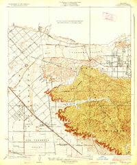
 1927 Pacoima1927 Print · USGSThe northern San Fernando Valley is seen here during the mid-1920s as early citrus groves and ranch lands began giving way to a modern street grid. Researchers can trace the layout of early communities like Mission Acres and Pacoima or locate the historic grounds of the San Fernando Mission.4 unique versions available
 - 1928 Map of Sylmar
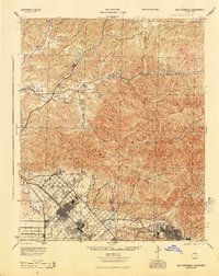
 1928 Sylmar1928 Print · USGSThe northern reaches of Los Angeles are seen here in the late 1920s, still bounded by the old lines of the Ex Mission San Fernando. Genealogists and historians can trace institutional sites like the Olive View Sanatorium and the San Fernando Cemetery along the Southern Pacific rail line.
 - 1929 Map of Sylmar
 1929 Sylmar1929 Print · USGSThe foothills of the San Gabriel Mountains are captured here in the late 1920s, showing a landscape defined by forest terrain and early public health infrastructure. Researchers can locate specialized sites like the Olive View Sanatorium and trace the paths of the early Aqueduct and Transmission Line.
 - 1932 Map of Sunland
 1932 Sunland1932 Print · USGSThe San Fernando Valley and the Verdugo Mountains appear here during the early 1930s, showing a landscape of open washes and emerging street grids. Genealogists can trace early residences near Sunland or follow the rail stops at Roscoe and Hewitt.
 - 1933 Map of Sunland
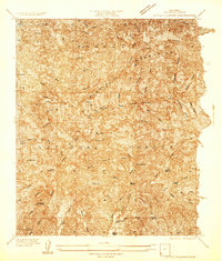
 1933 Sunland1933 Print · USGSThe San Gabriel Mountains and Angeles National Forest are captured in the early 1930s before the sprawl of Los Angeles reached these canyons. Genealogists and hikers can trace old property marks like Herreras Ranch and remote sites such as El Merrie Del or Selby Oaks.
 - 1934 Map of Little Tujunga
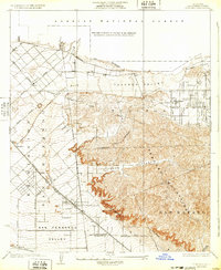
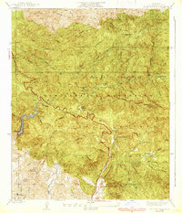
 1934 Little Tujunga1934 Print · USGSThe San Gabriel canyons come alive in the 1930s, showing a rugged landscape of high-altitude sanatoriums and family ranches. Trace the locations of De Mille Ranch, the Acme Mine, and the sprawling grounds of the Fairview Sanatorium.
 - 1935 Map of Sylmar
 1935 Sylmar1935 Print · USGSThe San Fernando Valley meets the mountains in the 1930s as the suburbs began to climb into the foothills. Genealogists and historians can trace the early streets of Sylmar, the grounds of the El Retiro School for Girls, and the sprawling Ex Mission San Fernando lands.3 unique versions available
 - 1939 Map of Little Tujunga
 1939 Little Tujunga1939 Print · USGSLos Angeles County's front range was a landscape of remote ranches and fire lookouts in the late 1930s. Researchers can locate canyon homesteads such as De Mille Ranch and Watts Ranch, or trace early health retreats like Fairview Sanatorium.3 unique versions available
 - 1940 Map of San Fernando, 1955 Print
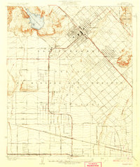
 1940 San Fernando1955 Print · USGSThe northern Los Angeles basin is shown here just before the postwar housing boom, as the valley floor transitioned from rural estates to suburban centers. Genealogists can trace family footprints near the San Fernando Mission or follow the rail lines through Solemint and Sylmar.2 unique versions available
 - 1942 Map of Sunland
 1942 Sunland1942 Print · USGSThe northeastern San Fernando Valley is captured here just as the aviation industry was transforming the landscape during the early 1940s. Genealogists and local historians can trace early neighborhood footprints in Roscoe and Sunland, or locate landmarks like Adams Airport and the Hansen Flood Control Basin.3 unique versions available
 - 1945 Map of San Fernando
 1945 San Fernando1945 Print · USGSThe northern reaches of Los Angeles County appear in the mid-1940s, just as suburban growth began to meet the steep canyon walls. Researchers can trace the path of the Southern Pacific through the mountain passes or locate landmarks like the San Fernando Mission and Sunland.
 - 1949 Map of Los Angeles
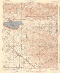
 1949 Los Angeles1949 Print · USGSSouthern California and the South Coast appear at the onset of the post-war boom, from the Channel Islands to the Mojave Desert. Trace early aviation sites like Lockheed Air Terminal and mining history at the Redrock Quicksilver Mine and Redrover Mine.2 unique versions available
 - 1953 Map of San Fernando, 1954 Print
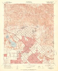 1953 San Fernando1954 Print · USGSThe San Fernando Valley meets the mountains in the early fifties during a period of rapid suburban and industrial expansion. Genealogists and local historians can trace the San Fernando Mission, find the Whiteman Air Park, and locate long-standing medical institutions like the Olive View Sanatorium.3 unique versions available
 - 1953 Map of Sunland, 1954 Print
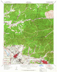
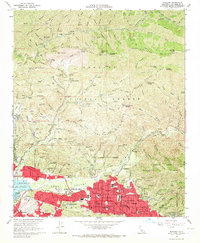
 1953 Sunland1954 Print · USGSThe Tujunga Valley and southern San Gabriel foothills are captured in the early 1950s, showing a mix of suburban growth and mountain ranching. Researchers can trace old family holdings like Dillon Ranch, local schools such as Plainview Ave School, and the industrial remains of the Mining Mill (Ruins).2 unique versions available
 - 1955 Map of Los Angeles
 1955 Los Angeles1955 Print · USGSThe mid-century transformation of Southern California comes into focus as the urban sprawl of Los Angeles meets the wilderness of the Santa Monica Mountains. Researchers can trace the development of post-war suburbs alongside historic landmarks like the Santa Barbara Lighthouse and early industrial sites such as the Good Luck Mine.
 - 1959 Map of Los Angeles
 1959 Los Angeles1959 Print · USGSCoastal California and the high desert met in a period of booming growth after the war. Researchers can trace early aviation and military history at the Point Mugu Air Missile Test Ctr or locate desert mining sites like the Double Eagle Mine.3 unique versions available
 - 1966 Map of Los Angeles
 1966 Los Angeles1966 Print · USGSSouthern California underwent a mid-century transformation as suburban grids reached the base of the San Gabriel Mountains. Researchers can trace the path of the Los Angeles Aqueduct or locate defense landmarks like Edwards Air Force Base.
 - 1966 Map of Sunland, 1967 Print
 1966 Sunland1967 Print · USGSThe foothills of the Verdugo Hills and the San Gabriel Mountains meet during the suburban expansion of the mid-sixties. Researchers can trace the development of Sunland and Tujunga, locating historic sites like the Lakeview Terrace Sanitarium, Hansen Dam, and the Angeles Gun Club.3 unique versions available
 - 1966 Map of San Fernando, 1967 Print
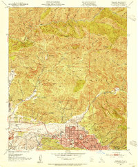
 1966 San Fernando1967 Print · USGSThe San Fernando Valley was undergoing a massive suburban expansion in the mid-1960s as major freeways reshaped the northern Los Angeles landscape. Researchers can trace the development of Sylmar and Pacoima, locate historic grounds like San Fernando Mission Cem, and see the footprint of Van Norman Lake before its reconfiguration.3 unique versions available
 - 1975 Map of Los Angeles, 1977 Print
 1975 Los Angeles1977 Print · USGSSouthern California is captured in a period of significant growth during the mid-seventies, showing the urban sprawl from the coast to the high desert. Researchers can trace the development of the Pacific Coast Hwy and find aerospace landmarks like Edwards Air Force Base and the Flight Test Center (NASA).2 unique versions available
Showing maps 1-25 of 37
Top cities near Lopez/Kagel Canyons
- Los Angeles historical maps
- Glendale historical maps
- Santa Clarita historical maps
- Palmdale historical maps
- Pasadena historical maps
- Burbank historical maps
See more
Top neighborhoods of Lopez/Kagel Canyons
Frequently asked questions
- What are the different types of historical maps available for Lopez/Kagel Canyons?
- What is the oldest map of Lopez/Kagel Canyons?
- Where can I purchase historical maps of Lopez/Kagel Canyons for my home or office?
- Where can I download high-res historical maps of Lopez/Kagel Canyons?
- Are there historical topographic maps available for Lopez/Kagel Canyons?
- Is there historical aerial imagery available for Lopez/Kagel Canyons?
- Where are historical maps of Lopez/Kagel Canyons sourced from?