Old Maps of Woodland Hills-Warner Center Neighborhood Council District, Los Angeles for Academic Research
Study the evolution of Woodland Hills-Warner Center Neighborhood Council District with 17 high-resolution historic maps. Whether you're teaching, researching, or modeling changes in land use, these maps provide essential visual documentation of urban, environmental, and geographic change.
- Analyze long-term change: Track patterns in development, transportation, and natural features.
- Ideal for environmental or urban studies: Support academic projects with primary historical map data.
- Use in the classroom or lab: Educators and researchers rely on these maps to bring historical context to life.
These maps are a powerful tool for teaching, research, and visualizing how Woodland Hills-Warner Center Neighborhood Council District has changed over the decades.
Woodland Hills-Warner Center Neighborhood Council District, Los Angeles maps
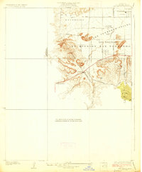
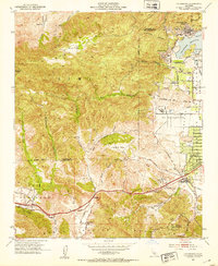
(17)- 1903 Map of Calabasas
 1903 Calabasas1903 Print · USGSCovers Woodland Hills-Warner Center Neighborhood Council District, including Los Angeles, Simi Valley, and other nearby areas9 unique versions available
 - 1903 Map of Camulos
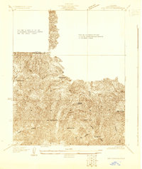
 1903 Camulos1903 Print · USGSCovers Woodland Hills-Warner Center Neighborhood Council District, including Los Angeles, Santa Clarita, and other nearby areas5 unique versions available
 - 1928 Map of Dry Canyon
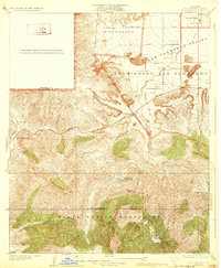
 1928 Dry Canyon1928 Print · USGSCovers Woodland Hills-Warner Center Neighborhood Council District, including Los Angeles, Calabasas, and other nearby areas
 - 1928 Map of Reseda
 1928 Reseda1928 Print · USGSCovers Woodland Hills-Warner Center Neighborhood Council District, including Los Angeles, Topanga, and other nearby areas4 unique versions available
 - 1929 Map of Dry Canyon
 1929 Dry Canyon1929 Print · USGSCovers Woodland Hills-Warner Center Neighborhood Council District, including Los Angeles, Calabasas, and other nearby areas
 - 1932 Map of Dry Canyon
 1932 Dry Canyon1932 Print · USGSCovers Woodland Hills-Warner Center Neighborhood Council District, including Los Angeles, Calabasas, and other nearby areas3 unique versions available
 - 1944 Map of Calabasas
 1944 Calabasas1944 Print · USGSCovers Woodland Hills-Warner Center Neighborhood Council District, including Los Angeles, Simi Valley, and other nearby areas
 - 1949 Map of Los Angeles
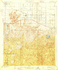
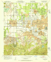
 1949 Los Angeles1949 Print · USGSCovers Woodland Hills-Warner Center Neighborhood Council District, including Los Angeles, Oxnard, and other nearby areas3 unique versions available
 - 1952 Map of Calabasas, 1953 Print
 1952 Calabasas1953 Print · USGSCovers Woodland Hills-Warner Center Neighborhood Council District, including Los Angeles, Simi Valley, and other nearby areas9 unique versions available
 - 1952 Map of Canoga Park, 1954 Print
 1952 Canoga Park1954 Print · USGSCovers Woodland Hills-Warner Center Neighborhood Council District, including Los Angeles, Calabasas, and other nearby areas7 unique versions available
 - 1955 Map of Los Angeles
 1955 Los Angeles1955 Print · USGSCovers Woodland Hills-Warner Center Neighborhood Council District, including Los Angeles, Oxnard, and other nearby areas
 - 1959 Map of Los Angeles
 1959 Los Angeles1959 Print · USGSCovers Woodland Hills-Warner Center Neighborhood Council District, including Los Angeles, Oxnard, and other nearby areas3 unique versions available
 - 1966 Map of Los Angeles
 1966 Los Angeles1966 Print · USGSCovers Woodland Hills-Warner Center Neighborhood Council District, including Los Angeles, Oxnard, and other nearby areas
 - 1975 Map of Los Angeles, 1977 Print
 1975 Los Angeles1977 Print · USGSCovers Woodland Hills-Warner Center Neighborhood Council District, including Los Angeles, Oxnard, and other nearby areas2 unique versions available
 - 1976 Map of Canoga Park, 1977 Print
 1976 Canoga Park1977 Print · USGSCovers Woodland Hills-Warner Center Neighborhood Council District, including Los Angeles, Calabasas, and other nearby areas2 unique versions available
 - 1976 Map of Calabasas, 1980 Print
 1976 Calabasas1980 Print · USGSCovers Woodland Hills-Warner Center Neighborhood Council District, including Los Angeles, Simi Valley, and other nearby areas2 unique versions available
 - 1979 Map of Los Angeles
 1979 Los Angeles1979 Print · USGSCovers Woodland Hills-Warner Center Neighborhood Council District, including Los Angeles, Glendale, and other nearby areas
End of results
Showing maps 1-17 of 17
Frequently asked questions
- What are the different types of historical maps available for Woodland Hills-Warner Center Neighborhood Council District?
- What is the oldest map of Woodland Hills-Warner Center Neighborhood Council District?
- Where can I purchase historical maps of Woodland Hills-Warner Center Neighborhood Council District for my home or office?
- Where can I download high-res historical maps of Woodland Hills-Warner Center Neighborhood Council District?
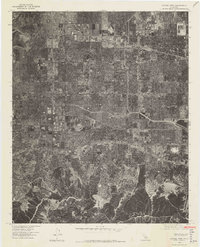
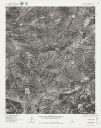
- Are there historical topographic maps available for Woodland Hills-Warner Center Neighborhood Council District?
- Is there historical aerial imagery available for Woodland Hills-Warner Center Neighborhood Council District?
- Where are historical maps of Woodland Hills-Warner Center Neighborhood Council District sourced from?