Old Maps of Woodland Hills-Warner Center Neighborhood Council District, Los Angeles for Metal Detecting
Plan your next treasure hunt with 17 historic maps of Woodland Hills-Warner Center Neighborhood Council District. Find old homesites, ghost towns, trails, and gathering spots that may be lost to time — perfect for identifying promising metal detecting locations.
- Locate forgotten sites: Uncover places like long-lost settlements, abandoned rail lines, or gathering spots.
- Plan better hunts: Use map overlays combined with LiDAR or satellite views to narrow in on historically rich areas.
- Made for detectorists: Thousands of hobbyists use these maps to discover relics, coins, and hidden history.
Use these historic maps to boost your research and find new opportunities beneath the surface of Woodland Hills-Warner Center Neighborhood Council District.
Woodland Hills-Warner Center Neighborhood Council District, Los Angeles maps
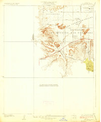
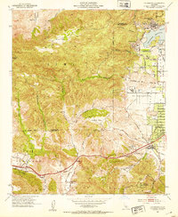
(17)- 1903 Map of Calabasas
 1903 Calabasas1903 Print · USGSCovers Woodland Hills-Warner Center Neighborhood Council District, including Los Angeles, Simi Valley, and other nearby areas9 unique versions available
 - 1903 Map of Camulos
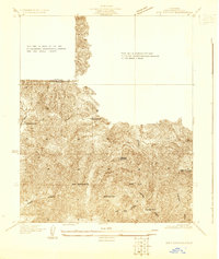
 1903 Camulos1903 Print · USGSCovers Woodland Hills-Warner Center Neighborhood Council District, including Los Angeles, Santa Clarita, and other nearby areas5 unique versions available
 - 1928 Map of Dry Canyon
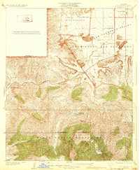
 1928 Dry Canyon1928 Print · USGSCovers Woodland Hills-Warner Center Neighborhood Council District, including Los Angeles, Calabasas, and other nearby areas
 - 1928 Map of Reseda
 1928 Reseda1928 Print · USGSCovers Woodland Hills-Warner Center Neighborhood Council District, including Los Angeles, Topanga, and other nearby areas4 unique versions available
 - 1929 Map of Dry Canyon
 1929 Dry Canyon1929 Print · USGSCovers Woodland Hills-Warner Center Neighborhood Council District, including Los Angeles, Calabasas, and other nearby areas
 - 1932 Map of Dry Canyon
 1932 Dry Canyon1932 Print · USGSCovers Woodland Hills-Warner Center Neighborhood Council District, including Los Angeles, Calabasas, and other nearby areas3 unique versions available
 - 1944 Map of Calabasas
 1944 Calabasas1944 Print · USGSCovers Woodland Hills-Warner Center Neighborhood Council District, including Los Angeles, Simi Valley, and other nearby areas
 - 1949 Map of Los Angeles
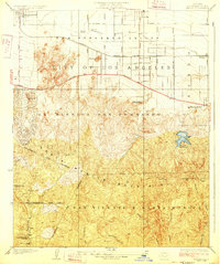
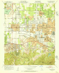
 1949 Los Angeles1949 Print · USGSCovers Woodland Hills-Warner Center Neighborhood Council District, including Los Angeles, Oxnard, and other nearby areas3 unique versions available
 - 1952 Map of Calabasas, 1953 Print
 1952 Calabasas1953 Print · USGSCovers Woodland Hills-Warner Center Neighborhood Council District, including Los Angeles, Simi Valley, and other nearby areas9 unique versions available
 - 1952 Map of Canoga Park, 1954 Print
 1952 Canoga Park1954 Print · USGSCovers Woodland Hills-Warner Center Neighborhood Council District, including Los Angeles, Calabasas, and other nearby areas7 unique versions available
 - 1955 Map of Los Angeles
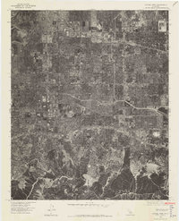
 1955 Los Angeles1955 Print · USGSCovers Woodland Hills-Warner Center Neighborhood Council District, including Los Angeles, Oxnard, and other nearby areas
 - 1959 Map of Los Angeles
 1959 Los Angeles1959 Print · USGSCovers Woodland Hills-Warner Center Neighborhood Council District, including Los Angeles, Oxnard, and other nearby areas3 unique versions available
 - 1966 Map of Los Angeles
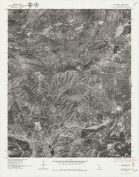
 1966 Los Angeles1966 Print · USGSCovers Woodland Hills-Warner Center Neighborhood Council District, including Los Angeles, Oxnard, and other nearby areas
 - 1975 Map of Los Angeles, 1977 Print
 1975 Los Angeles1977 Print · USGSCovers Woodland Hills-Warner Center Neighborhood Council District, including Los Angeles, Oxnard, and other nearby areas2 unique versions available
 - 1976 Map of Canoga Park, 1977 Print
 1976 Canoga Park1977 Print · USGSCovers Woodland Hills-Warner Center Neighborhood Council District, including Los Angeles, Calabasas, and other nearby areas2 unique versions available
 - 1976 Map of Calabasas, 1980 Print
 1976 Calabasas1980 Print · USGSCovers Woodland Hills-Warner Center Neighborhood Council District, including Los Angeles, Simi Valley, and other nearby areas2 unique versions available
 - 1979 Map of Los Angeles
 1979 Los Angeles1979 Print · USGSCovers Woodland Hills-Warner Center Neighborhood Council District, including Los Angeles, Glendale, and other nearby areas
End of results
Showing maps 1-17 of 17
Frequently asked questions
- What are the different types of historical maps available for Woodland Hills-Warner Center Neighborhood Council District?
- What is the oldest map of Woodland Hills-Warner Center Neighborhood Council District?
- Where can I purchase historical maps of Woodland Hills-Warner Center Neighborhood Council District for my home or office?
- Where can I download high-res historical maps of Woodland Hills-Warner Center Neighborhood Council District?
- Are there historical topographic maps available for Woodland Hills-Warner Center Neighborhood Council District?
- Is there historical aerial imagery available for Woodland Hills-Warner Center Neighborhood Council District?
- Where are historical maps of Woodland Hills-Warner Center Neighborhood Council District sourced from?