Old Maps of Redman, California for Metal Detecting
Plan your next treasure hunt with 19 historic maps of Redman. Find old homesites, ghost towns, trails, and gathering spots that may be lost to time — perfect for identifying promising metal detecting locations.
- Locate forgotten sites: Uncover places like long-lost settlements, abandoned rail lines, or gathering spots.
- Plan better hunts: Use map overlays combined with LiDAR or satellite views to narrow in on historically rich areas.
- Made for detectorists: Thousands of hobbyists use these maps to discover relics, coins, and hidden history.
Use these historic maps to boost your research and find new opportunities beneath the surface of Redman.
Redman, CA maps
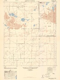
(19)- 1930 Map of Casa Desierta
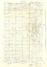 1930 Casa Desierta1930 Print · USGSAntelope Valley was a landscape of remote homesteads and desert roads during the early 1930s. Genealogists and desert historians can trace early community hubs like Antelope Sch, Redman Sch, and the network of life-sustaining wells near Buckhorn Dry Lake.
 - 1933 Map of Casa Desierta
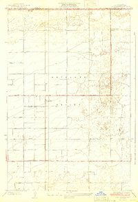 1933 Casa Desierta1933 Print · USGSThe high desert of the Antelope Valley appears here in the early thirties, defined by its rigid grid of numbered avenues and isolated wells. Genealogists and local historians can locate early landmarks like Antelope Sch, Redman Sch, and the route of the Redman Road.2 unique versions available
 - 1937 Map of Rogers Lake
 1937 Rogers Lake1937 Print · USGSThe Mojave Desert at the edge of the Antelope Valley appears here in the late 1930s, just as military aviation began to shape the landscape. Local historians can trace the early rail stops at Muroc and Solon Siding or locate vanished sites like the Oasis Duck Club.
 - 1942 Map of Rogers Lake
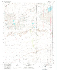
 1942 Rogers Lake1942 Print · USGSThe Antelope Valley and Mojave Desert appear in the early 1940s as a landscape of remote ranches and emerging military ranges. Trace the early boundaries of the Muroc Bombing and Gunnery Range and find rural landmarks like Redman Sch and Solon.2 unique versions available
 - 1947 Map of Redman School
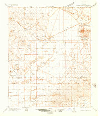
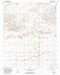
 1947 Redman School1947 Print · USGSAntelope Valley and the high desert are shown here in the late 1940s as military activity and rural settlement began to shape the land. Researchers can trace the boundaries of the Muroc Army Airfield Military Reservation and find local landmarks like Redman School and Ganso Bravo Ranch.3 unique versions available
 - 1953 Map of San Bernardino
 1953 San Bernardino1953 Print · USGSSouthern California underwent massive post-war growth as suburban sprawl reached the foothills of the San Bernardino Mountains. Genealogists and historians can trace the rail-and-road roots of the Inland Empire through the Union Pacific RR and Lake Arrowhead resorts.2 unique versions available
 - 1956 Map of San Bernardino
 1956 San Bernardino1956 Print · USGSSouthern California's Inland Empire and High Desert come into focus in the mid-fifties as agriculture gives way to suburban and military growth. Trace early rail lines like the Pacific Electric or find remote landmarks like Camp Rock Mine and George AFB.
 - 1956 Map of Rogers Lake, 1957 Print
 1956 Rogers Lake1957 Print · USGSThe High Desert during the early years of the space race shows a landscape transformed by the Air Force Flight Test Center. Researchers can trace the layout of Edwards Air Force Base and find local landmarks like Muroc, Desert High Sch, and the Joshua Tree Grange.2 unique versions available
 - 1957 Map of San Bernardino
 1957 San Bernardino1957 Print · USGSSouthern California's Inland Empire and High Desert met during the postwar expansion of the late fifties. Genealogists and historians can trace the growth of San Bernardino and Redlands alongside remote landmarks like Edwards AFB and the Camp Rock Mine.
 - 1958 Map of San Bernardino, 1975 Print
 1958 San Bernardino1975 Print · USGSSouthern California’s Inland Empire and High Desert come into focus during the mid-century boom, showing the rise of suburbs and massive military installations. Researchers can trace the rail networks of the Union Pacific RR or locate landmarks like Norton AFB and Big Bear Lake.
 - 1959 Map of San Bernardino
 1959 San Bernardino1959 Print · USGSSouthern California underwent a massive transformation in the late fifties as suburban growth and military power reshaped the desert and valley. Researchers can trace the legacy of the Union Pacific Railroad and locate early footprints of Joshua Tree National Monument and Edwards Air Force Base.
 - 1966 Map of San Bernardino
 1966 San Bernardino1966 Print · USGSThe San Bernardino Valley and Mojave Desert met during a period of massive military and suburban growth in the mid-sixties. Genealogists and historians can trace the development of Edwards Air Force Base, old desert mines like the Bagdad Chase Mine, and mountain communities near Big Bear Lake.
 - 1973 Map of Redman, 1977 Print
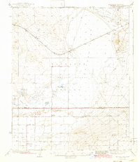
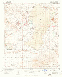
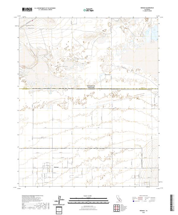
 1973 Redman1977 Print · USGSThe high desert of the Antelope Valley comes to life in this early 1970s survey, showing the vast military footprint in the Los Angeles and Kern County borderlands. Genealogists and researchers can trace the rural settlement of Redman and the Grange Hall alongside the specialized facilities of Edwards Air Force Base.2 unique versions available
 - 1982 Map of Victorville
 1982 Victorville1982 Print · USGSThe High Desert during the early eighties reveals a landscape of massive aerospace installations and growing desert communities. Researchers can trace the sprawling boundaries of Edwards Air Force Base alongside the vital California Aqueduct and the rail hub at Barstow.2 unique versions available
 - 1992 Map of Redman
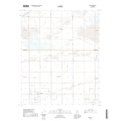
 1992 Redman1992 Print · USGSThe high desert of northern Los Angeles County is captured here in the early nineties as the military and civilian worlds converge. Trace the intersection of desert life and defense at Redman, the Air Force Flight Test Center, and the dry beds of Rogers Lake.
 - 2012 Map of Redman, 2012 Print
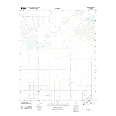 2012 Redman2012 Print · USGSCovers Redman, including Kern County, Los Angeles County, and other nearby areas
 - 2015 Map of Redman, 2015 Print
 2015 Redman2015 Print · USGSCovers Redman, including Kern County, Los Angeles County, and other nearby areas
 - 2018 Map of Redman, 2018 Print
 2018 Redman2018 Print · USGSCovers Redman, including Kern County, Los Angeles County, and other nearby areas
 - 2022 Map of Redman, 2022 Print
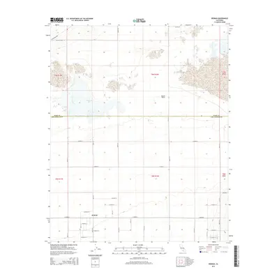
 2022 Redman2022 Print · USGSAntelope Valley and the high Mojave Desert are captured here during the early 2020s, showcasing the persistent grid of the California desert. Researchers can trace the layout of the Redman settlement and its connection to the Rosamond Hills via Rosamond Blvd.
End of results
Showing maps 1-19 of 19
Top cities near Redman
Frequently asked questions
- What are the different types of historical maps available for Redman?
- What is the oldest map of Redman?
- Where can I purchase historical maps of Redman for my home or office?
- Where can I download high-res historical maps of Redman?
- Are there historical topographic maps available for Redman?
- Is there historical aerial imagery available for Redman?
- Where are historical maps of Redman sourced from?