
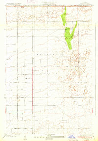
1933 Map of Casa Desierta
USGS Topo · Published 1933About this map
The Antelope Valley high desert landscape is captured here in 1930, displaying the rigid geometric grid of future development imposed upon an arid basin. This survey, conducted by E.P. Davis and C.W. Nessler, reveals a transitional era when simple dirt tracks and section lines began to define the region's geography. Educational outposts like Antelope Sch and Redman Sch serve as the primary landmarks in a sparsely populated terrain where survival depended on scattered wells. At the northern edge, the seasonal floor of Buckhorn Dry Lake straddles the boundary between Kern and Los Angeles Counties. The map is characterized by its meticulous recording of numbered thoroughfares, including Avenue B through Avenue I, and the vital Lancaster Muroc Road which facilitated travel through this portion of the Mojave Desert prior to mid-century growth.
Find a feature on this map
24 named features on this map. Tap any name to fly to it.
Don’t see what you’re looking for? This feature index may not catch every label — zoom into the map to look around manually.
Map Details
Editions of this 1933 Casa Desierta Map
2 editions found
Other maps of this area

1915 · Elizabeth Lake
USGS Topo · 1:125,000

1917 · Elizabeth Lake
USGS Topo · 1:125,000

1930 · Joshua
USGS Topo · 1:24,000

1930 · Lovejoy Springs
USGS Topo · 1:24,000

1930 · Roosevelt School
USGS Topo · 1:24,000

1930 · Casa Desierta
USGS Topo · 1:24,000

1930 · West Alpine Butte
USGS Topo · 1:24,000

1930 · Tierra Bonita
USGS Topo · 1:24,000

1933 · Lovejoy Springs
USGS Topo · 1:24,000

1933 · Roosevelt School
USGS Topo · 1:24,000