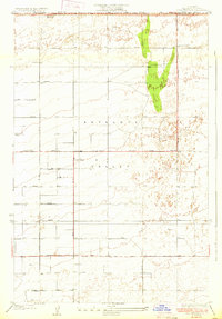
1933 Map of Casa Desierta
USGS Topo · Published 1933About this map
Antelope Valley appears here in the early 1930s, defined by a rigid grid of surveyed section lines and the stark transition between desert basin and rising alluvial slopes. At the northern edge, the boundary between Kern and Los Angeles counties cuts across Buckhorn Dry Lake, a landmark for early travelers through this arid corridor. The landscape is dominated by long, straight thoroughfares like Lancaster Muroc Road and a series of alphabetic avenues that structured the agricultural and residential development of the era.
Find a feature on this map
28 named features on this map. Tap any name to fly to it.
Don’t see what you’re looking for? This feature index may not catch every label — zoom into the map to look around manually.
Map Details
Editions of this 1933 Casa Desierta Map
2 editions found
Other maps of this area

1915 · Elizabeth Lake
USGS Topo · 1:125,000

1917 · Elizabeth Lake
USGS Topo · 1:125,000

1930 · Joshua
USGS Topo · 1:24,000

1930 · Lovejoy Springs
USGS Topo · 1:24,000

1930 · Roosevelt School
USGS Topo · 1:24,000

1930 · Casa Desierta
USGS Topo · 1:24,000

1930 · West Alpine Butte
USGS Topo · 1:24,000

1930 · Tierra Bonita
USGS Topo · 1:24,000

1933 · Casa Desierta
USGS Topo · 1:24,000

1933 · Lovejoy Springs
USGS Topo · 1:24,000