1930s Maps of Santa Monica, California
Explore 2 historic maps of Santa Monica from the 1930s. These maps offer a rare glimpse into what life looked like during the 1930s — showing old roads, neighborhoods, homes, and landmarks that have changed or disappeared over time.
Whether you're researching your family's past, planning a metal detecting trip, or studying how Santa Monica's landscape evolved across the 1930s, these high-resolution maps are a powerful tool for exploring the history of this region.
- Focus on a specific era: All maps on this page are from the 1930s, giving you a focused view of this time period.
- See what’s changed: Compare century-old streets, trails, and buildings to today's modern landscape using overlays and satellite layers.
- Research with precision: Use these maps for genealogy, historical research, land use analysis, or educational projects.
- View, download, or print: Maps are fully viewable online in high resolution, and can be downloaded or printed for your own records.
Start exploring Santa Monica's history through authentic maps from the 1930s. This is your window into the past.
Santa Monica, CA maps
(2)- 1934 Map of Sawtelle
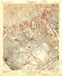 1934 Sawtelle1934 Print · USGSWest Los Angeles and Santa Monica undergo a period of rapid suburban and institutional expansion during the early thirties. Local researchers can trace the development of UCLA, the expansive Soldiers Home, and the legendary Fox Studio grounds.3 unique versions available
 - 1934 Map of Venice
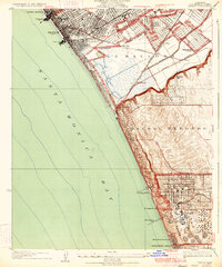 1934 Venice1934 Print · USGSThe Los Angeles coast in the mid-1930s reveals a landscape of tidal lagoons and burgeoning seaside industries. Researchers can trace the early rail network of the Pacific Electric, the footprint of Loyola University, and the massive Standard Oil Co Refinery.3 unique versions available
End of results
Showing maps 1-2 of 2
Top cities near Santa Monica
- Los Angeles historical maps
- Glendale historical maps
- Torrance historical maps
- Simi Valley historical maps
- Inglewood historical maps
- Burbank historical maps
See more
Top neighborhoods of Santa Monica
Frequently asked questions
- What are the different types of historical maps available for Santa Monica?
- What is the oldest map of Santa Monica?
- Where can I purchase historical maps of Santa Monica for my home or office?
- Where can I download high-res historical maps of Santa Monica?
- Are there historical topographic maps available for Santa Monica?
- Is there historical aerial imagery available for Santa Monica?
- Where are historical maps of Santa Monica sourced from?